Province: Vastmanlands Ian.
Region: Vastmanland.
HOTELS. Park, Gunnibogatan 2, 205 Metro, Vasagatan 22, 75 Stora Hotel let, Vasagatan 1 5, 164 Astoria Fenix, Kopparbergsvej 29A, 140 Klippan, Kungsgatan 4, 42 Arkad, Ostermalms-gatan 25, 80 b. YOUTH HOSTEL.
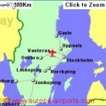
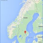
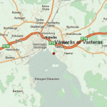
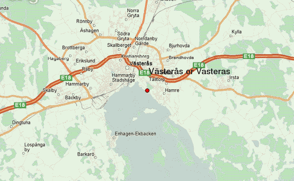
Vasteras, main town of the very fertile province of Vastmanland, lies in an inlet on Lake Malar, where the SvartS flows in. The town takes its name from its original site on the W side of the river mouth, Vastra Aros (aros = river mouth), which was corrupted into VasterSs.
At the beginning of the 1 3th c. this was the see of a bishop. Eleven meetings ofthe Diet were held here. The most important was the one in 1 527, during the reign of Gustavus Vasa, at which it was decided to adopt the Reformed faith.
The real development of the town began with the growth of industry in the present century. In 1 900, the population was just under 12,000; since then it has increased nearly tenfold. Among the principal industries is the manufacture of electrical appliances (ASEA). It also has an important inland harbour (many pleasure boats).
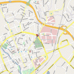
SIGHTS. In the middle of the town is the Stora Torg. To the S and E run Storagatan and Vasagatan (both for pedestrians only in this area). To the N of the Stora Torg stands the Cathedral (consecrated 1271; altered several times; restored 1959-61), a brick aisled church in Gothic style (tower 103 m (340 ft) high added by Tessin the Younger, 1 694). Between the choir and the nave is a 14th c. triumphal cross. The three carved screens in the choir came from Antwerp and Brussels; the one in the middle dates from 1516. Behind the altar is the marble sarcophagus of King Erik XIV. Other notable features are the Veronica Altar and the marble monument of Grand Marshal Magnus Brahe (1633). In the baptistry are carved woodwork by a North German master and a 15th c. reredos with an inscription in Low German.
In the square in front ofthe Cathedral is an unusual bronze statue (Carl Milles, 1923) of Bishop Johannes Rudbeckius (d. 1646), founder of the grammar school and the Diocesan Library (to the E of the Cathedral), now combined with the Provincial Library. Opposite the Cathedral stands the old Bishop’s Palace. To the N is the picturesque quarter of Kyrkbakken, the oldest part of the town. To the W is the Djakneberg Park, with a monument to famous Swedes. The Castle, on the banks of the Svartcl, was originally built in the 13th it now houses the Provincial Museum and provincial government offices. In Fiskartorg
the Town House (by Sven Ahlbom, 1959) has a tower 65 m (215 ft) high (carillon). In the old Town Hall is the Museum of Art (art from the 17th c. to the present). To the S of the Vasapark, in Sodra Ringvag, is the railway station and
2 to the E of the park can be seen the S’ imposing offices of ASEA (electrical appliances). Storgatan runs E to the Folkets Park (People’s Park), with recreational and sports facilities and amusements.
SURROUNDINGS. 2 km (1i miles) NW of the middle of the town, on the E18 expressway, is the interesting Vallby Open-Air Museum, with old wooden houses and other buildings (including a pharmacy, a silversmith’s workshop and a potter’s workshop) in which various craftsmen ply their trades. 6 km (4miles) NE is the’Anundshog, with a Viking cemetery (burial mounds, stone-settings). 2 km (14 miles) W of the town, in Lake Markar, is the little island of Elba (summer restaurant). From VasterSs harbour there are regular boat services to this island and to Ostra Hotmen (bathing). 15 km (10 miles) SW, on the shores of Lake Malar, is Tido Castle (1640-2), which contains a Toy Museum.
34 km (21 miles) E is Enkoping (Stadshotellet, 120 Gastis, 44 b.), a little town on the EnkopingsS whose economy, until the middle of the 19th c. depended upon craft production and the growing of herbs and spices; it became known as the horseradish town. From 1880 on, some of the craft workshops developed into small industrial firms and new firms were established, primarily in the engineering field. Todaya large proportion ofthe population is employed in industry. After the last great fire (1799), the town was rebuilt on a rectangular plan, still preserved in the middle of the town. Most of the buildings are relatively low. The Church of Our Lady (Varfrukyrkan), built of grey stone, was the seat of a bishop in the 12th c. To the SW of the church are the ruins of the 13th c. St Ilian’s Church. On the Munkssund are the remains of a Franciscan friary (restored).
Sala (Stadshotell, 101 Svea, 20 b.), 49 km (30 miles) NW of Enkoping, had its heyday in the 16th c. when the local silver-mines made a major contribution to the country’s revenues. The ore worked here is said to have had one ofthe highest silver contents in the world. Sala obtained its municipal charter in 1624, but mining was already in progress at the end of the 15th c. The mines were controlled by a bailiff who lived in Vasby Kungsgard, now a museum. There are conducted tours of the mining town, the mines and the museum. The deepest shaft is the Charles XI Shaft (318-8 m 1046 ft); the Queen Christina Shaft, at the entrance to the mines, is 257 m (843 ft) deep. A large system of water-mills provided power for the mines, which, when they were closed down in 1908, had yielded a total of 500 tons of pure silver and 30,000 tons of lead. Although mining continued on a very small scale until about 1950, the yield was insignificant.
In the Stora Torg in the middle of the town are the Town Hall and the Town House. Suckarnas Alle (Avenue of Sighs), which runs along Ovre Dammen, is named to commemorate the love affair between Gustavus Adolphus and Ebba Brahe. 1 km of the town is the 14th c. Provincial Assembly Church, with wall paintings (1465) which are the earliest known work of Albertus Pictor; the altar screen (c. 1520) was made in Brussels.
Vasteras Sweden Map Photo Gallery
Maybe You Like Them Too
- The Best Cities To Visit in The World
- World’s 10 Best Places To Visit
- Coolest Countries in the World to Visit
- Travel to Santorini, Greece
- Map of Barbados – Holiday in Barbados

