MOUNTAIN BRIDGE WILDERNESS AND RECREATION AREA MAP SOUTH CAROLINA
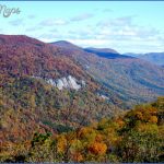
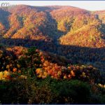
11,000 acres. Located in the northwest corner of South Carolina, the Mountain Bridge Wilderness and Recreation Area consists of two state parks7,476-acre Caesars Head State Park and 3,346-acre Jones Gap State Parkalong with three small nature preserves.
Caesars Head State Park includes mountainous terrain with rocky outcroppings, whereas Jones Gap State Park is in a valley. Of particular interest is Raven Cliff Falls, a 420-foot cascade. Much of the area is hardwood-forested, with rhododendron and mountain laurel. Among the wildlife are deer, bear, and fox.
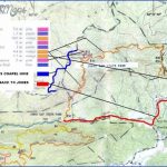
Activities: There are over 25 miles of trails for hiking and backpacking, and the 85-mile Foothills Trail (see entry below) terminates here. Difficulty ranges from easy to strenuous.
Fishing is available along the river, and limited seasonal hunting is permitted in a portion of the area. Mountain biking is restricted to roads.
Camping Regulations: Camping is allowed along just one trail, the 5.3-mile-long and moder-ately-strenuous Jones Gap Trail, which follows the beautiful Middle Saluda River.
Campers must register at one of the two park offices at either end of the Jones Gap Trail. There are 17 designated campsites along the trail, and these are assigned in advance. A nominal fee is charged. Existing fire rings mustbe used for campfires. No-trace camping practices are encouraged.
For Further Information: Mountain Bridge Wilderness and Recreation Area, c/o Caesars Head State Park, 8155 Geer Highway, Cleveland, SC 29635; (803)836-6115.
MOUNTAIN BRIDGE WILDERNESS AND RECREATION AREA MAP SOUTH CAROLINA Photo Gallery
Maybe You Like Them Too
- Explore Góra Kalwaria, Poland with this detailed map
- Explore Gumdag, Turkmenistan with this detailed map
- Explore Telfes im Stubai, Austria with this detailed map
- Explore Langenselbold, Germany with this detailed map
- Explore Krotoszyn, Poland with this detailed map

