Counties: Nordland fylke, Troms fylke.
Turistkontor Harstad,
N-9400 Harstad; tel. (0 82) 6 32 35.
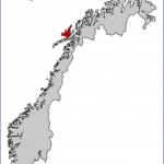
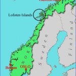
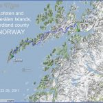
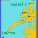
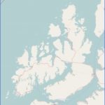
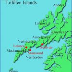
The Vesteralen (Western Islands), lying off the Vestfjord on the NW coast of Norway, are a NE extension of the Lofoten group.The landscape of these islands is less rugged than that of the Lofotens: the slopes are less precipitous, usually grass-covered to a considerable height, and frequently have a growth of forest, Access to the islands is by a suspension bridge over the Tjeld-sund and a number of ferries; the best starting point is Narvik. The midnight sun is visible from the end of May to the end of July.
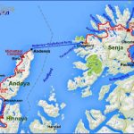
The much ramified island of Hinnoy is the largest Norwegian island after Spitzbergen. Half of it (to the WandS) belongs to Nordland country, the other half to the NE) to Troms. The island’s capital, Harstad (pop. 20,000; Viking Nordic Hotel, 160 SB; Grand, 120 camp site), reached from the mainland by Road 83 over the Tjeldsund bridge, lies in a sheltered area on the Vagsfjord to the NE and has large fish-processing industries. A festival (concerts, theatre, exhibitions, jazz) is held here at the end of June, and an angling contest in summer.
On a peninsula 3 km (2 miles) NE is the stone church of Trondenes (c. 1250), in medieval times the northernmost church in Christendom. To the N of the town is the tiny island of Kjeey (Stone Age rock paintings).
From the Tjeldsund bridge, Road 19 runs SW along the coast to a road junction just before Lodingen.
Lodingen (Svendsens Hotell, 50 b.), at the S end of the island, is an important traffic junction. From here there is a ferry service to Bognes, to the S.
Road 19 now turns N and cuts across the island and along the Gullesfjord’, then runs W to the Sortlandsund. Road 82 branches off to the N and, at the northern tip of Hinnoy crosses theAndeybro to the island of Andoy.
Viborg
The peak of Reka on the island of Langoy
Andoy is the northernmost of the Ves-terSlen Islands, with extensive areas of moorland from which a number of hills rise to heights of up to 600 m (1950 ft). On the E side is a seam of coal (not worked) extending into the sea. At the northernmost tip of the island is the little fishing port of Andenes (Andrikken Hotel, 57 Viking Gjestgiveri, 48 b.), with a breakwater 2-5 km (2700 yds) long. With its population of 4000, it has the air of a small town. It has a Polar Museum in an old burgher’s house.
Beyond the junction with Road 82, Road 19 crosses the Sortlandsbru which links Hinnoy with Langoy.
Langoy, with its numerous fjords and peninsulas, is the major island in the western part of the Vesterllen group. On the E coast is the old settlement of Sortland (pop. 3000; Sortland Hotell, 120 camp site), a port of call for the ships ofthe Hurtigrute.
From Sortland Road 19 runs S and continues over the Hadselbru (1 978: toll) to the island of Hadseloy and the little town of Stokmarknes (pop. 3000; VesterSlen Hotell, 45 camp site), at which the Hurtigrute ships also stop. From here there are attractive boat trips into the Eidsfjord. On the S side of the island is the little port of Melbu, the base of a large trawling fleet. There are magnificent views of the islands from Husbykollen (51 3 m 1683 ft). Ferry service to the Lofotens (179). The road back to Stokmarknes, along the W coast, offers delightful views.
Vesteralen Norway Map Photo Gallery
Maybe You Like Them Too
- The Best Cities To Visit in The World
- World’s 10 Best Places To Visit
- Coolest Countries in the World to Visit
- Travel to Santorini, Greece
- Map of Barbados – Holiday in Barbados

