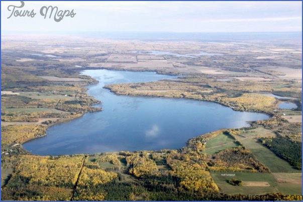
Baptiste Lake
Location: 18.6 km, or about 16 minutes, west of Athabasca on Hwy 2. At the intersection where Hwy 2 turns north, continue straight on Township Road 663A and follow this road until you see the park.
Info: 780-675-2273; www.athabascacounty.com.
A group of Metis from Saskatchewan settled in long, narrow lakefront lots along Baptiste Lake in the 1880s. Farming began in 1904, and by 1909 the land that remained was offered to homesteaders. Much of the agricultural land you see around this lake was broken before 1915. Baptiste Lake is named after early settler Baptiste Majeau.
The Athabasca County day-use area, located on the southwest corner of Baptiste Lake, provides a boat launch, large dock, washrooms, change rooms, picnic shelter, tables, and a playground. There is a concession across the road at a private campground. Although sometimes susceptible to blue-green algae, the lake is used extensively for swimming and boating, as well as for fishing for yellow perch, northern pike, and walleye. Narrows connect two lake basinsthe shallower northern basin is up to 16 metres deep, while the southern basin descends 28 metres.
Forfar Recreation Park
Location: 18 km south of Athabasca on Hwy 2, and then 23 km west on Hwy 663.
Info: 780-675-2273; www.athabascacounty.com.
Located on a different Long Lake than the one near Boyle (see Long Lake Provincial Park), Forfar Recreation Park has two very nice beach areas, a boat launch, picnic tables, firepits (with firewood available), a playground, and walking trails. There is a small day-use charge per vehicle.
Baptiste Lake Map Photo Gallery
Maybe You Like Them Too
- Explore Sasbach, Germany with our Interactive Map
- Explore Nevestino, Bulgaria with this Detailed Map
- Explore Pulau Sebang Malaysia with this Detailed Map
- Explore Southgate, Michigan with this detailed map
- Explore Les Accates, France with this Detailed Map