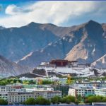
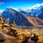
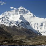
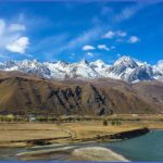
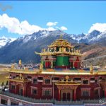
The land route to Tibet is still a difficult undertaking. The only option is to take an overland bus from Katmandu which involves an exhausting journey lasting several days over one of the few Chinese-Nepalese border passes, which reaches first Xigaze and then Lhasa. It is therefore worth taking the plane either from Chengdu which offers frequent two-hourflights or else from Beijing, a good 414 hour journey. The only airport is at Gonggar near Lhasa. It is some distance from the capital and the transfer bus takes a long time to reach the city centre.
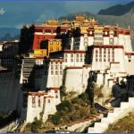
Lhasa the capital of Tibet stands at an altitude of 3650m/11,972ft and is therefore unsuitable for travellers suffering from heart problems or breathing difficulties. Xigaze Tibet’s second city is about 300km/185 miles from Lhasa and the journey takes a good six hours.
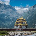
About halfway between the two towns lies the small settlement of Gyantse where the Kumbum, the biggest Nepalese-style stupa in Tibet, is worth a brief visit. This region with its mountains and lakes must surely rank as one ofthe most beautiful in the world. Excursions can be arranged.
China Silk Road
The old overland caravan route that the merchants used to transport History their goods between East and West Asia is known as the Silk Road (Sochou Zhilu). The discovery ofthe silkworm and the methods used to process the thread into silk probably date back thousands of years to well before recorded time and it was via the Silk Road that the prized fabric found its way to the West.
It is certain that this route existed over two millennia ago, perhaps even centuries before that. It started originally in the central Chinese town of Chang’an (Xi’an)-with connections to Beijing and Chengdu-and led westwards via Lanzhou, Anshi (Anxi) and Tunhwang (Dun-huang) dividing into a northern and southern route via the oases at the foot of the mountains to skirt the Tarim Basin and Takla-Makan Desert.
The two routes met again in Kashgar and then followed a variety of paths through or around the Pamirs and on to Antioch (Antakya).
Another route took a southerly course crossing the Karakorams towards India. It is thought that such a journey from Europe to China and back would have taken between six to eight years. The Silk Road which helped to create such Central Asian city-states as Turpan, Kho-tan and Yarkand was used mainly for transporting raw silk to the West but in return many plants and fruits found their way to the Middle Kingdom. Clover, peaches, almonds, spices and scented oils all began to appear but also glass, jewels and other luxury goods, not to mention Buddhism, Manichaeism, Nestorianism and Islam.
During the first thousand years after the birth of Christ, the Silk Road suffered badly from the violent disputes between the peoples of Central Asia, but during the years of Mongolian rule (13/14th c.), it recovered its importance as trade flourished. Marco Polo retraced sections of the Silk Road on his journey from Venice to China (1271-95), but shortly after, merchants began to preferthesea routes between the Far East and the Old World. These routes proved both quicker and safer than the extremely long overland distances ofthe Silk Road.
Along the Silk Road from Lanzhou to Kashgar via Dunhuang, Turpan and Urumqi
Following the old Silk Road involves taking exactly the same route -perhaps with a lighter load but still not without considerable effort -that travellers used over two thousand years ago as they established thefirst of what were to become important economic and cultural links between the Occident and the Orient.
Lanzhou is situated 676km/420 miles north-west of Xi’an (fifteen hours by train) between the Huanghe and a high, steep wall of rock. Beyond Lanzhou the railway follows the old caravan route through Gansu, a narrow strip of fertile land which separates the highlands of Qinghai from the Gobi Desert, and then crosses the Jiayuguan Pass. The remains of the last section of the Great Wall can be seen from the railway line. At Liuyuan, 24 hours (1800km/1120 miles) from Xi’an, a bus crosses the desert to Dunhuang, a journey of about 150km/ 90 miles. About 20km/12 miles south of the town lies the Mogao Caves, which are accessible by bus from the town centre or in jeeps which may be hired from the hotels. Dunhuang was once an important town on the Silk Road and between the 5th and 14th c. monks, painters, sculptors and other artists created a wealth of wall paintings and sculptures in the hundreds of caves. The expressive power of the outstanding work on display here was rarely surpassed in the periods that followed.
Returning to Liuyuan, the railway line continues westwards across the desert for a further twelve hours to Turpan, an extraordinarily beautiful and impressive oasis. Its climate and vegetation have much in common with Central Asia and visitors should take great care as Turpan is the hottest town in China and the sun’s rays can sometimes be dangerously powerful.
Travellers who wish to continue into Xinjiang should take the bus to Urumqi (6 hours). Although the city has little to offer in the way of tourist sights, excursions can be made into the surrounding region or else a four-day bus journey undertaken to Kashgar, the biggest and most distinctive ofthe Uigurian oases which are scattered throughout this desert region. For the monks, traders and pilgrims who plied the Silk Road Kashgar was the last town before the climb over the Pamirs.
The province of Anhui in eastern China lies between 114°43′ and 119°38’E and 29°25′ and 34°39’N.
Two large rivers, the Huaihe and the Changjiang (Yangtse), flow through Anhui from west to east. The province can be divided into three different zones – the plain to the north of the Huaihe, the hilly region between the Huaihe and the Changjiang, and the mountainous country south of the Changjiang.
Summers in the province are hot and humid and the winters generally cool but colder and drier in the north. Rainfall amounts are less in the north than in the south.
Tibet Photo Gallery
Maybe You Like Them Too
- The Best Cities To Visit in The World
- World’s 10 Best Places To Visit
- Coolest Countries in the World to Visit
- Travel to Santorini, Greece
- Map of Barbados – Holiday in Barbados

