Provinces: Varmlands Ian, Orebro Ian.
T Varmlands Turistrad, vS Box 323,
S-65105 Karlstad; tel. (0 54) 10 21 60.
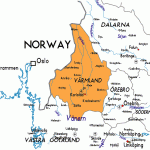
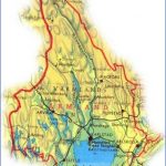
The beauty of Varmland is in its scenic variety, its alternation between uplands, expanses of plain and many lakes. Although archaeological finds have shown that the region was inhabited by Stone Age people, it was only thinly settled in the medieval period. In those days, there was active border trade with Norway. This was also a route by which Christianity made its way from Norway into Sweden. Given the nature of the soil, agriculture yielded meagre returns. The principal crop grown by the peasants was oats, both for their own subsistence and as fodder for the horses which were used in agriculture but were primarily bred on the landowners’ estates.
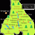
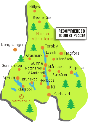
In the 16th and 17th c. many Finns settled in Varmland, attracted by the exemption from taxes which was offered as an inducement to settlers. These peasants, known in Sweden as svedje-bonder, had their own methods for cultivating the land they simply burned down the trees. In the course of time, this created difficulties for the mining and ironworking industries, which needed the timber for smelting the iron and for extracting the ore. It was common practice to light fires in the mine shafts to heat the rock, which cracked as it cooled and could be dug out with a pick. This meant that the mines required large quantities of timber, and, since the transport of timber was difficult, the mines were located close to areas of forest. The burning of forests led the mine-owners to complain to the Crown, and this brought the Finnish peasants into conflict with the court. The development of industry led to increased mining in the middle ofthe 19th c. and the ore, originally carried by pack-horses and small boats, began to be transported on the canals and by rail. Filipstad (pop. 7800; Esso Motor Hotel, 93 Hennickehammars HerrgSrd, 110 b.), named after Duke Karl Filip, Charles IX’s son, is in a beautiful area at the N end of Lake Dagldsen, surrounded by woodland and lakes. It is within easy reach of hills and attracts many skiing enthusiasts in winter. The town’s economy has long depended on the iron mines. Before receiving its municipal charter in 1611, Filipstad was a trading town where iron was exchanged for corn and beef cattle; the agriculture of the region contributed little to its survival. In the last forty years or so, there has been a distinct upsurge of prosperity: old industries have been modernised and new ones begun. Among the town’s largest industrial establishments are Wasa Spisbrods Fabrik AB, whose products include a very popular kind of crispbread, and Rosendahls Fab-riker, Sweden’s largest producer of ink and carbon paper.
The cruciform church (1785) was designed by Nicodemus Tessin the Younger. In the Eastern Cemetery (Ostra KyrkogSrden) is the mausoleum of the engineer and inventor, John Ericsson, whose name is synonymous with the construction of the Swedish railways. In the Market Square (Torget) can be seen an attractive and unusual statue by Bejemark depicting Nils Ferlin, a well-known native of the town, seated on a park bench. (Ferlin was an actor, singer, and the author of popular and satirical songs). Visitors to the town in the first half of September should not miss the traditional Oxhalja market. There are conducted tours ofthe Wasa crispbread factory. To the N of Filipstad is the Storbrohytta, a 16th c. hammer-mill which remained in operation until 1920.
A popular vacation area in Varmland is the region of the three Fryken Lakes (158), which, in addition to its beautiful scenery, has many associations with Selm3 Lagerlof, and particularly with her famous novel, Gosta Berling. At the N end of Upper Lake Fryken is the busy industrial and commercial town of Torsby (pop. 3000; Bjornidet Hotell, 40 b.).
Varmland Sweden Map Photo Gallery
Maybe You Like Them Too
- The Best Cities To Visit in The World
- World’s 10 Best Places To Visit
- Coolest Countries in the World to Visit
- Travel to Santorini, Greece
- Map of Barbados – Holiday in Barbados

