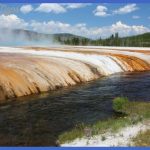
NOTE: Consult the Norris Geyser Basin map, 229, for Porcelain Basin’s walkways. Porcelain Basin Overview Approaching from the parking lot, turn right and pass through the museum breezeway to visit Porcelain Basin, or stop to visit the museum’s geological exhibits. The far side of the breezeway affords a panoramic view of the basin and of Mt. Holmes about 10 miles (16 km) beyond. The acres of geyser-ite and acid-leached lava here give the ground the texture and colors of fine pastel tableware. Porcelain Basin is aptly named, since geyserite is made of silica, Porcelain Basin below the Norris Museum. and silica and alumina are major constituents of porcelain. In the varying light between dawn and dusk, pools of opalescent water reflect different shades of blue. The basin shows delicate tints of canary yellow, sulfurous yellow green, aqua, orange, rose, coral, white, tan, and gray. Minerals like iron oxides and arsenic sulfides are responsible for much of the staining. Bright lime-green algae love the acidity in some runoff channels, while yellow, orange, and brown microorganisms thrive where the water is neutral or alkaline. The amount of water in Porcelain Basin’s aquifer seems to vary greatly. The water supply was especially low in 1996, a summer when the two Norris museums and the campground were closed as a government economy measure.
Porcelain Basin’s eastern loop is partly wheelchair accessible but steep in places. An extension of the eastern loop leads toward Nuphar Lake, Porcelain Terrace Springs, and Norris Campground. Because there are few signs pointing out the named features, this is the most dicult basin in the park in which to orient yourself. The western loop is about 0.5 mile long (0.8 km) and the eastern loop a little less. Porcelain Basin West Loop You might begin your tour of Porcelain Basin by taking the stairs down to follow the western loop in a counterclockwise direction. This will bring you close to the greatest number of hydrothermal features. First encountered as you bear right when the trail forks is Black Growler Steam Vent. One of the highest temperatures recorded at the surface of any feature in Yellowstone was in Black Growler’s steam, once measured at 284°F (140°C). North of Black Growler and a little farther from the walkway is Valentine Geyser, and even farther away (and harder to see when not erupting) is Dark Cavern Geyser. Valentine Geyser was called Alcove until one February 14th early in the 1900s, when the Norris hotel winter keeper watched as large amounts of rock, mud, water, and steam were blown out, forming a huge pit. It erupted quite regularly for some years to 75 or 100 feet (23-30 m), but is now irregular. This geyser has built a cone inside its alcove, the largest of any Norris geyser. Dark Cavern Geyser usually erupts quite regularly once or twice an hour up to 20 feet (6 m) and sometimes higher and very forcefully. It seems to be connected both to Valentine and Ledge Geysers.
Ledge Geyser erupts from five vents, from which water jets out in the shape of the fingers and thumb of a hand. For its muddy eruptions, it was often called Mud Geyser in early years. Geyser expert T. Scott Bryan writes that water from the thumb projects at a steep angle and to a height of 125 feet (38 m), while producing an unmatched booming and roaring. But, like Steamboat Geyser in Back Basin, Ledge is totally unpredictable. It erupted once each in 2006 and 2007, and twice by mid August in 2008. One recent summer, Basin Geyser, the small, steaming pool located shortly before the trail junction, had yellow mon-keyflowers growing in its alcove. Another year, the temperature of its water was posted as 202°F/94°C, a temperature that’s above boiling at this altitude and much too hot for flowers. Out across the barren flats are at least eight geysers or perpetual spouters and many hot pools. The one with the most significant activity in the 1980s and ’90s was Fireball Geyser, located 100 feet (30 m) or more from the walkway. Fireball’s main jet angles to the right, while a lesser column shoots straight up. It erupts about every 2 hours. Three geysers are near the walkway and on the right as you walk northwest. Little Whirligig Geyser sometimes sends up small, rapid bursts of water but is nearly dormant. Constant Geyser is farther from the walkway, making a triangle with the Whirligigs. Constant is not a perpetual spouter but does sometimes erupt for a few seconds several times an hour, sometimes to 30 feet (9 m). Whirligig Geyser (sometimes called Big Whirligig) is the third of this related threesome. The water of the bigger Whirligig swirls about in its crater during eruptions and a crack on the crater’s far side emits a loud chugging sound. Pinwheel Geyser, just east of the short spur of walkway, was a frequent performer until the ground settled some years ago, allowing runoff and sediment from above to cool and partially clog it.
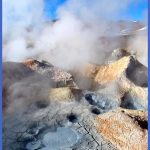
When this geyser is active, its runoff channel passes right across the crater of Splutter Pot Geyser, sometimes called the Washing Machine for its low belching water. After passing below a tree-covered hillside, the walkway brings you to Whale’s Mouth Spring, which rather resembles an open mouth with teeth and is usually full of green water. The jumble of high jagged rocks and fallen trees bordering the basin to the west appears on park maps as the Ragged Hills. These hills are full of rhyolite caverns, and bears have used them for hibernation. Smart bears! The ground there can be as much as 30°F (17°C) higher than the outside temperature. Named in the 1960s for the popping sounds from many bubbles are large, hot, A bright green Cyanidiales alga grows in a runoff channel. opalescent, blue-green Crackling Lake and its neighbor Crackling Spring, partway up the hill. To your right as you mount the stairs from the basin is the Milky Complex, whose Teal Blue Bubbler will sometimes be spouting as you pass. A few steps and a steep but shady path take you back to the start of this loop. Crackling Lake takes its name from the sizzling gas bubbles in its water. Porcelain Basin East Loop From the stairs just below the museum, turn right (east) for the eastern loop around Porcelain Basin. NOTE: © The eastern loop is partly wheelchair-accessible if you go past Bathtub Spring and around the museum to avoid the stairs (see map). First you’ll see a hillside full of steaming and bubbling fumaroles and spout-ers, lined in red, orange, or yellow and called Vermilion Springs. The variety in the colors here is due to different levels of acidity and different oxidation states of iron and sulfur. Such an area of hot sulfurous gases without pools or geysers can be called a solfatara. Farthest from the walkway is Locomotive Spring (or Springs, since there are a red and a blue pool though hard to see from the boardwalk), with occasional eruptions to 6 feet high (1.8 m).
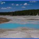
Congress Pool next to the boardwalk became a geyser in 1891, after beginning life as a fumarole. The geyser was named for that year’s Fifth International Geological Congress, and also (according to its namer, geologist Arnold Hague) because its earliest outbursts were powerful eruptions marked by periods of rest. The congress of geologists was held in Washington, D.C., but included a Yellowstone field trip. Congress promptly settled down to become a pool, a bubbling mud pot, or sometimes a weak steam vent. There’s more action on the hillside behind Congress Pool, where in 1929 an experimental drill hole went 265 feet (81 m) down. The enormous steam pressure had threatened to blow up the drilling rig. Despite being filled with cement, the Carnegie II Drill Hole (near the tree line) became a perpetual spouter many years later. The ground around it pulsates, threatening a future steam explosion. Along the trail to the north toward the Norris campground is cool Nuphar Lake, which carries the botanical name for the yellow pond lily, yet harbors grasses and reeds. The lake is fed by rainwater and small thermal springs and has no outlet. This section of boardwalk ends at the foot of Porcelain Terrace, where thermal activity is so intense and unpredictable that boardwalks have to be rebuilt frequently. After the 1959 Hebgen Lake earthquake, fractures formed on top of the terrace, and pools rich in sulfuric acid filled the fractures. This is causing View of most of Porcelain Basin and its jewel-like pools. the sinter to disintegrate and the hillside to crumble. Porcelain Springs (beyond the end of the boardwalk) broke out on the west slope of Porcelain Terrace in 1971. As with most features at Norris, these springs change unpredictably from geysers to pools and back again. Sinter buildup the most rapid in the park has filled in some previously important springs in the basin below.
Returning from Porcelain Terrace, if you bear right at the trail junction, you’ll find a bench where you might rest a bit and admire the unusual and beautiful basin vista. In the nearby collection of pools, each manages somehow to have a different color. The murky pools and stained sinter may be green, blue green, yellow, yellow green, reddish orange, mustard, or beige, due to different temperatures, chemical compositions, and degrees of turbidity of the water. The effect is like small jewels in the midst of desolation. Before the intersection of walkways, you’ll come to Hurricane Vent, above the path. Now usually just a deep hole in the hillside that emits a strong odor and sometimes splashes a bit of water, a century ago it played as a geyser that whirled the water about in its crater during eruptions. At other times it was a prodigious steam vent whose violent gusts bear a striking resemblance to the driving blasts of a tempest, according to historian Hiram Chittenden. Colloidal Pool is a large, shallow, funnel-shaped pool (or three or four smaller pools when the water level is low). In the past it has erupted muddy water as high as 30 feet (10 m). A colloid is a substance so fine grained that it is suspended indefinitely within another substance. In this case, silica and clay are suspended in water, as can be found in pools throughout Porcelain Basin. The last interesting feature before the trail junction is the long narrow pool of Sunday Geyser, named in response to its large initial eruption on Sunday, July 12, 1964, but since then erupting rarely. Turn left to return to the museum, Back Basin, or the parking lot. To the right, the path loops back along the basin’s west side (see Continuing northwest on 238).
WALKING TOURS OF PORCELAIN BASIN Photo Gallery
Maybe You Like Them Too
- The Best Cities To Visit in The World
- World’s 10 Best Places To Visit
- Coolest Countries in the World to Visit
- Travel to Santorini, Greece
- Map of Barbados – Holiday in Barbados

