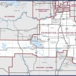
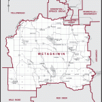
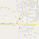
WETASKIWIN MAP EDMONTON
Directions: Exit Edmonton on Hwy 2 south; take exit 516 to reach Hwy 2A south to Wetaskiwin.
Distance: 71.2 km, or about 1 hour and 7 minutes, from Edmonton.
Info: 780-361-4417; 1-800-989-6899; www.wetaskiwin.ca.
Information on all of the city attractions and events can be obtained by dropping by the Visitor Information Centre, located across from the water tower along Highway 2A. As with most Alberta communities, the first Europeans to visit and settle in the area were missionaries and government agents. But long before the settlers arrived, two Aboriginal tribes fought to protect their territories from each other. Hostile enemies, the Cree lived to the north and the Blackfoot lived to the south of the Red Deer Rivera line that defined their hunting grounds. Every summer, Blackfoot warriors crossed the river to follow bison herds migrating north, sparking fierce battles and constant war.
According to legend, in about 1867 both tribes had young chiefs who had not yet fought each other. Planning a surprise attack, Blackfoot chief Buffalo Child took his rifle and left to discover where the
Cree were positioned. He travelled to the low hills north and west of present-day Wetaskiwin in search of a better view of the terrain and the Cree camps.
Also anxious to determine the enemy’s location, Cree chief Little Bear took his knife and made his way to the hills. Discovering each other face to face on the same knoll, the two chiefs put down their weapons and attacked each other with bared fists. Of equal size and strength, they tumbled, wrestled, and fought, but neither could overcome the other. Nearing exhaustion, they finally pulled away from each other to rest.
Watching Little Bear warily, Buffalo Child took out his pipe and began to smoke. Keeping his eyes on the Blackfoot warrior, Little Bear reached for his pipe but discovered it had broken during the struggle. Perhaps without thinking, the Blackfoot offered his pipe to the Cree, who automatically took the pipe and inhaled its rich flavour.
Tradition dictated that those who smoked from a shared pipe forged an unbreakable bonda promise of peace and camaraderie.
The young chiefs returned to their tribes to tell the elders what they had done, then brought their tribes to the hill, where the peace pipe was passed and promises made to remain friends for all time. The hills became known as Wee-Tas-Ki-Win-Spatinow, which means the hills where peace was made.
Still, peace did not reign everywhere. During the 1885 Northwest Rebellion, Fort Ethier was built to protect the Calgary-Edmonton Trail and provide a haven for settlers in the Wetaskiwin area. You can still see the log block building at its original location, though it is not accessible.
In 1890, work started on the C & E Railway between Calgary and Edmonton. During construction, Wetaskiwin was called Siding 16the 16th stop in the line north from Calgary. Sidings were spaced every 11 or 12 kilometres to allow trains travelling in opposite directions to meet one another. When this northern point was reached in 1891, settlers built a community around the train station. The following year, Father Lacombe suggested that Siding 16 be called Wetaskiwin. The community incorporated as a town in 1902 and became Canada’s smallest city in 1906.
A terrible fire destroyed much of Wetaskiwin’s wood-framed downtown in 1903. New businesses made of brick, sandstone, and Tyndall stone sprang up. You can follow interpretive signs through Wetaskiwin’s downtown and see several early-20th-century buildingsa number of which feature murals depicting local history. For those who like to shop along a main street, Wetaskiwin’s historical downtown core is also the place to browse through antique stores, gift shops, fashion boutiques, and galleries.
For a longer walk, explore the town’s beautiful walking trails connecting the downtown, Auto Mile, By-the-Lake Park, and Reynolds-Alberta Museum. Directional brochures are available at the Wetaskiwin and District Chamber of Commerce Visitor Information Centre (4910-55A Street) on the Auto Mile, on Highway 2A through Wetaskiwin. Home to more than 12,000 people, the city of Wetaskiwin has the highest per capita auto sales in the country and is called the Car Capital of Canada because of the multitude of vehicle dealerships on the Wetaskiwin Auto Mile.
There are two landmarks of note at the eastern and western entrances to the downtown core. Wetaskiwin’s historical water tower can be seen as you enter the city from any direction. Constructed in 1909, the iconic tower stands 45 metres high. It is located at the western entranceHighway 2A and 50th Street. Look for the restored 1907 courthouse, now Wetaskiwin City Hall, at the city’s east entrance47th Street and 50th Avenue. Be sure to inspect the carved ionic columns and elaborate
cornice work, which give this national historic building a modern Renaissance look. Guided tours of the old courthouse/new city hall are available by appointment from May through September on the third Wednesday of the month. During the rest of the year, visitors can take a self-guided tour through the building. Annual events include the Harvest Festival, and Gingerbread and Glitter Christmas festivities.
WETASKIWIN MAP EDMONTON Photo Gallery
Maybe You Like Them Too
- Explore Nevestino, Bulgaria with this Detailed Map
- Explore Pulau Sebang Malaysia with this Detailed Map
- Explore Southgate, Michigan with this detailed map
- Explore Les Accates, France with this Detailed Map
- Explore Góra Kalwaria, Poland with this detailed map

