The Stockholm skerries
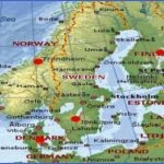
Between the southwest coast of Finland and the western coast of Sweden lies the largest fringe of skerries. Between Turku and the Aland Islands are swarms of these rocky islets, with rounded tops produced by the action of the glaciers, those nearer the coast being higher and wooded, while farther out they are completely bare. There is a similar fringe off Stockholm in which no fewer than 24,000 islands and islets have been counted. From here the Southern Lowlands of Sweden extend westward from Lake Malar to Lake Vanern, a relic of the sea which once covered this region.Tothesouth isSmSland, risingtor height of barely 400 m (1 300 ft); and i the southwest both the Southern Lo’ lands and SmSland are bounded by t coast of Bohuslan and Halland with fringe of skerries.
Geology. Skcine, at the southernmost tip of the Scandinavian peninsula, has a quite different geological structure from the rest of Scandinavia. A narrow ridge of ancient rock does, it is true, emerge from more recent deposits, pointing towards Bornholm; but for the rest the basement rocks match those of the Danish islands, and the coastal forms of Skcine are quite different from those found elsewhere on the Scandinavian peninsula. Here there are neither fjords nor skerries; instead there are projecting spits of land and fringes of dunes. In Denmark massive superficial deposits almost completely cover the basement rocks; only on the east sides of the islands of Falster and Mon and on the southeast coast of Zealand are there chalk cliffs such as are found on the German island of FSugen. Jutland, with coasts of quite different character on its west and east sides (dunes on the one side, coastal inlets on the other), is nevertheless, taken as a whole, an accumulation of superficial deposits, tending to be loamy in the east and sandy in the west.
Everywhere in Scandinavia north of Skcine very ancient rocks predominate in the landscape, though in many places they are overlaid by the most recent geological formations, the morainic deposits of the Ice Age. Mesozoic strata are entirely absent. The western parts of southern and central Sweden are mainly built up of gneisses, while to the east of a line running south through Lake Vattern granites predominate, overlaid in places by flows of porphyry. Horizontally bedded Cambrian and Silurian sediments are found only in the form of remnants of varying size, the Silurian deposits frequently providing the basis for expanses of fertile arable land. At various points, too, volcanic eruptions in the Palaeozoic era have yielded diabases producing, for example, the prominent Kinnekulle range and the plateau-like hills of Vastergotland with their striking rock walls. The islands of Oland and Gotland consist almost entirely of Silurian limestones.
In Silurian times the varied ancient rocks of the Scandinavian mountains were subjected to the Caledonian folding movement and thrust over the horizontally bedded rocks to the east. The southwestern continuation of the range, which is some twenty times older than the
Alps, emerges again in Scotland and northern Ireland.
The geological processes of the last Ice Age, however, played a much greater part in shaping the present topography of all the Scandinavian countries. Even when the morainic formations, so common everywhere, and other glacial deposits are lacking, the work of the ice has so radically transformed the earth’s surface that all older forms can be only dimly perceived below the surface: only the massive Scandinavian mountain chain has survived. For tens of thousands of years the whole of northern Europe and North Germany was covered with great masses of ice, only the highest peaks of the Scandinavian mountains emerging from the ice in the form of nunataks; but while North Germany became ice-free some 20,000 years ago northern Scandinavia was still covered with ice 10,000 years ago. Asa result of the gradual retreat of the ice the Baltic, originally only a large lake along the fringe of the ice, had a constantly changing coastline. Only in what is known as the Yoldia Phase did it connect up with the open sea not through the Danish Sound, as it does now, since that was not yet open, but by way of the Billingen Gate in central Sweden when this was opened up by the retreat of the ice. At the same time the Baltic was connected with the White Sea by a channel which ran northeast along the edge of the ice mass, so that the whole of northern Scandinavia now became an island.
Scandinavia Map Tourist Attractions Photo Gallery
Maybe You Like Them Too
- The Best Cities To Visit in The World
- World’s 10 Best Places To Visit
- Coolest Countries in the World to Visit
- Travel to Santorini, Greece
- Map of Barbados – Holiday in Barbados

