Continue down Jefferson Street you’ll now whiff the crab, sourdough loaves, and cotton candy while wandering past curio shops, sidewalk seafood restaurants, and the moored fishing boats of Fishermans Wharf. Look for dock openings on your left to wander out among the working boats, the muscle behind the glitz and gaucherie of the wharf. Then walk left at Taylor Street, past the ferry terminals at Pier 43. To the right of the Red and White Ferry, head out toward the Public Shore sign to the pier, which features a display commemorating a system of bells that kept ships from rocky shoals all around the Golden Gate. Then continue, passing Pier 41 with service to Alcatraz, to Pier 39.
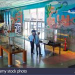
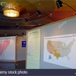
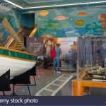
MARITIME MUSEUM, AQUATIC PARK MAP SAN FRANCISCO Photo Gallery
Working Fishermans Wharf
On the way to Pier 39 is one of SF’s most intriguing attractions: the Musee Mecanique (on Pier 45 at the end of Taylor Street), a wondrous, low-tech arcade of antique games from yesteryear. Automated Laffing Sal is sure to freak the whole family. Pier 39 is a two-level circus of colorful shops and restaurants set in rough-hewn buildings on a broad plank walkway that juts about 1,000 feet into the San Francisco Bay. At the end of the busy boardwalk is a viewing area, looking out toward Alcatraz and Angel Island. Go left at the viewing area to see Pier 39’s most-boisterous crowd: a hoard of up to 600 barking, frolicking and sunning sea lions gathered at K-dock. The migrating mammals began hanging out after the earthquake of 1989, enjoying a ready supply of herring in the shoreline waters. They have increased in number and migrated less since then, perhaps enticed and amused by an adoring human audience. On rare ocassion, the mammals may be elsewhere. You can then proceed along the outside of Pier 39.
Retrace your route back through Aquatic Park, but then stay to your right and head up the wide, paved path along the water to Fort Mason. At the top of the ramp, head down a long staircase to a half-dozen long, large buildings with red roofs set on piers. Poke around the blogstore, Mexican Museum, or lunch at the renowned Greens Restaurant. Fort Mason was the Army’s main Pacific supply center during World War II.
To walk the other way, from Fort Mason to Crissy Field, head to your left as you face the bay, walking the path or sidewalk nearest the water. For the first mile, the Marina Yacht Harbor will be on your right and the Marina Green, a playfield for locals, will be on your left. At the far end of the Marina Green, you’ll pass the yacht clubs, after which is the eastern end of the Golden Gate Promenade. This path follows the bay to the bridge.
Bike: The entire San Francisco Bay shoreline, from Fort Mason to the Ferry Building, and, going the opposite direction, to Fort Point and the Golden Gate Bridge, is bike friendly. For a touristy, sight-seeing ride, pedal up the multi-use path beside the Great Meadow, which takes you to Aquatic Park. From there, hug the shore-side streets, Jefferson, and then The Embarcadero, for a rolling look at the sights mentioned in the stroll above.
Continue along The Embarcadero, past piers going away from the buzz of Fishermans Wharf. Stay on a dedicated bike lane of Route 5 to the Ferry Building in the heart of downtown. You can have a picnic under skyscrapers at Justin Herman Plaza. The round trip from Fort Mason to downtown is almost 7 miles. From Fort Mason to Fort Point at the Golden Gate Bridge is a level ride of about 6 miles, round-trip. You can hug the water all the way, along the Marina Green and then Crissy Field. This is a breezy, open-view, “look ma, no-hands” ride.
Maybe You Like Them Too
- Arnold A Town with a Heart
- Map of New York City – New York City Guide And Statistics
- Map of San Francisco – San Francisco Map Free
- Coolest Countries in the World to Visit
- The 10 Best American National Parks to Visit

