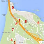
Parking From north of the Golden Gate Bridge on Hwy. 101, go through the far-right toll booth. Make an immediate right on Merchant St. and another immediate right, traveling under the roadway to the east side of the bridge. Veer right to a stop sign at Lincoln Blvd. Turn left on Lincoln and then turn left after a short distance into GGNRA parking for Battery East. From the south of the Golden Gate and the Bay Bridge, head toward the Golden Gate Bridge on Hwy. 101 and take the vista point exit on the San Francisco side, immediately before the toll plaza booths. Follow directions above to Battery East parking lot. Note: The metered parking at vista point is closer to the bridge. You’ll need quarters. Agency: Golden Gate National Recreation Area; Golden Gate Bridge District.
Golden Gate Bridge Map Photo Gallery
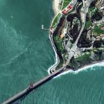
For all hikes, go down the stairs to a trail as you face the bridge not the bike route that takes off to the left. On your right is Battery East, the oldest U.S. gun emplacement, built in 1876. A hop to the top reveals its splendid vantage point. To Fort Point, which is also described in TH13, drop down the trail, just to the right of Battery East. You’ll go down stairs, through a eucalyptus and cypress grove with lush undergrowth. After descending about 200 feet, the trail reaches Long Avenue, which leads a short distance along a seawall. Often wet with crashing waves, this wall is where Kim Novak flung herself into the sea and was saved by Jimmy Stewart in Hitchcock’s Vertigo. The massive brick fortress is not far to your left.
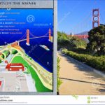
For the Golden Gate Bridge and Fort Scott overlook, continue on the trail past the battery, going through a brick tunnel, and coming to the vista point parking area. Among the sights here are a segment of the bridge’s huge cable and a statue of Joseph Strauss The Man Who Built The Bridge. Then head up to the roadway to begin the bridge walk. You’ll notice the clean Art Deco detail built into the bridge, and might be surprised by how much it curves upward in the middle. The towers are 500 feet above the roadbed, and it’s 220 feet to the sea. Be Aware: It’s usually breezy on the span.
To Fort Scott overlook, head down the stairs at the bridge observation area, leading to a path that takes you under the bridge. You’ll be on the Coastal Trail, and also portions of the Bay Area Ridge Trail and De Anza Trail. Keep right along the bluffs, coming to stair sections here and there. Along a .25-mile section you pass the Coastal Defense Batteries in this order: Battery Cranston, built in 1897; Battery Marcus Miller, 1891; Battery Boutelle, 1900, where the bike route joins the hiking trail; and finally to Battery Godfrey, emplaced in 1895. Just south of the parking area at Battery Godfrey is the Fort Scott overlook. This spot is across the street from the Presidio’s Fort Winfield Scott. Be Aware: Crumbling cliffs are hazardous.
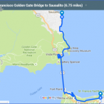
Bike: To head over to Marin north across the Golden Gate Bridge, take the bike route leading out the left side of the Battery East parking lot as you face the bridge, which takes you to the toll plaza. Note: As signs will indicate, the bike route on weekdays is shared with pedestrians on the east side of the bridge; on weekends, you cross under the bridge and ride the walkway on the west side. See Golden Gate Bridge North, TH15, for Marin-side bike routes.
Battery East is also a good parking spot for rides down to Crissy Field toward downtown, as well as rides toward the Pacific side of the Golden Gate toward Fort Funston. You can also go south through the Presidio to Golden Gate Park. To Crissy Field and the shoreline ride to the Ferry Building described in TH13 ride down Lincoln and take Long Avenue, which is the first street to your left, a sharp turn.
Maybe You Like Them Too
- Arnold A Town with a Heart
- Map of New York City – New York City Guide And Statistics
- Map of San Francisco – San Francisco Map Free
- Coolest Countries in the World to Visit
- The 10 Best American National Parks to Visit

