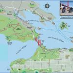
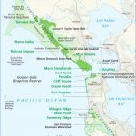
The Wolf Ridge loop is a fairly difficult walk, gaining some 1,000 feet, but offers a big-view payoff. Start on the Coastal Trail at Fort Cronkhite. You climb past Battery Townsley and up to where the Coastal Trail joins the Wolf Ridge Trail. Looking north, you’ll see Tennessee Valley. You have an option of taking the short scamper up to Hill 88, the highest point around. Then continue to your right on the Wolf Ridge Trail for another .75-mile, where you hit the Miwok Trail and turn right. Head down 2 more miles to Bunker Hill Road. Point Bonita Lighthouse is one of the most spectacular short walks this side of the moon. Veer left onto Field Road, as you approach Rodeo Lagoon, heading toward the visitors center. Continue about a mile, passing an excellent picnic area at Battery Wallace, to signed Point Bonita parking. The trail winds down a rocky spine and then through a rough-bored tunnel. You emerge at the western extremity of the Golden Gate and then walk a suspension footbridge that may give acrophobics sweaty palms. The lighthouse has aided ships since 1855. Be Aware: The trail is normally open 12:30 p.m. to 3:30 p.m, weekends and Mondays; call to verify times. To view Point Bonita from a distance, drive to the scenic turnout at road’s end, near Battery Mendell.
Golden Gate Bridge Map English Photo Gallery
Walk: Headlands Visitors Center; Headlands Center for the Arts; Marine Mammal Center; Headlands Institute.
Headlands hostel and trail
To visit Marin Headlands Visitors Center in the former Fort Barry Chapel, built in 1941 veer left off Bunker Road on the east end of Rodeo Lagoon. The center has a tasteful gift store, a wealth of blogs and other information, as well as displays that befit its historic setting. The Headlands Center for the Arts is located in the quaint assemblage of buildings, next to the hostel, up the hill on Bodsworth from the visitors center. The Center for the Arts is a nonprofit artists-in-residence program for a wide range of artists. The best time to visit is during one of the several open houses.
The Marine Mammal Center treats hundreds of sick and injured sea lions, elephant seals, dolphins and other warm-blooded marine critters. Its clinic is located on Old Bunker Road; veer right just before you reach Fort Cronkhite. The center is also active in research and education. Rebuilt in the last decade, the center’s viewing platforms are sure-thing kid-pleasers. Open to the public daily. The gift store is excellent. The Headlands Institute, which offers highly respected environmental studies programs for children, is located on Bunker Road headed toward Fort Cronkhite. Look for signs. bike: The ride to Hill 88 is a steep pump up about 900 feet along a section of the Coastal Trail that is open to bikes. You start the open upslope at the end of Bunker Road at Fort Cronkhite. The summit is just under 2 miles from the trailhead. You have a great view of Mt. Tam and the long view toward the Pacific. You need to roll back down, as the trails from here are closed to bikes.
The Tennessee Valley loop is a challenging ride of about 8 miles, gaining and losing more than 500 feet twice. Start out at the Rodeo Valley trailhead that is on Bunker Road about .5-mile east of the bridge at the lagoon. After a short distance, veer left on the Miwok Trail, and begin a mile-long ride, the steepest of the entire ride. The Miwok Trail joins Old Springs Trail, which drops down to the north, all the way to the Miwok Stables in Tennessee Valley. Before the stables parking, take Marincello Road to your right and loop back to the south, climbing at a manageable grade to join the Bobcat Trail. Go right on the Bobcat Trail, dropping through wide-open Gerbode Valley.
Maybe You Like Them Too
- Arnold A Town with a Heart
- Map of New York City – New York City Guide And Statistics
- Map of San Francisco – San Francisco Map Free
- Coolest Countries in the World to Visit
- The 10 Best American National Parks to Visit

