Getting there
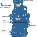
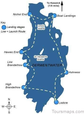
The lake is a short walk from Keswick town centre; the foreshore landings are 900 metres from the Moot Hall. Calfclose Bay is a further mile. Keswick is served by nearly all the bus routes across the region, the principal ones being the 555 from Lancaster via Kendal, Windermere and Grasmere and the X4 and X5 between Workington and Penrith. The 554 comes from Carlisle via Wigton and Bassenthwaite. The Honister Rambler (77/77A, Easter to October only) serves the western shore and the Borrowdale Rambler (78) serves the eastern shore. Use the Keswick Launch to get to Ashness, Brandelhow and other locations on the lake. It’s a lovely way to see the water, second only to swimming in it. In summer a favourite swim is to take the last launch across the lake and swim back to Keswick. I strongly advocate the use of public transport for Derwent Water, in particular for the western shore where parking is practically non-existent. During holidays I watch the bus struggling through lines of double-parked cars. With ample buses and a regular launch across the lake, there is really no need to drive.
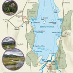
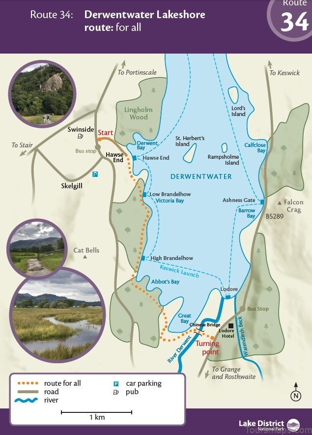
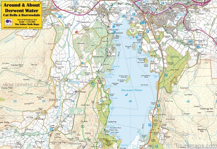
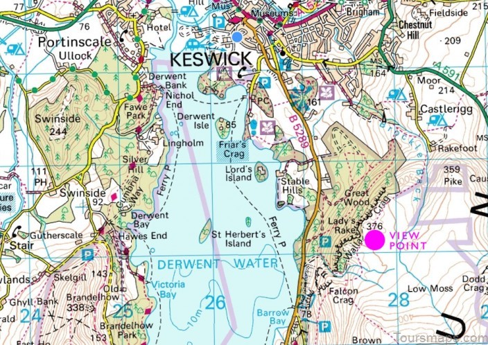
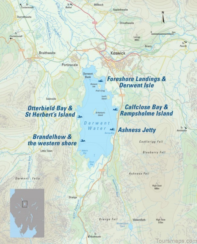
Derwent Water Map Swimming Guide Photo Gallery
Refreshments
» Little Chamonix, Keswick. Regular readers will be familiar with my pie-based tendencies but I’d easily pass up a pie for one of Ellen’s cakes.
» The Square Orange, Keswick. A tiny, narrow bar serving pizza and tapas and continental beers. The size of the kitchen has to be seen to be believed. It can get quite cosy and you often find yourself sharing a table – perfect for warming up!
» Fellpack, Keswick. The staff all love the outdoors and will happily chat to you about walks, runs or bike rides. Tell them about your swim over cocktails and a burger.
» Thomasons Butchers and Deli, Keswick. Be at the door by 8.00 a.m. for the best hot pie in town. Mine’s a meat and tattie.
Where to Avoid on Derwent Water
With a path hugging practically the entire shoreline, Derwent Water gives swimmers some of the best access to open water. However, it’s worth knowing the handful of places to avoid. Kettlewell This beach is a popular point of egress for kayakers. It’s OK for a splash and paddle but there are dense weeds close to shore. This shallow corner of the lake tends to catch the detritus of the lake and the water quality is not great. Abbot’s Bay Designated as a protected wildlife and nesting area. Boats are asked to voluntarily avoid the area and swimmers should do the same. Strandshag Bay ‘The shore of the bay frequented by shags.’ Lord’s Island is a busy roost for shags and the more frequent cormorants, geese and other waterfowl.
Their frequent deposits contribute to the rich, sulphurous silt that lines the shallow and narrow channel of the bay. It’s quite gross to swim through, especially when the water is low. Like Abbot’s Bay, boats are asked to avoid the area. It’s one place I am happy not to swim! Nichol End Marina and Derwent Water Marina These two busy marinas in the north-west corner of Derwent Water have sail boats moored all year round and smaller craft hired by the hour. There is an outdoor centre nearby too so there can often be flotillas of schoolchildren out on the lake.
Lakeland Rowing Club at Isthmus Check their website or Facebook page for regular training sessions but bear in mind that rowers can be out on the lake at any time and they travel backwards at a fair rate of knots. www.lakelandrowingclub.com As Derwent Water is a busy boating lake it is particularly important to follow good practice. Wear a brightly coloured cap – neon colours are recommended over silver or white; the drivers and boathands on the launch say the light reflects on silver, white and blue like water, making you virtually invisible – and take a tow float with a whistle tied on. It is easy to find somewhere to swim away from boats, especially if you are swimming early in the morning or in the evening. Awareness has improved but boaters will not necessarily be looking for swimmers.
Introduction
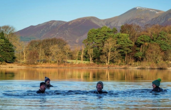
Jude and Ailie are redoubtable mainstays of Derwent Water. They swim in any weather and at any time of year. Wander down to the boat landings at first light and you will invariably find them on their way to their early morning swim; Jude’s laugh ringing out across the water and Ailie sipping hot lemon from a flask, the dogs trotting behind. There are no selfies and no Strava. No posts to Instagram or Facebook. They just swim. It is their morning routine of many years, riding out fads as they come and go. It was Jude who transformed me from a summer dipper to an outdoor swimmer.
She took me for my first ‘proper swim’ in Derwent Water and it changed the way I looked at water forever. Living in Keswick at the time, Derwent Water was a short walk from home and where I swam most often. We swam loops to the islands and held sunset barbecues, took quick dips to purge a day in the office and delighted in morning light seeping through trees lining the shore. Even swimming the same line day after day I never grew tired of the view. A bustling tourist magnet, Derwent Water and its hub town Keswick have been attracting visitors for centuries. Early tourists were inspired by the Lake Poets and guided by precise itineraries to dedicated viewpoints. Eccentric landowner Joseph Pocklington purchased Derwent Isle in 1778 and held mock battles on the water, firing a cannon from his fortified mansion on the island.
The Lodore Hotel also owned a cannon and guests could pay for it to be fired across the lake and marvel at the subsequent reverberations around the valley – one of the earliest tourist attractions in the Lake District. Swimmers today don’t need to worry about flying cannonballs. The popularity of Derwent Water has never waned and the lake is very busy during the day. Nowadays it’s the frequent launches and pleasure boats that swimmers need to watch out for.
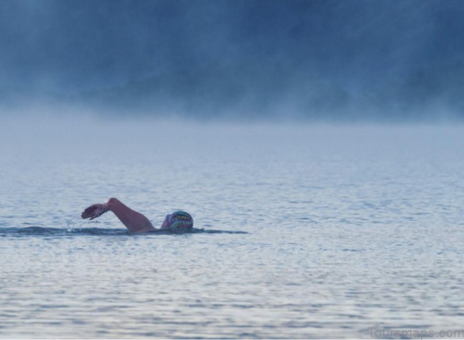
Swims in Derwent Water are planned with one eye on the boat timetable. I treasure the opportunities to swim in Derwent Water at its most spectacular moments. Swimming first thing, before the world comes to life, has been my preference since that first swim with Jude and Ailie, turning me from a night owl to committed early riser. From nuclear sunrises and balmy sunsets to baltic misty mornings and biting winter winds, it’s my lake for all seasons. These conditions are not unique to Derwent Water but the memory of experiencing them in the water for the first time will stay with me in the same way my first mountain sunrise does. Derwent Water is a lake of many firsts for me and will forever hold a very special place in my heart.
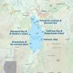
Foreshore Landings & Derwent Isle
I wouldn’t normally advocate swimming from or near a boat jetty, but I make an exception for the foreshore on Derwent Water. It’s where my love of open water was born and who am I to deny this pleasure to another hopeful swimmer? During the day it’s busy with pleasure boats but arrive first thing in the morning and you will have the place to yourself. Early mornings are my favourite time to swim down the channel towards Friar’s Crag. Light falling on the fells is an ever-changing show through the seasons and I could swim up and down this route a hundred times and never get bored. Although the boats do not tend to launch until after 9.15 a.m. be aware that the residents on Derwent Isle can come across to the ‘mainland’ in a small motorboat at any time of day. Derwent Isle is a delight. It lies less than 150 metres from shore, a swim low in effort but one that crosses the path of the launch and other boats. I love to swim round it on a summer’s evening, wondering what it would be like to live in the manor house and how they get the stripes on the sloping lawn so neat. Stately Skiddaw forms the perfect backdrop to this swim.
Calfclose Bay & Rampsholme Island
I have a love–hate relationship with Calfclose Bay. I’ve tried to stride purposefully across the pebble shore, after all how much can a few stones hurt? Quite a bit actually. I curse my way into the water, gratefully plunging in as soon as the shelving edge is reached. Once submerged, all is forgiven. It’s a perfect treat to starfish in the water and gaze up at Great Wood clinging to the vertiginous face of Walla Crag. Calfclose Bay is scooped out of the land and sheltered by the peninsula to the north, affording some shelter on windy days. In spring the smell of wild garlic wafts across the bay, carried on a breeze from Rampsholme Island. The island takes its name from one of the many names for wild garlic – ‘ramps’, but is a slight confusion with the American variety (Allium tricoccum) which are commonly known as ramps. It’s actually the European Allium ursinum known as wild garlic or ramsons that carpet the small island. ‘Ramps holme’ literally means ‘Garlic Island’ (holmr is Old Norse for small island). That’s my kind of island! If you decide to swim out to Rampsholme Island from here be aware that you cross the route of the launch. The island is roughly 550 metres from the shore.
Ashness Jetty
Breaking my jetty rule again, Ashness Jetty is another favoured evening swim spot. There are steps straight down from the road to a sheltered pebble beach with a lovely outlook. Swim here for Cat Bells sunsets and evening light on Falcon Crag; it’s under 250 metres in height but it looms like a monolith above the water. Ashness Jetty is probably the easiest swimming location to reach by public transport. The Borrowdale Rambler (78) stops just past the the top of the steps.
Brandelhow & the western shore
While the eastern shore is somewhat overshadowed by the busy Borrowdale Road, the western shore is much quieter. The road on this side is further away and parking is limited so most traffic is of the pedestrian variety. I don’t have a definitive recommendation as the entire shore offers much interest in its rocky beaches and bays. A walk and swim along the Brandelhow shoreline is a journey through history. This was the first piece of land purchased by the National Trust in the Lake District. Going back even further, the spoil heaps of Brandelhow Bay are relics of sixteenth-century mining. Cat Bells was mined extensively for silver, lead, copper and graphite by German miners brought to Cumbria by Elizabeth I and fenced mine shafts can be seen in this area. Watch your step.
Otterbield Bay & St Herbert’s Island
The narrow promontory at the edge of Otterbield Bay is a good starting point for swims to St Herbert’s Island. The lakeshore path goes over the top of the headland and few people deviate from it, so the beach below is often quiet. There is pleasant shingle on the beach and some shelter beneath the fractured headland. Otterbield Island is roughly 150 metres from the shore. It’s a popular nesting site which we found to our cost as we were dive-bombed on our approach by angry gulls. Swimming to Otterbield Island and then St Herbert’s Island is around 650 metres (one way). There is plenty of interest to explore on St Herbert’s Island and it’s a frequent stopping point for canoeists and kayakers. Swimming to St Herbert’s Island involves crossing the path of the launch. The launch will be easily visible from the north but not from the south. Check the timetable before you swim.
Table of Contents

