Robert H. Meyer Memorial State Beach
Hiking Distance: 2 Miles Round Trip (Total For All Beaches)
Hiking Time: 2 Hours Configuration: 3 Out-And-Back Trails Elevation Gain: 100 Feet For Each Hike Difficulty: Easy
Exposure: Exposed Beachfront Coastline Dogs: Not Allowed
Maps: U.S.G.S. Triunfo Pass And Point Dume
El Pescador, La Piedra, And El Matador State Beaches Are Three Small Oceanfront Parks On The Malibu Bluffs. Together They Comprise The Robert H. Meyer Memorial State Beach. The Three Pocket Beaches Are Within A One-Mile Stretch, Bounded By Rocky Points.
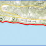
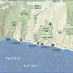
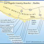
El Pescador La Piedra El Matador State Beaches Map Photo Gallery
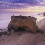
Each Park Contains A Blufftop Parking Lot, A Picnic Area With Overlooks, A Pretty Beach Strand, And A Trail Down The 100- Foot Eroded Cliffs To The Shoreline. Of The Three, El Matador Beach Is The Largest And Most Scenic, With Large Rock Formations, Arches, And Caves.
To The Trailhead
El Pescador State Beach: 32860 Pacific Coast Highway In Malibu. Heading Northbound On The Pacific Coast Highway (Highway 1) From Santa Monica, Drive 20 Miles Past Malibu Canyon Road And 6 Miles Past Kanan Dume Road To The Posted Turnoff On The Left (Oceanside).
From The Pacific Coast Highway (Highway 1) And Las Posas Road In Southeast Oxnard, Drive 13.4 Miles Southbound To The Posted El Pescador State Beach On The Right (Oceanside). The Turnoff Is 2.3 Miles South Of Leo Carrillo State Beach And Just South Of Decker Road.
La Piedra State Park: 32628 Pacific Coast Highway In Malibu. The Turn-Off Is 0.2 Miles East (Southbound) From El Pescador State Park.
El Matador State Park: 32215 Pacific Coast Highway In Malibu. The Turn-Off Is 0.9 Miles East (Southbound) From El Pescador State Park.
The Hike
El Pescador State Beach (10 Acres): Walk Across The Grassy Field To The Bluffs. The Path Begins From The West Side Of The Park. Descend The Bluffs To The East, Dropping Onto The Sandy Beach. The Small Beach Pocket Is Bordered On Each End By Blufftop Homes.
La Piedra State Beach (9 Acres): A Side Path By The Picnic Tables Leads To An Overlook On The Edge Of The 100-Foot Bluffs. The Main Trail Begins At The Upper West End Of The Parking Lot. Drop Down The Sandstone Cliffs Through A Draw To A Long, Narrow, Sandy Beach With A Rocky West End. To The East, The Beach Ends At A Home On The Point At The Base Of The Cliffs.
El Matador State Beach (18 Acres): Walk Towards The 100-Foot Bluffs To A Picnic Area Overlooking The Ocean And Adjacent Beachfront Homes. Take The Path To The Left, Looping Clockwise Down The Eroding Cliffs. Two Sets Of Stairs Lead Down To The Gorgeous Beach With Offshore Rock Outcroppings And Caves. When The Tide Is Right, Water Swirls Through The Caves And Sea Stack Tunnels In The Rock Formations. To The East, Beyond The State Park Boundary, Are Private Homes. If Strolling To The East, Stay Below The High-Tide Water Line To Avoid Property Owner Hassles.
Maybe You Like Them Too
- Top 10 Islands You Can Buy
- Top 10 Underrated Asian Cities 2023
- Top 10 Reasons Upsizing Will Be a Huge Travel Trend
- Top 10 Scuba Diving Destinations
- World’s 10 Best Places To Visit

