Province: Hameen laani (Tavastehus lanHame). Altitude: 85 m (279 ft). Population: 41,000.
Postal code: SF-13100. Telephone code: 9 17.
Kanta-Hameen Matkailutoimisto,
Raatihuoneenkatu 13: tel. 20 23 88 and 20 22 33.
HOTELS. Cumulus, Raatihuoneenkatu 18, 100 SB; Vouti, Raatihuoneenkatu 23,100 b. Aulanko, 5 km (3 miles) N, 500 bž SB. Two YOUTH HOSTELS. Two CAMPSITES.
EVENT. Finlandia cross-country ski race (February).
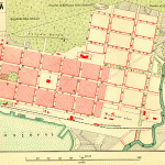
Hameenlinna (in Swedish Tavastehus), main town of the province of Hameen laani, is attractively set on a long narrow lake, the Vanajavesi, with the Hattelmala hills bounding it to the S. It was founded in 1639 on a site to the ll of the 13th c. Tavastehus Castle by Per Brahe, who also reinforced the castle. The town was moved to its present site in 1777. It was the birthplace of the great Finnish composer Jean Sibelius (1865-1957) and the poet Paavo Cajander (1846-1913), and President Paasikivi went to school here. In recent years there has been a considerable development of industry (woodworking, metalworking, etc.).
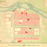
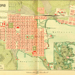
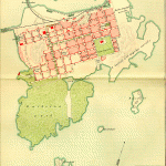
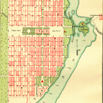
SIGHTS. In the middle of the town is the market square (Kauppatori). On the Eside of the square stands the Lutheran Church (1789), with a statue of Paavo Cajander in the gardens in front of it, and on the S side the Town Hall (1885). From here the Kirkkokatu runs N to the Grammar School (late 19th c.), built on the highest point in the town. Nearby are the Sibelius Park and the Sibelius House (museum), in which the composer spent his childhood.
At 6 Lukiokatu is the Municipal Museum, which contains much material from the Museum of ViborgViipuri, now in the Soviet Union. To the N of the town, on the shores of Vanajavesi, is the well-preserved old castle of Hameenlinna (Swedish Tavastehus Slott), begun at the end of the 13th c. by the Swedish king Birger Jarl and completed in 1639 by Per Brahe. Farther N lies the Municipal Park, with beautiful views. To the E of the river, at 2 Viipurintie, is the Museum of Art.
Hameenlinna (Tavastehus) Castle
SURROUNDINGS. 4 5 km (3 miles) N of the railway station is Aulanko National Park, with extensive recreational facilities (riding, golf, rowing, winter sports) and a mock ruined castle (performances of fairy-tale plays in summer). From the lookout tower there are magnificent views. Below, in a cave, is a group of bears by the sculptor R. C. Stignell.
4 km (2 miles) S of the station stands the stone-built medieval church of Vanaja, with a beautiful altar.
8 km (5 miles) N, on the Palkane road, is the old church of Hattula.
Hameenlinna to Tampere by the ‘Silver Line.
Atripon one ofthe boats of the Silver Line, which sail twice daily from Hameenlinna (one boat taking the western and the other the eastern route), offers a magnificent opportunity to experience the harmony between water and woodland in this part of Finland. The boat leaves Hameenlinna and sails along the narrow Vanajavesi; to the right is seen the Aulanko Hotel. The boat then continues into the Vanajanselka, at the W end of which (on right, the old stone church of Saaksmaki) the two routes diverge. The eastern route continues N, and beyond the industrial town of Valkeakoski enters the Malasvesi (locks); ahead, to the right, is the Palkane church. In 4 hours the boat reaches Vehoniemi, on the northern shore of Lake Roine. From there it is 35 minutes by bus to Tampere (262). The western route turns NW through the Makkaraseka to Toijala. At Lempaala the boat passes under the road and railway from Hameenlinna to Tampere and continues to Tampere.
Hameenlinna to Tampere via Palkane and Kangasala. This route (83 km 52 miles) is preferable to the main road (E79) and is only 3 km (2 miles) longer. From Hameenlinna the road follows the W side of the Vanajavesi, with Aulanko National Park on the opposite shore. 8 km (5 miles): Hattula, with a brick-built church (14th15th c.) which before the Reformation was a famous place of pilgrimage. It contains many pieces of sculpture, including a figure of St Olav from Lubeck. Fine 15th c. wall paintings. 2-5 km (1 miles) farther on is the new church of Hattula. 12 km (7 miles): road on left to the industrial town of Valkeakoski (25 km 15 miles). 4 km (2 miles): road on right to Hauho (12 km 7 miles), the oldest parish in the province of Hame (first mentioned 1329; church, c. 1400; museum). 11 km (7 miles): junction with Road 12. Tothe rightthis runs via Hauho (17 km 10 miles) to Lahti (88 km 55 miles); to the left it skirts Lake Pintele to Palkane (1 0 km 6 miles). The old church (c. 1400) is 1 5 km (1 mile) N ofthe lhari road, anotherl 1 km (7 miles) the road reaches Vehoniemenharju, a beautiful ridge of land between Lake Roine and the Langelmavesi. It then continues over the Kaivanto Canal which links thetwo lakes and soon afterwards passes Keisarinharju (extensive views).
Kangasala (pop. 17,400; camp site) lies at the S end of the Vesijarvi. The church has a carved pulpit of 1661 and a picture of the Swedish queen Karin MSnsdotter, who died in 1612 on the royal estate of Liuksiala, 6 km (4 miles) S. The main road follows the long straggling lake of Kaukajarvi. Viataa, to the left, has a modern cemetery chapel. Beyond this is the old church of Messukya. 18 km (11 miles) from Kangasala is Tampere (262).
Hameenlinna to Tampere on E79. The road runs NW through wooded hill country. In 9-5 km (6 miles) a road goes off on the right to Paroa. Before the level crossing (grade crossing), to the left of the road, is an open-air museum of tanks and anti-tank weapons from 1919 onwards. Then on to Hattula (6-5 km 4 miles). E79 now runs along the S side of the Lehijarvi at some distance from the lake, and enters in 13-5 km (8 miles) (off the road to the left) the well-known glass-manufacturing town of Littala (conducted tours of glass factories), on the N side of the narrow Kalvolanjarvi.
11 km (7 miles) beyond this a road goes off to the left along the S side of the Makkarselka to the railway junction of Toijala (Pirkka Hotel, 12 b.), from which E80, coming from Turku, runs N via Lempaala to Tampere.
Continuing N, E79 crosses the Saaksmaen Silta suspension bridge (205 m (225 yds) long) at the W end of the Vanajanselka (restaurant, bathing beach, beautiful view). Soon afterwards the old stone church oi Saaksmaki, one of the oldest in Finland (c. 1550), is visible on the right. A short distance beyond this a road on the right (3 5 km 2 miles) leads to the industrial town of Valkeakoski (pop. 22,600; Keski-Hame Hotel, 39 Kaupinginhotelli, 22 closed in July; Kesahotelli, 48 open 1 June to 15 August; youth hostel; camp site). In another 21 km (13 miles) E79 joins E80, coming from Lempaala. From here it is 15 km (9 miles) on the highway to Tampere (P- 262).
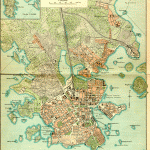
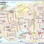
Hameenlinna Tavastehus Finland Map Photo Gallery
Maybe You Like Them Too
- The Best Cities To Visit in The World
- World’s 10 Best Places To Visit
- Coolest Countries in the World to Visit
- Travel to Santorini, Greece
- Map of Barbados – Holiday in Barbados

