Counties: Oppland fylke, Hedmark fylke, Akershus fylke.
Altitude: 124 m (407 ft).
JN Reiselivslaget for Hamar og Hedemarken,
Brygga,
N-2301 Hamar; tel. (0 65) 212 17.
Gjovik Turistkontor,
KauffeldtgSrden,
N-2800 Gjovik; tel. (0 61) 716 88.
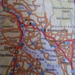
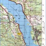
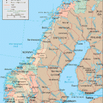
Lake Mjosa, Norway’s largest lake, extends for 100 km (60 miles) through a fertile region from Eids-voll in the S to Lillehammer in the N. Reaching a maximum width of 15 km (9 miles), it has an area of 362 sq. km (140 sq. miles), slightly less than Lake Garda in Northern Italy. Its greatest depth is 443 m (1450 ft). The lake is heavily stocked with trout.
ROUND THE LAKE. Lake Mjosa is reached from Oslo on E6. From the little town of Eidsvoll, on the right bank ofthe broad, clear River Vorma, there is a boat service up Lak Mjosa to Lillehammer (about 6 hours) between mid-June and mid-August. E6 continues N and beyond Minnesund crosses a bridge over the Vorma at its outflow from the lake (beautiful view); it then runs along the E side of Lake Mjosa, through attractive scenery, climbing slightly. Soon after Espa, a little place on the picturesque Korsodegardsbugt, E6 leaves the lake and does not return to its shore until Hamar. Those who want to keep close to the lake should take Road 222, which runs parallel to E6 to the W. This road runs through Stange. 3 km (2 miles) W of Stange is the village church (Stange Kirke), one ofthe two most beautiful churches in Hedmark (the other is Ringsaker), founded about 1250 and remodelled in the 17th c. Between the road and the lake, sometimes directly on the lakeside, are several prosperous farmhouses (storgarder), many dating from the 18th c. They bear witness to the wealth of this fertile region.
The next place of any size is Hamar (pop. 1 6,000; Victoria Hotel, 142 Triangelen, 56 Olrud Turisthotell, 230 Ormseter Ungdomssenter, 62 b.), country town of Hedmark. Hamar is located on the N side of the Akersvik and at the mouth of the Furnesfjord, which runs N for some 1 5 km (10 miles). To the W of the town, on the peninsula of Storhamarodde (Dom-kirkeodde), are the ruins of the 12th c. Cathedral and the Hedmark Museum, with a number of old wooden buildings (the oldest from 1583), an open-air theatre and a restaurant; nearby is a camp site. A little way N is Norway’s only Railway Museum (Jernbanemuseet). 28 km (17i miles) E of Hamar, on the Glomma, is Elverum (alt. 1 88 m (61 5 ft); pop. 7500), once a fortified town, with the interesting Glomdal Museum (80 old peasants’ houses from the prosperous Osterdal, with period furnishings) and the Norwegian Forest Museum (forestry management, fishing, shooting).
Beyond Brumunddal, E6 reaches the N end of the Furnesfjord and turns W. At the village of Ringsaker (old church with a carved and painted Flemish altar) it returns to Lake Mjosa, and continues via Moelv along the long narrow N arm ofthe lake to Lillehammer.
It is also possible to take a ferry across the lake from Hamar, passing between the large peninsula of Nes on the right and Heigoy (the island of saints) on the left, to Gjovik (pop. 16,000; Strand Hotel, 1 50 SP, SB; Grand, 48 Park Inn, 37 youth hostel), capital of the district of Toten on the W side of Lake Mjosa. From Gjovik, Road 4 goes N to Lillehammer, while Road 33 runs S down the W side of the lake. To the W of Kapp (pop. 11 00) is the Toten Museum, a farmhouse (1 790). On a promontory N of Skreia (pop. 900) is Balke church (c. 1200; restored 1967). The road now keeps close to the shore, with the Skreia ridge of hills to the W (Skreikamp, 708 m 2323 ft). At the farm of Bjornstad, a road leads N to the Feiring ironworks (Feiring jernverk), established in 1 797, with 24 buildings (stamping mill, blast furnace, etc.) which give visitors an idea ofthe state of technology at this early stage of the industry. At Minnesund we return to the starting-point of the tour.
Lake Mjosa Norway Map Photo Gallery
Maybe You Like Them Too
- The Best Cities To Visit in The World
- World’s 10 Best Places To Visit
- Coolest Countries in the World to Visit
- Travel to Santorini, Greece
- Map of Barbados – Holiday in Barbados

