Provinces: Kymen laani (Kymmene lanKymi), Mik-kelin laani (Sankt Michels lanMikkeli).
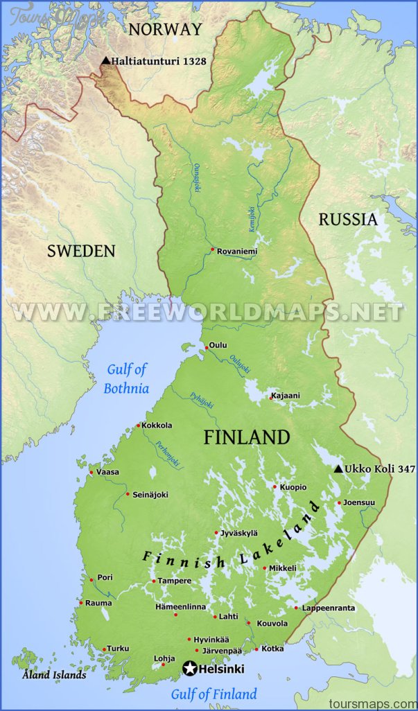
Lake Saimaa, the lake of a thousand islands, is the most southerly part of an intricate system of lakes, linked by numerous rivers and narrow channels, extending over the whole of the pastern part of the Finnish Lake Plateau. It is abundantly stocked with fish.
Lake-Saimaa itself, lying at an altitude of 76 m (250 ft), has an area (excluding its countless islands) of some 1300 sq. km (500 sq. miles), with a maximum depth of 90 m (295 ft); the lake plateau of which it forms part has an area of some 7000 sq. km (2700sq. miles). The lowsouthern rim of the lake is formed by the Salpausselka ridge.
Passenger boat on Lake Saimaa
The whole system of lakes the dark colourof which, taking on ayellowish hue in the shallower places, comes from the numerous bogs in the region is drained by the River Vuoksi, which flows out of Lake Saimaa to the N of the town of Imatra and flows into Lake Ladoga after 1 50 km (95 miles). The hilly shores of the lake and most of its islands are almost entirely covered with coniferous forest, with some birch forests farther to the N.
A number of agencies, mostly in Lappeenranta ( 173), run cruises on Lake Saimaa (either day cruises or cruises lasting several days).
Lake Saimaa Finland Map Photo Gallery
Maybe You Like Them Too
- The Best Cities To Visit in The World
- World’s 10 Best Places To Visit
- Coolest Countries in the World to Visit
- Travel to Santorini, Greece
- Map of Barbados – Holiday in Barbados