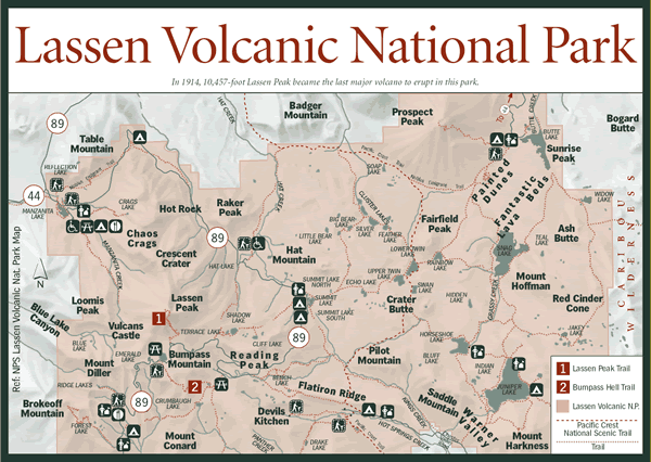
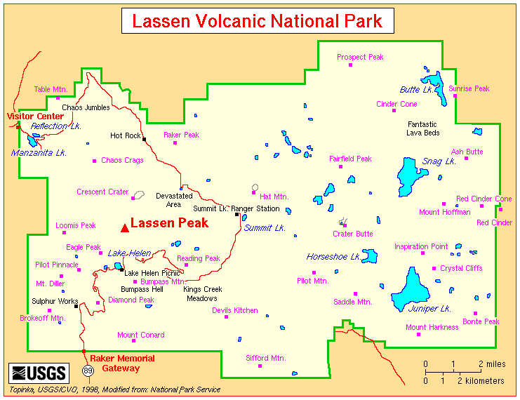
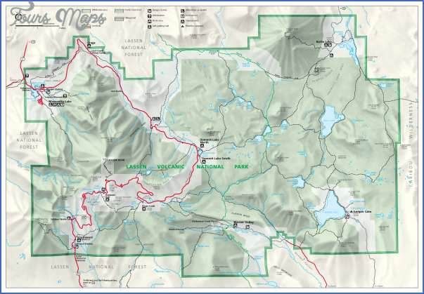
LASSEN VOLCANIC NATIONAL PARK MAP CALIFORNIA
106,372 acres. Located in the Cascades of northern California and surrounded by lands of Lassen National Forest, this National Park features a number of volcanic mountains, including 10,457-foot Lassen Peak.
The park has craters, cinder cones, lava flows, and deep canyons, with hot springs and other thermal areas, streams, and some lakes. There are also meadows and forests of fir and pine. Deer, bear, mountain lion, and coyote are among the wildlife.
Activities: Backpacking and hiking are available on 150 miles of trails, including a 17-mile section of the Pacific Crest Trail (see entry page 113). Difficulty varies from easy to strenuous. Higher elevations are likely to be free of snow only from July through September.
Some trails are open to horseback riding. Crosscountry skiing and snowshoeing are possible on trails in the winter. Fishing is available along the streams and lakes. Bikes are not allowed on trails, and hunting is prohibited.
Camping Regulations: A free wilderness permit is required in order to camp in the backcountry here. Permits may be obtained in person, or requested by mail or phone two weeks in advance. Some areas in the park are closed to camping.
Campsites should be at least 100 feet from water sources and trails, away from meadows and other vegetation, and one mile from roads and developed areas. Campfires are prohibited, so a stove is necessary if one wishes to cook. Maximum group size allowed is 10. Pets are not permitted in the backcountry.
For Further Information: Lassen Volcanic National Park, P.O. Box 100, Mineral, CA 96063; (916)595-4444.
LASSEN VOLCANIC NATIONAL PARK MAP CALIFORNIA Photo Gallery

Maybe You Like Them Too
- The Most Comprehensive Travel Guide to St. Croix With Maps, Things To Do and Restaurants
- The Frederick Map Travel Guide for Tourist: Another Great Destination
- Gdynia Travel Guide for Tourist – Map of Gdynia
- Freetown Travel Guide for Tourist: Maps of Freetown
- Add MediaFoz Do Iguaçu: The Best Travel Guide For Tourists And Sightseers