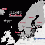
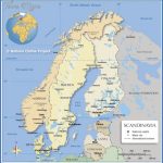
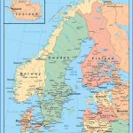
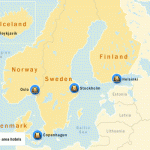
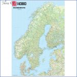
Thus Scandinavia in the wider sense coincides with the geographical conception of NORTHERN EUROPE, a region of clearly marked individuality. If we disregard eastern Europe, there is no other part of the European continent with such a uniform topographical structure. It lacks the fragmented pattern of uplands and mountains found in central and particularly in southern Europe; and although the coasts of Scandinavia are much indented they follow a generally straight line, while there is easy passage from end to end of Sweden, impeded by rivers but without any mountain barriers. Though much broken up by geological action, the Scandinavian mountains form a unified and self-contained complex.
Scandinavia in this wider definition, bounded in the east by the Soviet Union and to the south by Germany, has an area of some 1,150,000 sq. km (444,000 sq. miles), or more than four and a half times that of the United Kingdom. The distance from Gedser to the North Cape is about the same as from Gedser to Tunis, while the distance from Bergen in the west to the shores of Lake Ladoga in the east is about the same as from Paris to Warsaw.
The total population of this large area, however, is only some 22,000,000, and the population of its northern parts is particularly sparse: although the regions north of the 61 st parallel account for two-thirds of the total area of Scandinavia they are occupied by only a fifth of its population, at a density of only about 5 to the sq. kilometre (1 3 to the sq. mile). This relative concentration of population in the southern parts of Scandinavia is, of course, primarily due to climatic conditions; but the northern regions could undoubtedly support a larger population than any other part of the world in the same latitude.
More significant than the inhospitable climate, however though this, thanks to the Gulf Stream, is milder than in similar territories elsewhere is the fact of the long winter nights, with their inevitably depressing psychological effect. The variation in the length of the day over the course of a year increases towards the north, so that beyond the Arctic Circle (66°33′) the sun does not set in summer or rise in winter for an increasing number of days (at Kiruna about 45 days, at Hammerfest 72). At the North Pole it appears above the horizon on 21 March and does not set until 21 September, so that in spring it climbs above the horizon in an apparently spiral course and in autumn spirals down again.
The topographical structure of Scandinavia appears remarkably simple. Throughout the whole length of Norway and along the Norwegian-Swedish border the Scandinavian mountain chain extends for a distance of some 1 700 km (1000 miles) compared with barely 1000 km (600 miles) for the Alps. Its characteristic features are the great expanses of high plateau, partly consisting of peatbogs and dotted with small lakes, which lie at a fairly uniform altitude between 1000 and 1500 m (3000 and 5000 ft). Above the plateau, particularly around the Sognefjord and in northern Sweden, rear numerous sharply pointed and much glaciated peaks which reach heights of 2468 m (8098 ft) in central Norway (Galdhopiggen) and 2117m (6946 ft) in northern Sweden (Kebnekaise); and here and there isolated massifs rise to heights of some 1 800 m (5900 ft).
On the Norwegian side of the chain the high plateaux are slashed by numerous valleys, the lower reaches of which are frequently filled by the ends of fjords which cut deeply into the land, and the upper parts by long narrow lakes. The valleys have the typical U-shaped profile gouged out by the mighty glaciers of the Ice Age, extending right down to the Atlantic. Along the west side of the mountains is a relatively flat coastal strip, beyond which the tops of rocky hills worn by ice action emerge from the sea in the form of skerries or rock islets. Whec6 the coastal strip is wider and stands higher above the sea, as for example at the mouth of the Hardangerfjord, we find expanses of attractive green countryside.
On the Swedish side the valleys tend to be broader and the plateau more broken up into separate massifs. Along the eastern fringe of the mountains runs a broad swath of uplands ranging in width between 150 and 250 km (90 and 150 miles), falling from about 600 m (2000 ft) to 200 m (650 ft) near the Gulf of Bothnia. In this region are numerous isolated hills of the type known to geologists as monadnocks (local name klack), but these rise barelyabove 800 m (2600ft). In Norrland the coastal strip and the girdle of skerries are very narrow indeed.
From the Finnish coast, lying opposite Sweden across the Gulf of Bothnia, the land rises much more gradually to the Finnish Lake Plateau, an extraordinary tangle of lakes, inlets, islands and peninsulas which has its counterpart in Sweden, on a smaller scale, in the Lake Malar complex. This region the inland counterpart of the fjords and skerries of the Scandinavian west coast is brought to an abrupt end by the Salpausselka ridge of hills, to the south of which the land slopes regularly and gradually down, with only a few lakes of smaller size, to the Gulf of Finland.
Scandinavia Map Photo Gallery
Maybe You Like Them Too
- The Best Cities To Visit in The World
- World’s 10 Best Places To Visit
- Coolest Countries in the World to Visit
- Travel to Santorini, Greece
- Map of Barbados – Holiday in Barbados

