Tennessee Map Tourist Attractions
LAND BETWEEN THE LAKES
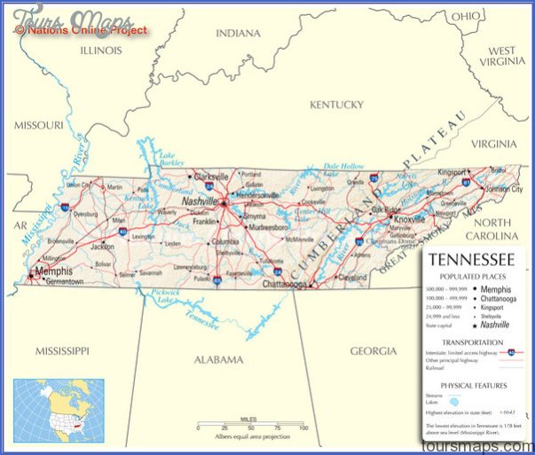
170,000 acres. Managed by the Tennessee Valley Authority, and surrounded on three sides by two huge lakes (Kentucky Lake and Lake Barkley), this is an enormous, 40-mile-long peninsula. It’s located both in southwest Kentucky and northwest Tennessee.
Terrain here is gently hilly, with a maximum elevation change of only 200 feet. There are woodlands, some inland lakes and ponds, and wildlife including deer, bison (which are restricted to a 200-acre range), bobcat, and wild turkey.
Activities: Backpacking and hiking are available on some 200 miles of easy to moderate trails. Included are the 60-mile North-South Trail, which extends the length of the peninsula, and the 26-mile Fort Henry National Recreation Trail, which forms a series of loops. The area has about 30 miles of horse trails. Fishing is available, and hunting is permitted in season.
Camping Regulations: There’s a series of trail shelters along the North-South Trail. Camping is allowed elsewhere as well on the peninsula, as are campfires, except where posted otherwise. No permits or fees are required. Campsites should be at least 50 feet from trails. Backpackers are asked to check in at one of three welcome stations and leave their itinerary.
For Further Information: Land Between the Lakes, 100 Van Morgan Drive, Golden Pond, KY 42211; (502)924-5602.
Tennessee Map Tourist Attractions Photo Gallery
Maybe You Like Them Too
- Arnold A Town with a Heart
- The Best Cities To Visit in The World
- World’s 10 Best Places To Visit
- Map of New York City – New York City Guide And Statistics
- Map of San Francisco – San Francisco Map Free