Malibu Creek State Park, Located In The Central Section Of The Santa Monica Mountains, Stretches Over 10,000 Acres Of Rugged, Diverse Terrain. It Is One Of The Mountain Range’S Premier State Parks. The Land Was Acquired By The California State Park System In 1974. Previous To This, The Land Was Divided Into Parcels Belonging To Bob Hope, Ronald Reagan, And 20th Century Fox. Although The Park Is Still Used As A Filming Site, It Is Primarily Used For Day-Hiking And Picnicking.
Malibu Creek, The Principal Watercourse In The Santa Monica Mountains, Flows Through The Park From Malibu Lake. It Is The Only Stream-Channel That Bisects The Mountain Range. Within The Park, Malibu Creek Was Dammed Around 1900 To Form Century Lake. The River Continues Over 13 Miles Down Malibu Canyon And Enters The Ocean At Malibu Lagoon At Surfrider Beach. Malibu Canyon Is The Chief Pass-Through In The Santa Monica Mountains.
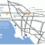
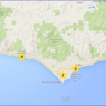
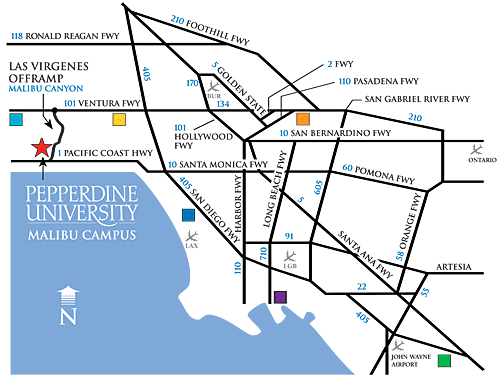
Where is Malibu ? Malibu Map Location Photo Gallery
Connecting The Inland Valley At Calabasas With The Malibu Coast.
Malibu Creek State Park Has A Mix Of Sandstone, Conglomerate, And Volcanic Rock Formations That Include Picturesque Buttes, Deep Gorges, Prominent Cliffs, Vertical Peaks, And Rocky Outcroppings. The Diverse Plant Habitats Include Coastal Sage Scrub, Chaparral, Rolling Grasslands, Broad Meadows, Oak Savannas, Sycamore Woodlands, Freshwater Marshes, And Streamside Vegetation. The State Park Is Also Home To Three Natural Preserves: 1,920-Acre Kaslow Preserve, 730-Acre Liberty Canyon, And 300-Acre Udell Gorge. Amenities Include A Visitor Center And A Campground.
The Park Was The Filming Location Of Notable Movies Such As Butch Cassidy And The Sundance Kid, Daniel Boone, Tarzan, Planet Of The Apes, And The Television Series M*A*S*H.
More Than Twenty Miles Of Hiking, Biking, And Equestrian Trails Crisscross The Park. The Trail System Includes Streamside Strolls, Paths Through Canyons And Valleys To Natural Preserves, Movie And Historic Sites, And High Ridges With Spectacular Scenery That Spans From The Ocean To The Mountains,.
The Main Entrance Into The Park Is On Malibu Canyon Road, Just South Of Mulholland Highway.
Rock Pool, Century Lake, Udell Gorge Preserve
Malibu Creek State Park
1925 Las Virgenes Road Calabasas
Hiking Distance: 8.3 Miles Round Trip Hiking Time: 4.5 Hours
Configuration: Out-And-Back Plus Three Spur Trails Elevation Gain: 400 Feet Difficulty: Moderate
Exposure: A Mix Of Exposed Hills And Shaded Forest Dogs: Not Allowed
Maps: U.S.G.S. Malibu Beach And Point Dume Tom Harrison Maps: Malibu Creek State Park Trail Map Malibu Creek State Park Map
The Santa Monica Mountains Are Bisected Near Their Center By Malibu Creek. It Is The Only Creek That Cuts Entirely Through The Mountain Range From North To South. The Year-Round Stream Flows More Than 13 Miles, Beginning From Its Headwaters In Westlake Village To Santa Monica Bay At Malibu Lagoon. Along The Way, It Meanders Through Malibu Creek State Park And Down Malibu Canyon To The Ocean. The Malibu Creek Watershed, The Largest In The Range, Drains Over 100 Miles Of Land From The Southern Simi Hills And Western San Fernando Valley.
This Premier Hike Begins From The Main Entrance Road To Malibu Creek State Park And Follows Malibu Creek Through The Heart Of The State Park To Malibu Lake, Passing A Series Of Scenic Landmarks And Man-Made Features. The Creek And Trail Weave Along Goat Buttes, The Two Picturesque Volcanic Peaks Rising From The Center Of The Park. At The Base Of The Buttes Are Century Lake And Rock Pool. Century Lake Was Formed In 1901 When A Dam Was Built At The Mouth Of A Gorge By Members Of The Crags Country Club. The 20- Acre, Man-Made Lake Was Used For Fishing, Sailing, And Duck Hunting. Since That Time, The Reservoir Has Silted Up And Become A Pastoral, 7-Acre Freshwater Marsh. Rock Pool Is A Natural Lake Dammed By Volcanic Boulders. The Pool Sits In A Deep Gorge In Triunfo Canyon And Is Framed By Massive Vertical Cliffs And Groves Of Bays And Sycamores. The Tarzan Movies And South Pacific Were Filmed At This Site.
Rock Pool, Century Lake, Udell Gorge Preserve, Malibu Creek State Park
The Well-Known M*A*S*H Television Series Was Filmed In The Park From 1972 To 1983. The M*A*S*H Site Sits In A Gorgeous Meadow In Triunfo Canyon Beneath Goat Buttes. The Area Was Used In The Opening Sequence Of Each M*A*S*H Episode. The Production Sets Are Gone, But A Rusted Jeep And Ambulance Still Remain. The Film Site Is Very Recognizable From The Series.
The Trail Passes Through Two Of The Park’S Three Natural Preserves. The Udell Gorge Natural Preserve (300 Acres) And Kaslow Natural Preserve (1,920 Acres) Protects Rare Plants And Volcanic Formations. The Kaslow Preserve Is Also A Protected Nesting Ground For Golden Eagles. En Route, The Hike Detours To An Overlook On The Lost Cabin Trail At The Southern Edge Of Goat Buttes And Strolls Through A Redwood Grove On The Banks Of Century Lake.
To The Trailhead
From Santa Monica, Drive 12 Miles Northbound On The Pacific Coast
Highway/Highway 1 To Malibu Canyon Road. Turn Right (North) And Continue 6 Miles Up The Winding Canyon Road To The Signed Malibu Creek State Park Entrance On The Left. (It Is Located 0.2 Miles Shy Of Mulholland Highway.) Turn Left And Drive 0.35 Miles To The Second Parking Lot On The Left. A Parking Fee Is Required.
From The Ventura Freeway/Highway 101 In Calabasas, Take The Las Virgenes Road Exit. Drive 3.1 Miles South To Mulholland Highway. Continue 0.2 Miles Straight Ahead To The Signed Malibu Creek State Park Entrance On The Right. Turn Right And Drive 0.35 Miles To The Second Parking Lot On The Left. A Parking Fee Is Required.
Free Roadside Parking Alternative: Park West Of The Intersection Of Malibu Canyon Road/Las Virgenes Road And Mulholland Highway In The Pullouts Along Mulholland Highway. Take The Posted Grassland Trail (A Footpath) South 0.7 Miles To Crags Road.
The Hike
Cross The Park Road To The Posted Trailhead. Take Crags Road, Crossing Over Las Virgenes Creek. The Paved Road Turns To A Narrower Dirt Road. Pass The Signed Grassland Trail On The Right, A 0.7-Mile Connector Trail From Mulholland Highway. Continue Straight, Following The North Bank Of Malibu Creek While Enjoying The Great Views Of Goat Buttes. Stroll Through Overhanging Oak Groves With Picture-Perfect Views To A Posted Junction. Detour Left Towards The Visitor Center. Walk 60 Yards To A Trail On The Right, Just Before The Malibu Creek Bridge (Which Leads To The Visitor Center).
Veer Right On The Gorge Trail And Go Another 100 Yards To A Picnic Area. The Dirt Road Bends To The Right And Climbs To The Top Of The Rock Formations. Continue Straight, Staying On The Canyon Bottom Among The Deeply Eroded Rock Formations With Caves. Follow The West (Right) Side Of The Canyon To Rock Pool By A Massive, Rock-Walled Gorge.
Return To Crags Road And Continue A Half Mile West To A Footpath On The Left. Take The Path Into A Lush, Shaded Canopy With Ferns And Moss-Covered Boulders. The Short Path Ends At The Dam Overlooking Century Lake By Another Steep-Walled Gorge.
Return To Crags Road And Head Northwest Along The Narrow Lake, Passing The Lookout Trail And Cage Creek Trail On The Right. Stroll Through The Meadow Surrounded By Mountains. Cross Logan’S Bridge Over Malibu Creek. (The Bridge Was Named After The 1998 Film Logan’S Run, Which Was Filmed Here.) Walk 75 Yards To The Signed Forest Trail On The Left, Where Crags Road Becomes A Footpath. Detour To The Left On The Half-Mile-Long Trail Along The Backside Of Century Lake. Walk East Through The Oak-Rimmed Meadow. Enter The Forest, Skirting The South Edge Of The Meadow. The Shaded Path Passes Towering Redwood Trees Planted In The 1920s By Crag’S Country Club Members, And A Series Of Weather-Etched Volcanic Boulders. Follow The South Edge Of Century Lake, Passing More Redwoods, To The End Of The Fern-Lined Trail At The Concrete Dam And Another View Into The Vertical-Walled Gorge Beneath Goat Buttes.
Return To Crags Road And Continue Up The Forested Canyon. Follow The Perimeter Of The Udell Gorge Natural Preserve Between Malibu Creek And The Steep Rock Wall Of Goat Buttes On The Left And A Dense Isolated Forest On The Right. At The Southeast Corner Of The Wetland, Where The Canyon Widens, Is A Posted Junction With The Lost Cabin Trail On The Left, Just Shy Of The M*A*S*H* Site. For Now, Detour Left And Head South Into The Kaslow Natural Preserve, A Nesting Area For Golden Eagles. Cross A Stream And Meander Up The Isolated Side Valley Along The Southern Base Of Goat Buttes. Cross The Stream Two More Times While Walking Beneath The Gorgeous Rock Cliffs And Pock-Marked Outcrops. Climb To A 700-Foot Saddle At The Head Of The Canyon. Curve Left And Go Downhill To The Posted End Of The Trail And The Site Of The Lost Cabin, Although No Remnants Remain. The Spot Is Located Just Before A Branch Of Malibu Creek In A Deep Gorge Between Century Lake And Rock Pool.
Return To Crags Road. Bear Left And Enter The M*A*S*H Site In A Meadow Framed By The Prominent Goat Buttes. Walk Around The Famous Flat Surrounded By Mountains. Meander Among The Vehicle Props, Abandoned After Filming, And An Unlocked Shed With Artifacts And Photographs From The Tv Series. Detour Left Up The Slope To The Old Helicopter Landing Area On A Perch Overlooking The Site. After Perusing The Area, Cross Mendenhall Creek And Continue Through Oak-Filled Triunfo Canyon To A Posted Junction With The Bulldog Motorway On The Left. This Dirt Road Leads 3.4 Miles To Castro Crest, High Above Solstice Canyon. Continue Straight On Crags Road, And Cross Another Stream To A Fork 0.2 Miles Ahead. Crags Road Veers Left And Leads 0.3 Miles To The Park Boundary And Onto Residential Crags Road, Located 0.7 Miles From Lake Vista Drive. Instead, Veer Right And Pass Rock-Lined Pools And Massive Outcrops To The Park Boundary, Just Short Of The Malibu Lake Dam. The Fenced Private Land Halts Access. On The Right Is A Quiet Picnic Area.
Return Along The Same Route.
Maybe You Like Them Too
- Top 10 Islands You Can Buy
- Top 10 Underrated Asian Cities 2023
- Top 10 Reasons Upsizing Will Be a Huge Travel Trend
- Top 10 Scuba Diving Destinations
- World’s 10 Best Places To Visit

