ATHABASCA
Directions: Exit Edmonton on Hwy 2 north, bear right at Hwy 18 east, which is also Hwy 2, and continue north to Athabasca.
Distance: 152 km, or about 2 hours, from Edmonton.
Info: 1-877-211-8669 (Athabasca Country Tourism); 780-675-9297; www. athabascacounty .com.
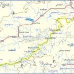
An alternative, more scenic route to Athabasca is along the old highwaya well-maintained gravel road. Although not currently signed as a different course, you can access this north-south road from Tawatinaw, Rochester, Perryvale, and Colinton. Be sure to watch for birds near the numerous bluebird boxes along the way. You might want to visit Perryvale’s traditional general store and two churches, as well as its charming picnic grounds and apiary. Nestled in a stunning valley, the hamlet of Colinton has a number of stores and cafes, including the historical Colinton Hotel.
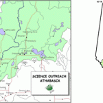
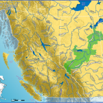
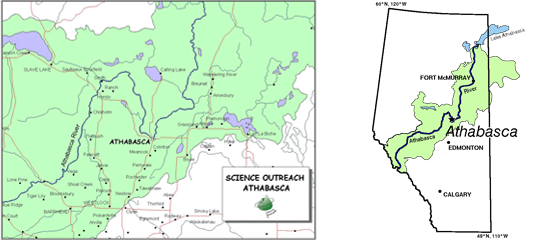
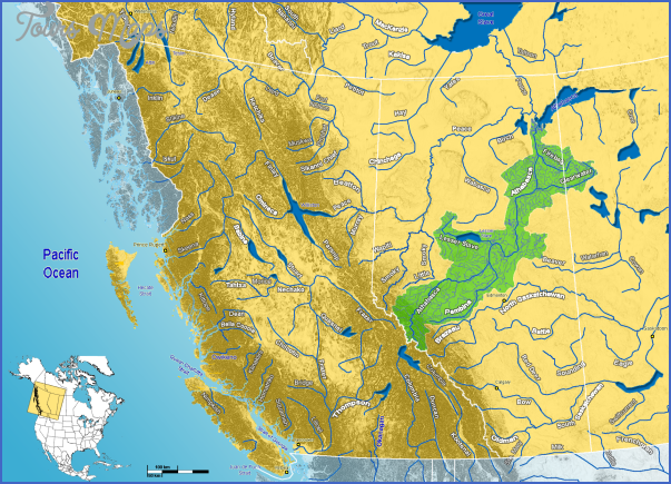
One of North America’s longest undammed rivers, the Athabasca River flows 1,231 kilometres from the Rocky Mountains to Lake Athabasca; it eventually reaches the Arctic Ocean via the Mackenzie River system Flowing through the town of Athabasca (formerly Athabasca Landing), it is a reminder of the days when scows and paddlewheel steamers travelled the river in the late 19th and early 20th centuries.
Athabasca Landing was a significant trade link between the prairies and distant northwest from 1876 to 1913. It became the main transfer spot for all goods sent north and for all furs shipped south using the Athabasca, Peace, and Mackenzie River systems. Missionaries followed the fur traders, with Anglicans arriving first in 1884 and making the Landing the centre of their missionary operations. Roman Catholics and Methodists followed, and the North West Mounted Police arrived by 1893.
In 1898, about 600 prospectors used the Athabasca Landing Trail on their way north, either crossing the river and travelling upriver by boat or going west on the Peace River Trail. Poet Robert W. Service, famous for his poems about the Yukon frontier and gold seekers, is believed to have enlisted to serve in World War I in Athabasca and worked at the Imperial Bank. The Shooting of Dan McGrew and The Cremation of Sam McGee are known around the world.
This is the Law of the Yukon, that only the Strong shall thrive; That surely the Weak shall perish, and only the Fit survive.Robert Service
Athabasca Landing grew as the centre of the northern transportation system, but its significance ended when the railway failed to expand northeast and northwest from the town. The community became an incorporated town called Athabasca Landing in 1911, with Landing dropped from the name in 1913. The name Athabasca is believed to have come from the Cree word athapaskaw, which means where there are reeds or grass. Athabasca and the surrounding area offer heritage experiences and northern Alberta wilderness recreation, including dogsledding. Summer daylight hours are even slightly longer than in Edmonton, meaning more daylight hours to enjoy the region.
The population of Athabasca is 2,990. For a great view of the community, visit the scenic Centennial Park Lookout on the side of the river opposite the town. Follow Highway 813 north and take the first left, after the bridge. Keep to the left route going up the hill and follow the signs to the nearby lookout.
A pleasant way to get a feel for Athabasca is to walk around town, aided by signage that reveals the community’s history. You can get a walking heritage tour map from the tourist information centre, the Alice B. Donahue Library, or from www.athabasca.ca. The tour will take you past the Athabasca Train Station, Old Brick School, Athabasca United Church, and Grand Union Hotel, which has been serving the community since 1914. During World War II, seemingly endless US convoys passed through Athabasca as they travelled Highway 2once called the Alcan Highwayto access Alaska via the Alaska Highway at Dawson Creek. American truckers boarded at the always-full Union Hotel, sometimes with men using sleeping bags that they laid out in the lobby. The truckers were forced to leave their diesel trucks running all night when temperatures dipped to -45 to -60°C, and on those days local residents woke to a haze of blue smoke over the town.
Just off Highway 2 west on University Drive is Athabasca University, Canada’s largest online and distance education provider with more than 50 undergraduate and graduate degree, diploma, and certificate programs. It offers more than 900 courses for students in 90 countries. Ask for a free tour to see its facilities, art collection, and library. To book a tour in advance, call 1-800-788-9041 or 780-675-6709 or email tours@athabascau.ca; go to www.athabascau.ca for more information.
ATHABASCA COUNTRY TOURISM
Rotary Trail on the Athabasca waterfront
Visitor Information Centre and Rotary Riverfront Trail
Location: 510150th Avenue, Athabasca.
Info: 780-675-9297.
Look for the tourist information centre, which is housed in the old train station, next to the distinctive Canadian National Railways caboose on the Athabasca riverfront. Summertime visitors who would like to arrange for a guided walking heritage tour of the town’s historical buildings must make arrangements ahead of time by calling the Town of Athabasca at the phone number given at the top of this entry. If you prefer a self-guided tour, pick up a booklet about historical houses from the Tourist Information Centre, Alice B. Donahue Library and Archives, or town office.
Tawatinaw Creek enters the Athabasca River at the campground adjacent to the Tourist Information Centre caboose. You can walk the Rotary Riverfront Trail and read interpretive signs that explain early transportation, boat building, river trackers, area settlers, natural history, and commerce at Athabasca Landing. Murals on Athabasca’s riverfront buildings depict scenes of the days when trappers as well as Cree and Metis river trackers ruled the river. A short walk up 48th Street reveals a mural that honours Athabascans who have served in the Canadian Forces.
The annual Magnificent River Rats Festival on the Canada Day weekend hosts top Canadian performers, a car show and shine, children’s activities, and numerous other festivities for visitors of all ages. Performers grace the stage at the Athabasca Riverfront Park (along the river at 50th Avenue and 50th Street). As well as the carnivals, music events, and other performances held here, the area has a water spray park, skateboard park, gazebo, playground, and walkway. Plans are underway for an outdoor fitness park.
ATHABASCA MAP Photo Gallery
Maybe You Like Them Too
- Explore Góra Kalwaria, Poland with this detailed map
- Explore Gumdag, Turkmenistan with this detailed map
- Explore Telfes im Stubai, Austria with this detailed map
- Explore Langenselbold, Germany with this detailed map
- Explore Krotoszyn, Poland with this detailed map

