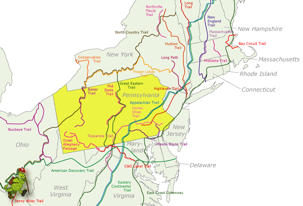
BAKER TRAIL MAP PENNSYLVANIA
141 miles. This trail winds through forests, woodlands, and farmlands in western Pennsylvania, following old roads and paths. Much of the trail is on private lands. It connects with the North Country Trail in Allegheny National Forest.
Camping Regulations: There are 10 shelters located on side trails along the way. The shelters are not indicated by signs, so a trail guidebook may be essential in locating them. Other established sites are found along the trail as well.
Where the trail is on private lands, camping is restricted to these designated sites. Camping is prohibited on state game lands. Campfires should be built only in existing fire rings, and a stove is recommended. Groups should be kept to a maximum of 10.
For Further Information: Baker Trail Chairperson, AYH, Pittsburgh Council, 6300 Fifth Avenue, Pittsburgh, PA 15232. A guidebook with maps is available from this organization.
BAKER TRAIL MAP PENNSYLVANIA Photo Gallery
Maybe You Like Them Too
- Arnold A Town with a Heart
- The Best Cities To Visit in The World
- World’s 10 Best Places To Visit
- Map of New York City – New York City Guide And Statistics
- Map of San Francisco – San Francisco Map Free