Category: Maps
GIBBONS Directions: Exit Edmonton on Hwy 28A, north. Distance: 39.7 km, or about 38 minutes, from Edmonton. Info: 780-923-3331; www.gibbons.ca. Gibbons, a town of 3,030 people located along the …
FORT SASKATCHEWAN Directions: Exit Edmonton on Hwy 16 east, and turn onto Hwy 21 north. Distance: 38.7 km, or about 35 minutes, from Edmonton. Info: Visitor Information Centre: Dow …
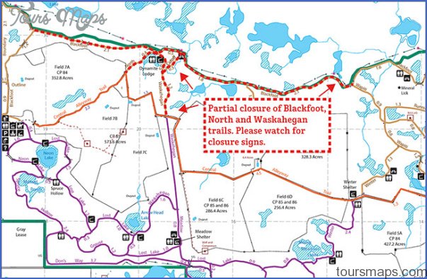
The 309-kilometre Waskahegan Trail loops between Fort Saskatchewan, Edmonton, and Camrose, using both public and private land. From Edmonton, the trail leads south along the Whitemud and Blackmud Creeks, …
Directions: Exit Edmonton travelling east on the Yellowhead Trail. Continue east on the Yellowhead Highway (Highway 16), turn left on Range Road 201A, and follow the signs into the …
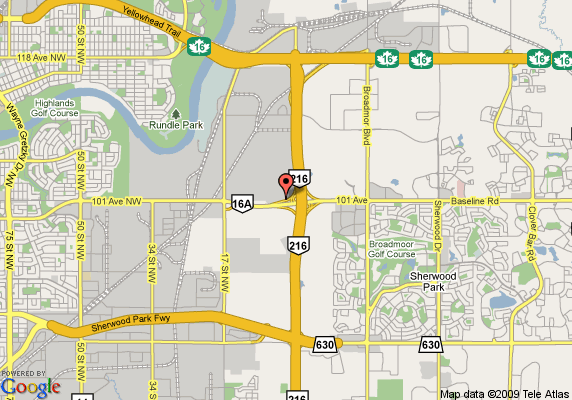
Directions: Exit Edmonton on Hwy 16 east. Distance: 22.5 km, or about 24 minutes, from Edmonton. Info: www.strathcona.ca. Directly east of Edmonton, and part of Strathcona County, Sherwood Park …
EAST OF EDMONTON East-central Alberta visitors enter the heritage district known as the Kalyna (pronounced kah-LEHN-ah) Country Ecomuseum, a multicultural area where visitors can see historical attractions in their …
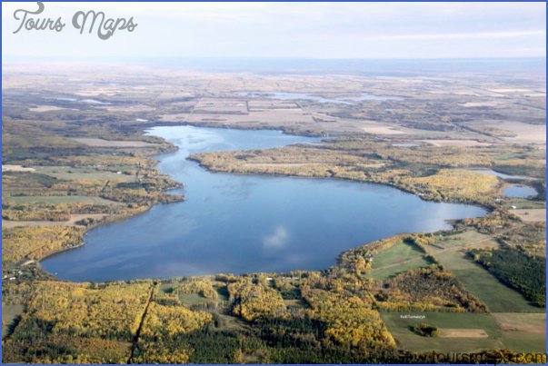
Baptiste Lake Location: 18.6 km, or about 16 minutes, west of Athabasca on Hwy 2. At the intersection where Hwy 2 turns north, continue straight on Township Road 663A …
Muskeg Creek Trails Location: The trailhead borders Landing Trail Intermediate School at 5502-48th Avenue, Athabasca. Info: Neither motorized vehicles nor pets are allowed on the trail. Contact Athabasca Regional …
ATHABASCA Directions: Exit Edmonton on Hwy 2 north, bear right at Hwy 18 east, which is also Hwy 2, and continue north to Athabasca. Distance: 152 km, or about …
Holmes Crossing Sandhills Ecological Reserve and Holmes Crossing Recreation Area Location: About 4 km southwest of Fort Assiniboine on Hwy 33; the reserve and recreation area border are on …