ESTIMATED LENGTH: 47 miles
Highlights: Yellowstone River, Chico Hot Springs, Pine Creek Tavern getting there: Take Exit 333 off I-90 in Livingston.
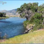
In many ways, the visually appealing drive along the Yellowstone River embodies the new
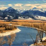
Montana. Lured by the jagged peaks of the Absarokas, the trout-rich waters of the Yellowstone, and proximity to the world’s first national park, both the well-heeled and off-the-grid sorts call the aptly named Paradise Valley home. In the beginning, the name came from the Crow Indians, who once thrived on the prolific wildlife drawn here in winter when ferocious winds scoured the grasslands of snow. The Crow, who call themselves the Absaroka (children of the large beaked bird), have been banished to a reservation farther to the east, but the name and the unparalleled beauty remain.
Livingston, immortalized in song by Jimmy Buffett with Livingston Saturday Night, Monday Monday, and, reputedly, Cheeseburger in Paradise, is an old railroad town that has become an artist colony with more professional writers per capita than any town in the United States. From Livingston, drive south on US 89 through a skinny gap in the Absaroka and Gallatin ranges, and imagine for a moment a dam there instead; yes, flooding the Paradise Valley with a reservoir was actually proposed at one time. When the valley opens, look for a left turn on East River Road (Highway 540) and cross the Yellowstone River at Carter’s Bridge.
Drive along the river and absorb the views of the Absarokas. For a down-home weekend evening in the summer, dance under the pines and stars to live music at the Pine Creek Tavern. Or take a break for a soak and five-star dinner at Chico Hot Springs, 30 miles south of Livingston. The walls of the historic main lodge at Chico are adorned with photos of one of the springs’ biggest fans many years ago, the actor Warren Beatty. At Pray, a community you could’ve owned in its entirety for the tidy sum of $1.2 million in 2012, cross over the river to US 89 and the homespun Wildflower Cafe & Bakery for some baked goods, soup, and perhaps some live music before doubling back to East River Road.
East River Road reacquaints itself with US 89 after hugging the Yellowstone for about 8 miles. About 4 miles to the north on US 89, and then another 5 miles up Dry Creek Road, is the comfortably rustic Mountain Sky Guest Ranch, a gateway to the Gallatin Range’s wild country. Mountain Sky and the lands surrounding it receive special affection from owner Arthur Blank, who co-founded Home Depot and also owns the Atlanta Falcons of the NFL. Equally spectacular, if not more so, is
Maryanne Mott’s eco-oriented B Bar Ranch about 10 miles up Tom Miner Road, almost to the Yellowstone National Park boundary. The B Bar is the ranch where the movie Rancho Deluxe was set, but today its lodge and cabins are a magnet for conservation groups and others who come in winter to ply the extensive cross country ski trails.
SIDE TRACKS
East Rosebud (18 miles)
If you’re coming from Columbus and Absarokee, prepare yourself for a visual feast. As you leave MT 78 at the leafy little community of Roscoe, the landscape becomes increasingly undulating and the snow-capped Beartooth Mountains fill up your windshield with wonder and anticipation. Rosebud Lake Road follows tumbling East Rosebud Creek protected in 2015 under the federal Wild & Scenic Rivers Act through prime ranchlands into the mouth of the mountains. Look for moose in the willows along the creek. After passing Sand Dune Picnic Area and Jimmy Joe Campground, the shear walls of the Beartooths quickly envelop the view. You’ll need to crane your neck to see the tops of granite walls that compare to Yosemite National Park’s famed Half Dome.
The picture keeps evolving to the Swiss Alps-like grandeur at the little enclave of Alpine at shimmering East Rosebud Lake, where you’re as likely to run across a moose as people. This community, which was tight-knit before a fire roared through a decade earlier and is even more so now, is composed of multiple generations of Montanans. Stop for an ice cream sandwich at the quaint little general store, where any fantasies about buying a cabin in this idyllic mountain setting will quickly be tempered. Land and cabins rarely become available, and when they do the neighbors have a lot to say about who gets invited into the circle of trust.
Park in the gravel area near the Forest Service campground and consider one of two trails leaving the area. We recommend following the east shore of the lake being mindful of private property and moose and traversing the rock-strewn trail along East Rosebud Creek, where you might see otters frolicking in the froth. The trail switchbacks from one lake to the next before eventually reaching Rainbow Lake, about 5 miles east of 12,799-foot Granite Peak Montana’s tallest.
West Rosebud (25 miles)
The road to West Rosebud isn’t as dramatic as East Rosebud, but it does offer more diversity. Leave MT 78 at the junction of Nye Road, marked by a gas station/convenience store and signs for the cottonwood oasis of Fishtail (pop. 478), an L-shaped wide spot that hugs two briskly moving forks of West Rosebud Creek. Stop in Fishtail for lunch at the cuter-than-cute, white-and-red Fishtail General Store, a community gathering spot that has been selling a little bit of everything since 1900 making it the oldest continuously operating mercantile in Montana still in its original location. These days the bright and cheerful store has everything from soup to nuts to bolts. Made-in-Montana gifts, sundries, DVD rentals, and fishing and hunting gear make room for local honey, pistachios, made-to-order deli sandwiches, freshly crafted pizza, huge homemade cookies, sweet rolls, and divine cheesecakes. Owners Bill and Katy Martin bought the store as a retirement project and have been welcomed into the community. One visit and you’ll soon see why.
WESTERN TIGER SWALLOWTAIL ‘ BUTTERFLIES CONGREGATE ON BLOOMING LILAC BUSHES MIDSUMMER
Up the road, beyond a little roadside blip called Dean, is Nye (pop. 272), home to a buffalo jump, a three-room motel, and the country’s only palladium mine, which sits, relatively unobtrusively and perhaps somewhat ironically, near the entrance to the Absaroka-Beartooth Wilderness. Wilderness trails traverse boulder-strewn valleys through old burns along the east and west forks of the tumbling Stillwater River.
Just after the turnoff for Tom Miner Basin, US 89 squeezes through Yankee Jim Canyon. For a step back in time, cross the river on the old iron bridge at the Carbella Fishing Access site and follow the signs for the Yankee Jim historical site. Park and walk along the old railroad grade into the canyon and note the rock walls from the Yankee Jim toll road, which pre-dates the railroad’s arrival more than a century ago. Several rocks are still adorned with painted advertisements from a bygone era.
ADS FOR GARDINER BUSINESSES IN YANKEE JIM CANYON PREDATE THE RAILROAD AND CAR TRAFFIC
At the upper end of Yankee Jim on US 89, look to the right for a unique red rock formation called Devil’s Slide. As you continue toward Gardiner, you’ll see a string of four large high fence enclosures with ominous government No Trespassing signs and the handful of bison that are normally inside. These are quarantine pens where bison migrating out of Yellowstone National Park are tested for brucellosis and other diseases. The state has planned to release disease-free wild bison at wildlife refuges and on Indian reservations across the West, but thus far resistance from ranchers has stifled progress. Small herds were moved to the Fort Peck Indian Reservation in northeast Montana in 2012 and 2014, some animals were eventually trucked to the Fort Belknap Reservation in north-central Montana, and ten more went to a natural prairie area outside of Fort Collins, Colorado, in late 2015.
Gardiner (pop. 875) is an incorporated town with much of its frontier character and is home to many Yellowstone National Park employees. For eats, the K Bar & Cafe has average ambience but a surprisingly excellent pizza. The Tumbleweed Bookstore & Cafe is the place for a veggie sandwich, earthy soup, coffee or tea, and Internet access. Helen’s Corral Drive-In (summers) was famed regionally for Helen’s hateful hamburger until she passed away, but new owners have kept the tradition going, sans the grumpiness and precariously dangling cigarette for which crusty old
Helen was famed. The Cowboy Lodge & Grille is a place to satisfy your hunger with southern-style BBQ pork, chicken, brisket, or ribs and then settle in for the night in one of the thoughtfully refurbished townhouse-style rooms. Yellowstone Grill is the latest new restaurant trying to provide some semblance of upscale dining, though the seasonal dining room at Mammoth Hot Springs, 5 miles up the hill in the park, has a creative menu. Before entering the park, stop at the classy Yellowstone Association headquarters near the Roosevelt Arch. The group, whose mission is to educate and inspire, refurbished the 1903 Reamer Building and has Yellowstone-related displays, books, gifts, helpful tips for sightseers, and a cool interactive map showing where wildlife have been seen.
The end of this route is at the park entrance, where road construction in 2015 significantly altered a familiar landscape, enabling visitors to bypass the arch and the frequent photo-op traffic jams. The arch, an impressive stone-basalt structure, was built in 1903 31 years after the creation of the park to commemorate the arrival of the railroad, which brought wealthy tourists to Yellowstone’s doorstep. President Theodore Roosevelt, a former mason, placed the first stone. Look for bison, elk, and pronghorn browsing or resting in the grassy meadows on both sides of the park entrance.
East River Road in the Paradise Valley Livingston to Yankee Jim Canyon Photo Gallery
Maybe You Like Them Too
- The Best Cities To Visit in The World
- World’s 10 Best Places To Visit
- Coolest Countries in the World to Visit
- Travel to Santorini, Greece
- Map of Barbados – Holiday in Barbados

