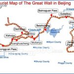
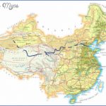
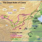
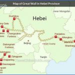
“Nobody can be a true hero unless he has travelled along the Great Wall” goes the popular saying, and this clearly demonstrates the great importance which the Chinese attach to this unique monument. The Great Wall (in Chinese Wanli Chang Cheng, or The Wall That Is Ten Thousand Li In Length) today stretches about 6000km/3700 miles in all, from Shanghai-guan Pass in the east to Jiayuguan Pass in the west. It passes through Hebei, Tientsin, Beijing, Shanxi, Inner Mongolia, Ningxia, Shaanxi and Gansu. It averages 6 to 8m/20to26ft in height, rising to 16m/52ft in places, and is 6 to 7m/20to 23ft wide at the top with battlements and watch-towers. Because ofthe poor condition of much of it only some sections are open to visitors. Along the wall will be found many cultural monuments and historical towns. There are a large number of walls in China with a total length of 50,000km/30,000 miles.
Building of the wall began in the Spring and Autumn periods, between the History 8th and 5th c. B.C., and work continued during the subsequent period ofthe Warring Kingdoms (475-221 b.c.). Fearing attacks by neighbouring states and by the Huns and other tribes who had settled in north and west China, the individual emperors built massive defensive complexes along their boundaries. Following the unification of the country in 221 b.c. Emperor Qin Shi Huangdi (221-210 b.c.) ordered the various defensive walls to be joined up to form one great wall. 300,000 soldiers and 500,000 peasants, Great Wall The Great Wall near Beijing many of whom died, were forced to work for several years on his mammoth construction of rammed earth. After completion it measured some 5000km/3000 miles in length and reached from Lintao in the west to Lia-dong peninsula in the east. Under the Han dynasty (206 b.c. to a.d. 220) it grew to 10,000km/6000 miles. In the Ming period (1368-1644), when the country was attacked by Mongols from the north and tribes of hunters from the north-east, the wall was strengthened and lengthened; many sections were completely rebuilt in brick and stone, and watch-towers erected at intervals of between 200 and 300m/220 and 330yd. The first Ming Emperor Zhu Yuanzhang ordered his General Xu Da to improve and renew the wall and defend the passes. Nine commanders, under the direct command of the Emperor himself, were put in charge ofthe defences. Most ofthe Great Wall as we see it today was built under this dynasty, although parts were destroyed by local inhabitants who stole stones from it to build houses and roads.
Jugongguan Jugongguan Pass begins 50km/30 miles north-west of Beijing, extends for
Pass over20km/1272 miles through a valley and ends 5km/3 miles from Badaling.
After the Great Wall had been completed Emperor Qin Shi Huangdi settled the workers in a number of villages scattered along this valley; none of which survive today. At one time the pass was strategically very important as it safeguarded the northern approach to Beijing. The fortress here dates from the 14th c. The Terrace ofthe Clouds (Yuntai), built of marble c. 1345, measures 10m/33ft high, 27m/89ft long and 18m/59ft wide, and once had three towers and later a temple. Today it boasts an arched gateway decorated with reliefs of deities, guardians of the heavens and mythological animals as well as Buddhist inscriptions in Sanskrit, Tibetan, Mongolian, the Xixia language, Uigur and Chinese. Badaling One ofthe best-maintained sections ofthe Great Wall (restored in 1957) is unquestionably that near Badaling Pass, at a height of 1000m/3300ft above Guangdong sea-level and 85km/53 miles north-west of Beijing, from where it can be reached by train or bus. This section of the wall is between 7 and 8m/23 and 26ft high and 5 to 6m/16 to 20ft wide. Ten men or five horses can stand side by side across the top. It is faced with three layers of bricks. Along the inside runs a parapet 1m/3ft high and along the outside are battlements twice that height. The wall was also important as a traffic route. In this mountain pass there is a fort built in 1502 which covers an area of 5000sq.m/53,OOOsq.ft. In the exhibition hall in front of it visitors can see terracotta figures of warriors from the Qin period (221-206 B.C.). The section ofthe Great Wall near Gubeikou, 130km/80 miles from Beijing, Gubeikou is also very impressive. It was built on Mounts Panlong and Wohu and there is a wonderful view from here. The defensive tower built during the Ming period (1368-1644) is now just a ruin.
Province
Area: 198,500sq.km/76,640sq. miles Population: 64,390,000. Capital: Canton Traversed by the Tropic of Cancer, Guangdong lies in south China, between Situation and 108°13′ and 119°59’E and 3°28′ and 25°31’N. Its jurisdiction covers a main- Dialects land region together with a number of islands scattered over the South China Sea. The main dialect is Cantonese, which is spoken mainly in the west and north ofthe province, while the Hakka dialect will be heard in the north and Fujian in the eastern coastal region.
Great Wall China Map Photo Gallery
Maybe You Like Them Too
- The Best Cities To Visit in The World
- World’s 10 Best Places To Visit
- Coolest Countries in the World to Visit
- Travel to Santorini, Greece
- Map of Barbados – Holiday in Barbados

