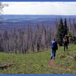
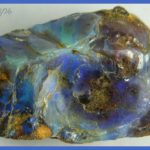
You can follow a Gallatin National Forest trail into the mountains to find specimens of petrified wood like those preserved in Yellowstone. The petrified trees are located about a mile (1.5 km) from the end of Tom Miner Basin Road. The specimens in Yellowstone Park are at the top of long and dicult trails up the western slopes of the Gallatin Range in the northwest corner. You’re not allowed to collect them there. From this east side of the mountains, however, you may take home samples of petrified wood but first ask for a free collection permit at the Forest Service Ranger Station in Gardiner. Also ask about recent bear sightings, since both black and grizzly bears live in the area. On U.S. 89, you’ll leave Paradise Valley and enter Yankee Jim Canyon. Here you also enter the Gallatin National Forest, which alternates with private land in checkerboard squares. Between here and the town of Gardiner are a forest service campground, a picnic area, and several river access points. To create Yankee Jim Canyon, the Yellowstone River has carved through volcanic rocks to the very old Precambrian basement rocks below. James (Yankee Jim) George took over the road-building job from a southern-born prospector named Henderson and was able to blast enough rock to make the road through the canyon passable for wagons. Then from 1874 until about 1910, he exacted a toll from all who passed by.
You can see the old road clearly across the river. In some places the old railway roadbed is also visible closer to the river. The town of Corwin Springs used to have its own plunge or hot spring pool, using water piped from La Duke Hot Spring to the south. Near here a 5000-year-old Native American hearth was found on the Rigler Bluffs east of the river. Initially puzzled by the hearth’s height and distance from the river, researchers concluded that the river must have been dammed by landslides and that Native Americans must have camped along the edge of the resulting lake. At Corwin Springs you may cross the river and continue to the park along a parallel dirt-and-gravel road. That road passes the historic sites of the towns of Electric, which had extensive coal mines with an aerial tramway, and Cinnabar, which was the first terminus of the Northern Pacific Park Branch Line. Cinnabar claimed to be the capital of the United States for a few days in 1903, because President Theodore Roosevelt had left his train and communications center there while he traveled through Yellowstone. A few months later, the railroad terminus was moved to Gardiner, and not long after, Cinnabar became a ghost town. Heat over the Hot Spring In the late 1980s, the Church Universal and Triumphant (CUT) began drilling into the La Duke Hot Spring aquifer in order to heat a spa and buildings. La Duke Hot Spring and the bottom of Devil’s Slide are on the church’s property. Since Yellowstone’s geothermal systems may have some connections to underground systems outside the park, drawing off water as the controversial church had planned to do could have serious consequences for Mammoth Hot Springs.
Yellowstone Park’s former Chief Ranger, Dan R. Sholly, expressed concerns about this close neighbor of the park in his 1991 book, Guardians of Yellowstone. The church’s 12,000-acre (49 sq km) tract of land, named the Royal Teton Ranch after it was purchased from multi-millionaire Malcolm Forbes in 1981, shared 5 miles (8 km) of border with the park at that time. Sholly wrote that CUT agreed to cap its well and allow the U.S. Geological Survey to determine the relationship between its hot spring and those in Yellowstone. All water use north of the park is being closely monitored. In 1999, the Forest Service purchased about 7800 acres (32 sq km) of the Royal Teton Ranch, acquiring the ranch’s geothermal rights and adding to the lands now available for winter grazing by Yellowstone’s elk, bison, bighorn sheep, mule deer, and pronghorn. On the main road, less than 2 miles (3 km) south of Corwin Springs, the La Duke Spring National Forest picnic area is an excellent place to get a good look at Devil’s Slide on Cinnabar Mountain. Early prospectors mistakenly thought the slide’s red color was due to cinnabar, or mercuric sulfide, but it’s actually sandstone and shale stained.
For Hikers and Mineral Collectors Yellowstone Photo Gallery
Maybe You Like Them Too
- The Best Cities To Visit in The World
- World’s 10 Best Places To Visit
- Coolest Countries in the World to Visit
- Travel to Santorini, Greece
- Map of Barbados – Holiday in Barbados

