County: Buskerud fylke.
Altitude: 97 m (318ft). Population: 12,000.
Postal code: N-3500. Telephone code: 0 67.
T Turistkontoret for Ringerike, A Rutebilstasjon (Bus Station); tel. 2 15 77.
HOTELS. Grand Hotell, 37 Kleekken Turisthotell, 5 km (3 miles) E, 123 bž SP. YOUTH HOSTEL CAMP SITE at youth hostel.
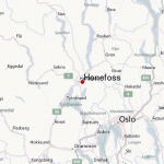
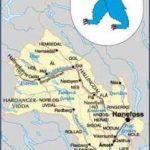
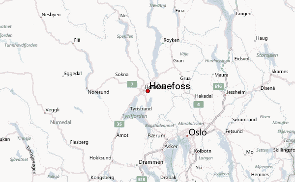
The Norwegian town of Honefoss, at the junction of the Begna (Adal-selv) and the Randselv, is the industrial and administrative capital of the district of Ringerike. It is an important traffic junction. The Begna divides the town into a northern and a southern half, forming the double falls, the Honefoss, from which it takes its name. The falls (hydroelectric power station) are impressive only when the water level is high.
The falls have provided the basis for the town’s industrial development; in 1668 there were 23 sawmills here. In addition to woodworking, the local industries include clothing factories and the manufacture of skis and tools.
SIGHTS IN SURROUNDING AREA. An attractive trip from Honefoss is via Klaekken to the Ringkollen (701 m (2300 ft): 15 km (9 miles) E on a toll road; magnificent views, weather station). 4 km (2 miles) S of Honefoss, on E68, is Norderhov, with a medieval church containing the tombs of the pastor, Jonas Ramus, and his wife, Anna Kolbjomsdatter. The local legend has it that the lady enticed a hostile
Swedish force into an ambush in which the Swedish colonel, Lowen, was taken prisoner (1716). Souvenirs of the event are on display in the Ringerike Museum in the old presbytery. In 10 km (6 miles) begins a beautiful stretch of road (3 km 2 miles) along the Steinsfjord (on left). After this the road crosses the Kroksund, which links the Steinsfjord with the Tyrifjord (alt. 62 m 203 ft); at the end of the bridge, on the right, is the Sundoya Restaurant. Then comes Sundvolen, 15 km (9 miles) from Honefoss, a popular resort at the NE end of the Tyrifjord (alt. 76 m (250 ft); Sundvollen Hotel, 140 b.). To the S rises Krokkleiva (443 m 1453 ft), reached either by a 4 km (2 mile) side road (toll) or by a barrel lift (tonneheis) 1266 m (4150 ft) long. Below the hill is the Kleivstua (restaurant; 24 b.), with the beautiful Queen’s View (Dronningens Utsikt). There is an even finer view from the projecting spur of rock called the King’s View (Kongens Utsikt, 379 m 1243 ft), 25 minutes’ walk away.
3-5 km (2 miles) farther along E68, on the right, is the Tyrifjord Restaurant. There are a number of fine views of the fjord. 9-5 km (6 miles): Skaret (alt. 252 m 827 ft), with a magnificent prospect of the Tyrifjord and Steinsfjord. Here Road 285 from Drammen (20-5 km 13 miles) enters on the S. E68 now leaves the shores of the fjord and climbs 3 km (2 miles) E, with many bends, to Sollihogda (341 m (1119 ft): inn). Magnificent view of the Tyrifjord below. From here it is 28 km (17 miles) to Oslo via Sandvika (E18).
Road 7 runs NW from Honefoss, passing (on the right) the large stone bridge carrying the Bergen railway. It then climbs gradually up the Soknadal and through Sokna (24 km (1 5 miles): alt. 143 m 469 ft) toHamremoen (14 km (9 miles): 135 m 443ft), with an old storehouse raised on posts. 5 km (3 miles): Noresund, where a road goes off on the left (9-5 km (6 miles): toll) to the Norefjell (Fjellhvil Hotel, 96 b.), a popular skiing area, with facilities from the 1952 Olympics (two ski-lifts; chair-lift from 750 m (2450 ft) to 1000 m 3300 ft). The main road follows the E side of the beautiful Lake Kroderen (area 43 sq. km (1 7 sq. miles), length 41 km (25 miles), depth 119m-390 ft). 22 km (14 miles): Qrgenvika. Higher up, to the right, is the end ofthe Haversting Tunnel (231 2 m 2500 yds) on the Bergen railway. From here it is 13 km (8 miles) to Gulsvik, the gateway to the Hallingdal ( 115).
Road 68 runs N from Honefoss on its way to the Valdres district (282). An alternative route to Bjorgo is by Road 35, running along the E side of the Randsfjord, an additional distance of 37 km (23 miles).
Road 35 goes off on the right at Hov, 2 km (1 Smiles) from Honefoss. E68 follows the valley of the Begna (Adalselv), running through forest for part ofthe way, and after 29 k (18 miles), at Finsand (alt. 155 m 509 ft),to LakeSperillen (alt. 148m (486ft); 23km (15 miles) long, up to 2 km (H miles) wide, up to 108 m (350 ft) deep). It then runs along the E shore of the lake for 26 km (16 miles). Shortly after the But-tingsrud camp site there is a view of the church at Viker on the other side of the lake. Before the road reaches Nes, it offers a glimpse of the church with its slender spire (1860).
Nes Ada! (alt. 1 50 m (492 ft); pop. 250) lies on the right bank of the Begna above its outflow into Lake Sperillen. Road 243 goes off on the left (25 km 15 miles) to Hedal, with a 13th c. stave church. The church was converted into a cruciform church in 1738 (restored 1901; fine furnishings). From Hedal it is possible either to continue to Nesbyen (47 km 30 miles) on an unmade road or to return to E68 at Begndal (6-5 km 4 miles).
From Nes, E68 runs through wooded country along the left bank of the Begna. A few miles on it passes from Buskerud county into Oppland and enters the Valdres district.
The alternative route into Valdres, along the Randsfjord (Road 35), leaves E68 on the right at Hov, 2 km (1 miles) N of Honefoss. As far as Jevnaker (13 km 8 miles) there is an attractive alternative (beautiful scenery, large farms, fine views) from Honefoss to Klaekken (5 km 3 miles), then turning left into Road 241 (9 km 5 miles).
Jevnaker (alt. 141 m (463 ft); pop. 3000) lies at the S end of the Randsfjord, the fourth largest lake in Norway (area 136 sq. km (53 sq. miles), length 73 km (45 miles), depth up to 108 m 350 ft). The little town has two glass factories Hadelands Glassverk (1765: conducted tour) and Randsfjords Glassverk (1949) as well as clothing manufacture and engineering works. Road 35 continues along the E side of the lake. The road on the W side (87 km (55 miles) to Dokka) is of poorer quality but offers a wider variety of scenery. 25 km (15 miles): Tingelstad, from which a side road runs a short distance E to Halvdanshaugen. In Halvdanshaugen are a Romanesque church (unusued) and the Hadeland Folke-museum. 4 km (2miles): Brandbu (alt. 178 m (584 ft); pop. 2000), which also lies on Road 4 (74 km (46 miles) to Oslo, 55 km (34 miles) to Gjovik). 5-5 km (3 miles) S of Brandbu (3-5 km (2 miles) on Road 4, then a side road to the right) is Gran, with two old churches (c. 1100). Road 35 continues to Roykenvik (4 km 21 miles); to the right is a hill with far-ranging views (Brandbukampen, 522 m 1713 ft). Then on via HoviLand (37 km (23 miles): alt. 134 m 440 ft), with a church (1781), and Fluberg (11 km (7 miles): 155 m 509 ft) which has a church (1703; altarpiece, 1752, a copy of one by Rubens), to Singvoll (2 km H miles), where Road 33 goes off on the right to Gjovik (28 km 17 miles). Finally, via Odnes (ski-jump: record 108 m 354 ft) to Dokka (14 km (9 miles): alt. 148 m (486 ft); pop. 2000; Centrum Hotel, 21 b.), main town ofthe district of Nordre Land. Local museum with 15 old houses. The Dokkaelv flows into the Etna here. The road from Jevnaker, along the W side of the Randsfjord (No. 245), joins Road 35, which follows the valley of the Etna. 5 km (3 miles): Nordsinnichurch (built at Haugnar in 1758, moved to Nordsinni in 1898, restored 1961; beautiful interior). 8 km (5 miles): Mollerstugufossen, with 12 rock carvings about 4000 years old. 16 km (10 miles): Tonsasen (alt. 624 m 2047 ft), where a road enters on the left from Bagn. Soon afterward Road 35 reaches its pinnacle (726 m 2382 ft), and then drops down to 510 m (1673 ft) at Bjorgo (12 km-7miles), in the wooded Valdres district, where it meets E68, on the way from Honefoss.
Honefoss Norway Map Photo Gallery
Maybe You Like Them Too
- The Best Cities To Visit in The World
- World’s 10 Best Places To Visit
- Coolest Countries in the World to Visit
- Travel to Santorini, Greece
- Map of Barbados – Holiday in Barbados

