While China divides into two in a topographical sense, the same is true in hydrographical terms. From the cold, dry central highlands with irregular internal drainage in the west, vast river systems flow east into the uplands and plains of East Asia. With modest amounts of precipitation on the high plateaux of Central Asia and year-round coverings of snow on the high peaks, there is little productive run-off.
Typical phenomena resulting from this type of drainage system are rivers which form from melted snows but which then seep through the never-ending desert and peter out or else shallow, saline lakes whose water level varies dramatically. Most notable for its “movements” is the Lop Nur lake in the Tarim Basin. With a surface area sometimes reaching 7000sq.km/2650sq. miles, it never exceeds 2m/6>6ft in depth.
The irregular drainage flows and the large variations in the water level have made it difficult to use the lakes and rivers of Central Asia productively for such purposes as irrigation.
By contrast with the Asian interior, several mighty rivers cross the wetter, monsoonal East Asia in an west-east direction, irrigating land from the outer edges of the Asiatic highlands to the Pacific on their way. The change from cold, dry winters to damp, hot summers, plus the considerable monsoon rainfall leads to massive fluctuations in spring, the Huanghe is regarded as the “creator of the plains”, but during the high water months of the summer, it is known as “China’s sorrow”.
Time after time, the Huanghe has overflowed and caused catastrophic floods with the deaths of tens of thousands of people living alongside its densely populated banks. In 1867 more than a million people drowned and over 22, OOOsq. km/8360sq. miles of the Great Plain were inundated when the river broke its banks.
One problem which typifies the unpredictability of the Huanghe is the pendulum effect of its alluvial fan, which is constantly rising as a result of the ongoing silt deposits.
In the last four thousand years, despite tremendous efforts to contain the waters, there have been 430 incidents in which the dykes have been breached and at least eleven changes to the embanked watercourse. Atthe mouth of the Huanghe, the “swing of the pendulum”, i.e. the various courses the river has taken as it approaches the sea, covers between 800 and 1000km/500 and 600 miles! The Changjiang is of even greater proportions. Over 6000km/3720 Changjiang/ miles in length, it irrigates a fifth of China. Originating in the Tibetan Yangtsekiang Plateau it links a number of basin landscapes (Red Basin, Tangho (Blue River) Basin, Wuhan and Anquing lake valleys), cutting through narrow gorges to finally flow through a delta out into the East China Sea near Shanghai just beyond the Jiangsu Plain.
On account of the larger catchment basin, greater precipitation and important tributaries which join from the south, the average outflow is in fact much greater then the Huanghe. The amount of water flowing from the Changjiang at its mouth (35,000 cubic metres/71/2 million gallons per second) is only exceeded by the Amazon and the Congo!
Erosion-resisting vegetation within the catchment area and the greater strength of the flow reduces the extent of particle and sediment content to a relatively low level. By way of contrast with the Yellow River, the Changjiang is virtually free of siltand sand and is sometimes known as the “Blue River”.
The Changjiang is not subject to the same risk of flooding as the Huanghe, for the simple reason that afterthe river has passed through steep, narrow valleys, it always opens out into wide lowland basins where flood plains can absorb increased flows. The amphibian landscape around theTangho Basin near Wuhan is one of the most impressive examples of how the course of a river can become a maze of uncontrolled meanders when the speed of flow is suddenly reduced as it passes beyond the rapids and gorges of Wushan. The Xijiang, the third longest of China’s river systems, drains an area of Xijiang 435,OOOsq.km/167,OOOsq. miles. Although it is only 2130km/1341 miles West River in length and has a catchment area half the size of that of the Huanghe, the outflow is nevertheless much higher, largely because of the considerable monsoon rainfall in the tropical south.
Despite the greater volumes of water, the risk of flooding is much less than for the northern rivers, thanks mainly to the more consistent rainfall levels and also the contours. The course of the river is determined by the South Chinese Highlands and the water is directed along tectonically-formed valleys to the South China Sea.
The differences between the rivers have had significant consequences on the development of the Chinese culture. In the north, there is considerable emphasis on communal strength in the battle with the river embankments and flood protection, while in the south, for thousands of years, the navigable southern rivers have had an important function within the Chinese economy as arteries for travel and trade.
Furthermore, the huge volumes of water have provided magnificent opportunities for the development of irrigation schemes and also the cultivation of rice.
Lakes There are in excess of 2000 larger lakes in China so only a few notable examples are included here to represent the very many different types which occur in such a vast country. The mainly saline lakes of the steppes and those between the mountain ranges in the Central Asian Highlands have already been mentioned.
The Lop Nur in the Tarim Basin is an example of a shallow lake only found in areas with no natural drainage. The shore line is constantly changing and the lake can sometimes dry up completely. But in the Quaidam Basin (Quinghai Nur) in the Tibetan Highlands (Nam Co, Tangra-yum Co) and also the Dsungaria (Ebi Nur), there are examples of extensive salt lakes and impassable swamps.
Of great importance in maintaining the water levels in East Asia are the vast amphibian landscapes of the lowland basins. The maze of rivers and freshwater lakes which have formed in these valleys serve as natural reservoirs and flood basins. They can have a regulatory effect on the water volumes of the lowland rivers. In addition, such lakes as the Dongtinghu, Poyanghu, Daguanhu, Chaohu, Hongzehu and Taihu fulfil a useful function where the agriculture requires intensive irrigation.
Waterpower The major Chinese rivers have been put to good use as sources of electricity. Hydro-electric dams have at the same time helped to moderate the potentially destructive forces of these mighty watercourses. In recent decades many more dams and dykes have been built and sections of the Huanghe and the Huaihe have been modified to become reservoirs and flood basins. The coast China’s 20,000km/12,500 mile coastline extends from Korea to Viet- nam. It can be divided into two sections, mirroring the differences between the north and south of the country in both a topographical and cultural sense. The dividing line comes at the Bay of Hangzou where the foothills of the Quinlinshan and the Dabieshan reach the sea. To the north the coastline is generally flat and sandy, to the south it is rugged and indented with rias, or fjord-like inlets.
The flat, north Chinese coast is only interrupted by Sinian horsts.the Liadong and Shandong peninsulas. The remaining coast consists of late Quaternary river sediment. The mud and sand from the Huanghe and the Changjiang have created an inaccessible, shallow, shifting shoreline. There is a tendency to silting up and the beaches grow considerably every year.
Consequently, all important harbours in northern China are situated a little upstream in river estuaries such as at Shanghai and Tianjin or in the better protected bays of the previously mentioned peninsulas such as at Qingdao, Weihai, Yantai and Dalian.
The mountains of south China which extend as far as the sea are responsible for the creation of the steep and stable southern coastline. The mountain valleys lead down to inlets (rias), bays and countless offshore islands.
This type of coastline has of course always been much better suited for the siting of ports, which then provide a favourable environment for shipping, trade and fishing.
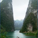
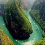
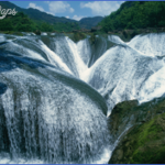
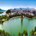
Lakes and rivers of China Photo Gallery
Maybe You Like Them Too
- The Best Cities To Visit in The World
- World’s 10 Best Places To Visit
- Coolest Countries in the World to Visit
- Travel to Santorini, Greece
- Map of Barbados – Holiday in Barbados

