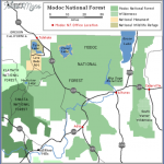
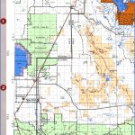
MODOC NATIONAL FOREST MAP CALIFORNIA
1,651,232 acres. This extremely large National Forest is made up of tracts in the northeast corner of California. Terrain here is mountainous, with some lofty peaks and volcanoes, cliffs and canyons. Highest point is 9,892-foot Eagle Peak, which is located in the National Forest’s one designated wilderness area, the 70,385-acre South Warner Wilderness.
There are glacial lakes and streams, forests of pine and fir, with juniper and sagebrush, plus meadows, grasslands, and alpine vegetation. Wildlife includes mule deer, pronghorn antelope, wild horse, black bear, coyote, and cougar.
Activities: Hiking and backpacking are possible on over 100 miles of trails. Difficulty ranges from easy to strenuous. Horseback riding is allowed on most trails.
Some Nordic skiing and snowshoeing are possible here in the winter. Fishing along the many akes and streams is another option. Hunting is permitted in season.
Camping Regulations: Camping is allowed in most parts of the National Forest, except near public use areas or where otherwise prohibited. Campsites should be at least 100 feet from water sources and trails. A fire permit must be obtained in order to make a campfire or use a stove.
For Further Information: Modoc National For-3st, 441 North Main Street, Alturas, CA 96101; (916)233-5811.
MODOC NATIONAL FOREST MAP CALIFORNIA Photo Gallery
Maybe You Like Them Too
- Arnold A Town with a Heart
- The Best Cities To Visit in The World
- World’s 10 Best Places To Visit
- Map of New York City – New York City Guide And Statistics
- Map of San Francisco – San Francisco Map Free

