County: Nordland fylke.
Altitude: sea level. Population: 1 5,000.
Postal code: N 8500. Telephone code: 0 82.
HOTELS. Grand Hotel Royal, 230 Victoria Royal, 78 Malm Pensjon, 50 Nordstjernen, 50 Breidablikk Gjestgiveri, 48 b. YOUTH HOSTEL. CAMPSITE.
SPORTS and RECREATION. Fishing; cruises in the fjords.
BOAT SERVICES to the Lofoten Islands (179).
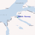
The northern Norwegian port of Narvik is situated at the W end of a peninsular between the Rombaks-fjord to the N and the Beisfjord to the S. These fjords are branches of the Ofotfjord, which gives Narvik its access to the Atlantic. In the 1880s g British company obtained a concession to develop the iron-ore mines in Kiruna (Sweden) and permission to build a railway from Kiruna to a small village on the ice-free shores of Ofotfjord. Its offices were built by the first Manager, William Spear, who called the place Spear-gSrden, He was very autocratic and caused a great deal of trouble. After his departure the English called the harbour Victoriahaven, after the Queen, but after the English had gone the Norwegian Storting renamed the port Narvik after the name of an old manor-house which had previously stood on the site.
The town, which received its municipal charter in 1902, is of great economic importance as the terminus of the Ofot railway (Lapland railway) from the Kiruna iron-mines in Sweden and as an ice-free harbour. During the Second World-War the town was fiercely contested by
Passenger quay, Fauske, Trondheim
German and allied forces and suffered heavy damage. When it was rebuilt after the war, the old wooden houses were replaced by new stone buildings.
SIGHTS. The town is divided in half by the extensive installations of the ore port, modernised and enlarged in 1977. The ore brought by rail from Sweden is carried by long conveyors to various depots and to the Malmkai (Ore Quay). The port can now handle ore-carriers of up to 350,000 tons, and has a total handling capacity of some 30 million tons a year. On the S side of the loading installations in a small park there is an attractive sculpture of a group of children.
Along the E side of the port installations runs the town’s main street, Kongensgate. In the Torg (market square) is the Town Hall (1961), and, in front of this, a signpost with 23 signs giving the distances to the North Pole and many cities throughout the world. Nearby is a War Museum. At the S end of the Kongensgate stands the Swedish Seamen’s Church (Svensk Sjomannskirke) (library). Diagonally opposite is a monument to the Norwegian warships Norge and Eidsvold, which were sunk during the 1940 fighting. To the N, beyond the railway, is the Gulbransonspark, and to the W of this are 4000-year-old rock carvings. Some distance E of the town
Narvik
Ore-handling installations is the cemetery, with the graves of allied and German soldiers.
20 minutes W of the town is a fine lookout, Frammeasen (1 02 m 335 ft), with a view embracing the Ofotfjord and the hill of Kongsbaktind.
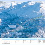
SURROUNDINGS. SE of the town is the Fager-nesfjell (1250 m 41 01 ft), with a cableway up to 700 m (2300 ft) (restaurant at upper station). The hill offers magnificent views; midnight sun from the end of May to mid-July.
Narvik to Abisko by rail (there is also a new road).
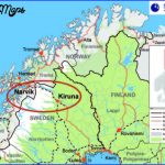
The section of the line within Norwegian territory is known as the Ofot Railway, the Swedish section as the Lapland Railway. The line, completed in 1903, serves primarily for the transport of iron ore from the Kiruna and Gallivare mines (both in Sweden) to Narvik. In good weathera trip on the railway into Swedish Lapland is very attractive, taking the visitor in barely two hours from the fjord to the desolate Arctic uplands. The best view is on the left-hand side. In addition to the many ore trains using the line, there are also passenger trains.
From Narvik, the line runs along the S side of the Rombaksfjord, already beginning to climb (beautiful views). Beyond Rombak there is a further climb, with an impressive view, looking backwards, of the Rombaksbotn and the end of the fjord. The line runs through many tunnels and over viaducts, and the vegetation becomes increasingly sparse. Beyond Bjornfjell, the last Norwegian station, the watershed between the Baltic and the Arctic Ocean is crossed at an altitude of 525 m (1720 ft), and soon afterwards the Norwegian-Swedish frontier is reached. 2 km (1 miles) farther on is the Swedish town of Riksgransen, in a magnificent mountain setting, with the Lapplandia Hotel (very popular skiing area). From here to Abisko, 54.
Lofoten Islands: p. 179 Vester&len: p. 291.
The Nordfjord, lying almost exactly on the 62nd degree of northern latitude extends parallel with the Sognefjord to the S for a distance of over 90 km (55 miles) from Maloy to Olden, with a depth of up to 565 m (1850 ft). The various parts of the fjord have different names; in the past the name of Nordfjord was applied to the entire district. The juxtaposition of wide expanses of water, mighty mountains and glaciers give the inner branches of the fjord a particular charm.
The Nordfjord is reached from the S on E6, which runs via Lillehammer to Otta. From Otta Road 1 5 runs W via Lom to Stryn on the N side of the Innvikfjord, the most easterly ramification of the Nordfjord.
Narvik Norway Map Photo Gallery
Maybe You Like Them Too
- The Best Cities To Visit in The World
- World’s 10 Best Places To Visit
- Coolest Countries in the World to Visit
- Travel to Santorini, Greece
- Map of Barbados – Holiday in Barbados

