Province: Ostergotlands Ian.
Region: Ostergotland.
Altitude: sea level. Population: 120,000.
Postal code: S-60 . .. Telephone code: 011. ‘ NNorrkopings Kommunes Fritidsnamnden, iHospitalsgatan 30,
HOTELS. Ritz, Vattengranden 11,130 Standard, Slottsgatan 99, 245 Esso Motor Hotel, Jarngatan, 315 Centric, Gamla R dstugugatan 18-20, 46 Casa, TradgSrdsgatan 6A, 26 Mobien, Odenslund, 250 Strand, Drottninggatan 2, 32 Frasingsa(-mens Studiehem, Bredgatan 46, 45 b. YOUTH HOSTEL.-CAMPSITE.
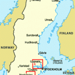
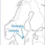
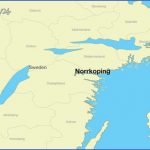
The port of Norrkoping lies at the outflow of the River Motala into the BrSvik, an inlet on the Baltic which stretches inland for 50 km (30 miles). The Brcivik forms a natural boundary between the wooded region of Kol-m&rd to the N and the fertile arable land of Vikboland to the S. IMorrkoping is a busy commercial port (important harbour) and industrial area (metalworking, textiles).
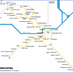
SIGHTS. To the E of the station are the remains of the Johannisborg. Although nothing is left standing but the gate and the adjoining walls, there is enough to give some impression of what this 1 7th c. castle was like in its heyday. The gate tower was restored in 1 934. S of the station is Karl Johans Park, with an interesting collection of cacti; every year a new species is added to the 25,000 plants already there. Intheparkisa monumentto King Karl XIV Johan (by Schwanthaler, 1846). Facing the park is the Town House. On higher ground, SW of the station, stands the neo-Gothic St Matthew’s Church (1 892).
On the S bank of the River Motala is the Tyska Torg (German Market), with St Hedvig’s Church, built in 1673 for the town’s German community (altered in the 18th altarpiece painted by Pehr Hor-berg). The Town Hall (1907-10) on the S side of the square has a tower 68 m (225 ft) high (carillon, daily at 12 noon and 5 p.m.). In Drottninggatan, the town’s main street, is the Clock-Tower (1 750), the great symbol and landmark of Norrkoping; the watchman used to call the hours from the tower. One of the oldest churches in the town, the Ostra Eneby church (12th c.), contains medieval ceiling paintings, valuable tapestries and a beautiful font (basin of KolmSrd marble).
The Gamla Torg, where theTown Hall and the Burghers’ Guildhall once stood, is now surrounded by handsome early 1 9th c. houses. In the square can be seen a monument to Louis de Geers, the Dutchman who brought industry to the town in the 17th c. by Carl Milles. The monument faces the Holmen works, which de Geers founded (tower painted in the colour known as Norrkoping yellow). In the Sodra Promenade is the New Municipal Library, in Kristinaplats the Norrkoping Museum, with departments of older and of modern art; in St Persgatan a Dyeing Museum (FargagSrden); and in Lidaleden a Museum of Crafts. Gammalt Hantverk displays tools and implements of 40 different crafts. To the W of the town are the People’s Park and Himmelstalund Park, with the former spa establishment and a 200-year-old theatre.
SURROUNDINGS. 5 km (3 miles) NWon the road to Svartinge we find the manor-house of Ringstad. Near here are old graves and the remains of a 7th c. Viking stronghold, identified as the one mentioned in the Helgi lays of the Edda. 29 km (18 miles) NW of Norrkoping is FinspSng, in an old mining area, with modern industry and a castle (1 668). 10 km (6 miles) NE of Finsp ng is Rejmyra, with a glassworks (products ofthe factory a re forsale).-10 km (6 miles) SW of Norrkoping is Lovstad Castle.
KolmSrd Forest lies on the boundary between Sodermanland and Ostergotland, to the N of the long inlet of Br3vik-a wooded upland region extending for 1 00 km (60 miles) from Wto E. The rocks are primarily reddish gneiss, but there is also red and black granite. Stone from this area was used in the construction of the Parliament Building in Stockholm in the 19th c. There is also a certain amount of iron and copper in Kolmrd. The famous green marble found in the eastern part ofthe region was worked at intervals over a period of 300 years (1673-1960). Farther E is a Wildlife Park, which is steadily increasing in size. Nearby can be found the Stone Age occupation site of Fagervik. Eriksgatan, the old main road between Gotland and Svealand, cut through the KolmSrd area from the Krokek Inn to Utterberg Castle. A forerunner of today’s inns was the Monastery of Our Lady (VSrfrueklostret) in KolmSrd, which provided accommodation fortravellers. Beside the monastery a chapel was built using stone from its ruins and in 1747 the old church of Krokek, now also ruined. 1 5 km (10 miles) SE of Norrkoping is Soderkoping (pop. 6000; Stadshotellet, 1 32 b.), founded in the 1 3th c. as a trading station for Lubeck merchants, who built a large church here (as well as at Sanninge). The church (St Lawrence’s) was not completed until 200 years later at the end of the 15th c. Excavations, particularly in Storgatan and Vintervadsgatan, have uncovered merchants’ and craftsmen’s houses and equipment which show that during the Middle Ages Soderkoping was one of Sweden’s principal commercial areas. In 1 567, the town was partly destroyed by Danish forces; it was rebuilt in stone. John III made Norrkoping the administrative headquarters of the region and promoted the development of mining. Trade declined and the German merchants left Soderkoping; the town turned to fishing in the skerries for survival. On the islands of Bjorkeskarand Viskar, a trading settlement enjoyed a monopoly of fishing on the Ostergotland coast for 80 years, until 1731. Later, the mineral water of St Ragnhild’s Spring acquired some reputation and was marketed commercially. Features of interest in the town include the Drothem quarter (church) and a number of old-world buildings around St Lawrence’s (St Lars’) Church, including the belfry (1 582) and the old schoolhouse. On Gilleskul-len is an open-air museum, with old houses from the surrounding area. There are fine views from the Ramunderberg (castle).
Norrkoping Sweden Map Photo Gallery
Maybe You Like Them Too
- The Best Cities To Visit in The World
- World’s 10 Best Places To Visit
- Coolest Countries in the World to Visit
- Travel to Santorini, Greece
- Map of Barbados – Holiday in Barbados

