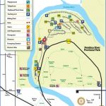
PEMBINA RIVER PROVINCIAL PARK MAP EDMONTON
Directions: Exit Edmonton on Hwy 16 west; take the Hwy 22 (Range Road 74) exit toward Entwistle. At the fork, stay right and follow the signs for Hwy 16A west to access Pembina River Provincial Park.
Distance: 106 km, or about 1 hour and 15 minutes, from Edmonton.
Info: Before entering the river, ensure your safety by asking park staff about the river’s current conditions. Identify where you will get off the river before you start, because it is not marked. 780-727-3643; 1-800-427-3582.
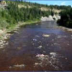
Pembina River Provincial Park is located near the towering Pembina River gorge, where cliffs rise up to 62 metres from the rocky riverbed. Retreating glacial meltwater created the gorge during the Wisconsin Age, between 75,000 and 10,000 years ago.
Visitors ride inner tubes and air mattresses down the river, which winds around the campground. Depending on water levels, this refreshing trip takes about an hour to complete. Put in at the beach near the park gate and exit at the trail adjacent to the amphitheatre. The walk back to the starting point takes about 15 to 20 minutes.
The park has an interpretive trail and viewpoint; there are opportunities to swim, canoe, kayak, fish, hike, and play horseshoes and volleyball. Amenities include a playground, cook shelter, firepits, and both flush and pit toilets.
In 1862 gold seekers paddled the Pembina River near modern-day Entwistle on their way to the tempting Cariboo goldfields. A farming community, Entwistle is home to 534 people, but in 1909 it was much busier, with as many as 3,000 homesteaders living within a 48-kilometre radius. Rails were laid from Stony Plain to Entwistle in the fall of 1909 but stopped at the daunting Pembina River gorge. As the end of the line, Entwistle thrived as businesses provided goods and services to settlers moving farther west; the town also catered to the several hundred men working on the Grand Trunk Pacific Railroad trestle.
Entwistle was called the toughest town in the Canadian northwestern frontier. Moonshine was freely sold, and four houses of ill repute, in addition to gambling joints, were in operation until the 1909 arrival of five Royal North West Mounted Police. When the Pembina River bridge was completed in 1910, construction gangs moved west and this reduced demand for the types of services provided by Entwistle’s criminal element. Today the hamlet of Entwistle, named after James Entwistle, is known for its 270.6-metre railway bridge spanning the Pembina River.
In 1909, the CNR neared Entwistle and built its own bridge, made of steel, over the river; by 1917, however, 129 kilometres of track near Obed were removed to provide steel for the war effort, and the
CNR steel bridge was dismantled. You can still see the bridge’s eight concrete pilings along Pembina River Provincial Park’s day-use road.
PEMBINA RIVER PROVINCIAL PARK MAP EDMONTON Photo Gallery
Maybe You Like Them Too
- Explore Doncaster, United Kingdom with this detailed map
- Explore Arroyito, Argentina with this Detailed Map
- Explore Belin, Romania with this detailed map
- Explore Almudévar, Spain with this detailed map
- Explore Aguarón, Spain with this detailed map

