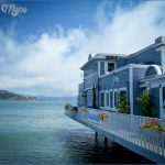
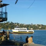
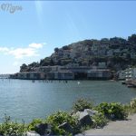
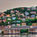
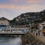
What’s Best: A blend of Mediterranean burg and the old Barbary Coast with views of San Francisco and Angel Island. Sausalito lures sightseers from all over. Above the town is access to the high trails of the Marin Headlands.
Parking:From Hwy. 101 north, take the Sausalito-Marin City exit. Turn left at stop sign, go under freeway and turn right on Bridgeway. Follow Bridgeway about 1.5 ml. and park near Napa St, across from Dunphy Park. From Hwy. 101 south, take the Alexander Ave. exit north of the bridge, follow into Sausalito, merging with Bridgeway. Continue through Sausalito to Napa St. Addtional directions included in the activity paragraphs below. Agency: Golden Gate National Recreation Area; Sausalito Parks & Recreation
The Morning Sun Trail is a locals’ favorite. Parking: From Highway 101, take the Spencer Avenue-Monte Mar exit, the next exit south of Rodeo. A variety of coastal flora and fauna complements the views on the 300-foot climb to Wolfback Ridge. From the Ridge, you can drop about 800 feet over 3-plus miles to Fort Cronkhite, via the Rodeo Valley Trail a very good car-shuttle hike. The SCA Trail overlook offers an astounding look down at the bridge, the bay, and the city, as well as the Marin Headlands. Keep going past the Rodeo Valley Trail (a route to the Marin Headlands) and veer left on the SCA Trail.
Sausalito began in 1838 as Rancho Del Saucelito Ranch of the Little Willow Grove part of a Mexican land grant received by Englishman William Richardson. After Richardson died, the Saucelito Land and Ferry Company purchased 20,000 acres and laid out lots for development. Sausalito received a major growth spurt when, in 1871, a railroad connection to the town’s docks linked Northern California’s timber with San Francisco’s building boom. After the Golden Gate Bridge opened in 1937, ferry and suburban train service to the city ceased and the town languished prior to its beginnings as a quaint tourist attraction. Ferry service was re-established in 1970.
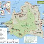
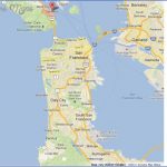
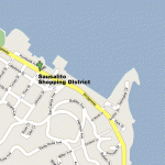
SAUSALITO MAP SAN FRANCISCO Photo Gallery
Begin your Sausalito walk through Dunphy Park, with its gazebo and small sandy beach. From Dunphy Park, stay left along the water, heading along the plank walkway of the Sausalito Yacht Harbor. Emerging from the yacht harbor, to your left you’ll see Sausalito Point a short walk out Spinnaker Drive. Ahead is the Ferry Terminal and Gabrielson Park, a perfect place to occupy a bench where the town meets the bay. Then turn to your right on El Portal, out to Bridgeway, where you’ll see Del Mar Plaza with a grand fountain, bordered by redwood and palm trees the center of Sausalito. Turn left on Bridgeway. On your right is Princess Street, heading uphill. Many visitors will just want to walk around; about 20 galleries, and as many historic buildings, are located on Princess Street and in the 500 and 600 blocks of Bridgeway.
Urban hikers can continue south on Bridgeway. Just past Princess Street on the water side, is Yee Tock Chee Park, named in honor of a beloved local grocer, which marks the spot where the Princess, a small paddlewheeler, docked in 1868 on Sausalito’s first ferry run. Continue along .25-mile shoreline path and veer left at the far end of town on a boardwalk that takes you in front of a restaurant that is the former Valhalla a restaurant once owned by Sally Stanford, a fabled San Francisco madam who became mayor of Sausalito in the late 1960s. Go up to Second Street. Turn left and then left again, toward the water, on Valley Street. After a short block, take a long flight of stairs down to Swedes Beach, a cove tucked away beneath beach cottages and condos.
Del Mar Plaza, Sausalito Yacht Harbor
To return, either backtrack on the other side of Bridgeway, taking in shops and galleries; or, for a look at a neighborhood perched above the town, cross Second Street and go right up Third Street. At the top is pleasant South View Park. You’re now in Sausalito’s “banana belt,” known for its sunshine. Walk right on Atwood Avenue, which joins with Bulkley Avenue, heading back toward town above Bridgeway. Sitting spots offer places to enjoy the charming neighborhood, nestled amidst flowering gardens and trees. Where Princess Street joins Bulkley Avenue, look for Alta Mira Hotel and Restaurant, a Sausalito tradition. Pass the Alta Mira on Bulkley. To return to the town, turn right down a flight of stairs on Excelsior Lane; or pass Excelsior and take another flight of stairs on El Monte Lane. Both take you back near Del Mar Plaza.
Bike: Not many cyclists will begin in Sausalito, but many pedal through, perhaps stopping for libation while taking the bike path from Richardson Bayfront, TH21, to Fort Baker, TH17. Buffed bikers also may begin a loop at the Rodeo Avenue, an exit off Highway 101. You pedal up about 400 feet initially, on a nicely graded road surface. From the top, turn right, or north, on Old Marincello Road, whizzing down into Tennessee Valley. Then take Tennessee Valley Road out cross under Shoreline Highway and head out along the wetlands to the Mill Valley-Sausalito bike path. Turn toward Marin City, crossing over Bridgeway and under Highway 101. Then take Donahue
Street up you’ll do most on the climb back on pavement to the Alta Trail. The Alta Trail joins with the Rodeo Avenue Trail, which you take back down to parking. This ride involves about 1,200 feet of climbing over 8 miles.
Maybe You Like Them Too
- Arnold A Town with a Heart
- Map of New York City – New York City Guide And Statistics
- Map of San Francisco – San Francisco Map Free
- Coolest Countries in the World to Visit
- The 10 Best American National Parks to Visit

