Special Self-governing Municipality
Altitude: 4m/13ft. Area: 4276sq.km/1651sq. miles Population: 9,280,000
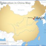
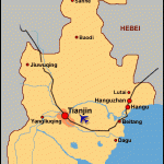
Tianjin lies in the north of China, 137km/85 miles south-east of Beijing, at 117°13’E and 39°09’N. It can be reached from Beijing by rail, bus or air. As Tianjin is an important rail, road, air and shipping hub – it lies at the confluence of five tributaries ofthe Haihe river- it is also easy to get to from other large Chinese cities. There are also daily scheduled flights to Hong Kong.
The first settlements in the region date back to the times of the Warring Kingdoms (475-221 b.c.). Tianjin was well known as a trading settlement in the 12th c., when it was a centre for the sale and distribution of corn and other foodstuffs from the south.
In 1404 the town-then known as Tianjinwei – was given a town-wall and made into a military garrison. It became increasingly important as a commercial centre during the Qing dynasty (1644-1911). In 1858 the Chinese government was obliged to sign the “Treaty of Tianjin” which provided trading concessions to foreigners, something which the population found abhorrent and which led to serious conflicts. Two years later foreign powers occupied Tianjin and declared its port open to all trading ships. In the years that followed Great Britain, France, Japan, Germany, Russia, Italy, the Austro-Hungarian Empire and Belgium were all granted trading franchises here, and they gave the town a certain European character which it still retains to some degree.
By 1860 Tianjin had grown into an important sea-port, and ten years later the first Chinese textile factory opened up here. In the 130 years since then about 4400 firms of various kinds have become established.
During the Boxer Rebellion in 1900 the town-walls were destroyed. In 1937 the Japanese occupied Tianjin. After 1949 industry, especially heavy
Tianjin: a bridge over the Haihe
industry, developed apace. Floods, which had previously been a frequent menace, were kept at bay by means of various engineering projects. In 1976 a devastating earthquake destroyed large parts ofthe city.
Tianjin, the third largest city in China, is one of northern China’s leading industrial cities. Although heavy industry predominates, light industry, chemicals, textiles and the famous carpet factories all make an important contribution to the economy. The city co-operates to a major degree with countries overseas.
Xingang, one of China’s largest ports, is only 48km/30 miles from the centre of Tianjin.
Economy
This hall was built in 1976 in memory of Zhou Enlai (see Famous People), who attended Nankai School here between 1913 and 1917 and promoted a patriotic movement.
The Grand Mosque built of wood and located in the north-west of Tianjin dates from 1644. Although the architecture is Chinese the decorative patterns such as flowers and geometric designs clearly show an Islamic influence.
Tianjin Map Photo Gallery
Maybe You Like Them Too
- The Best Cities To Visit in The World
- World’s 10 Best Places To Visit
- Coolest Countries in the World to Visit
- Travel to Santorini, Greece
- Map of Barbados – Holiday in Barbados

