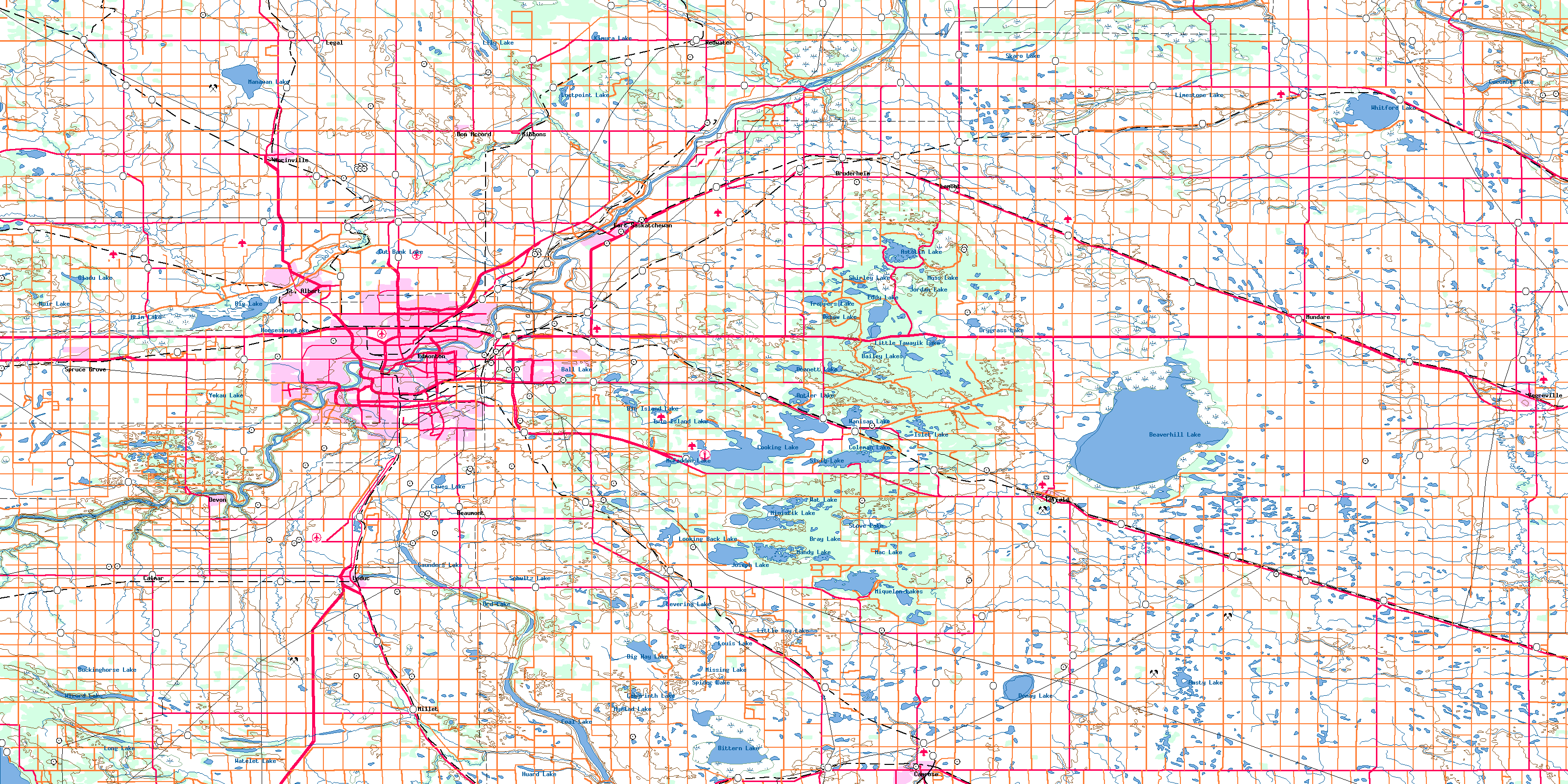
WILLINGDON AREA MAP EDMONTON
Directions: Exit Edmonton on Hwy 16 east, turn left onto Hwy 15, turn right onto Hwy 29, left onto Hwy 857, and left onto Hwy 45/Hwy 857.
Distance: 131 kilometres or 1 hour, 29 minutes.
Info: 780-367-2337.
Willingdon a small village of around 300 people, is located close to the junctions of Highways 45 and 857. The railway arrived in 1927, and Ukrainian and Romanian pioneers arrived to settle the area. Named for Lord Willingdon, Canada’s Governor-General from 1926 to 1931, the community claims to be home of the world’s largest lapel pin. Watch for it along Highway 45 at the Willingdon Tourist Park.
Historical Village and Pioneer Museum at Shandro,
Location: About 9 km north of Willingdon.
Directions: Exit Edmonton on Hwy 16 east, turn left at Hwy 15, and continue on Hwy 855/Sawchuk Street; turn right at Hwy 29 (637), turn left at Hwy 857, and turn left again at Hwy 45/Hwy 857.
Info: Open Canada Day weekend to Labour Day weekend by special request. Advance notice is required. Donations appreciated. 780-603-0616.
Most Willingdon-area settlers were of Ukrainian and Romanian origin. Their history comes to life at the Historical Village and Pioneer Museum at Shandro. This 19-building site includes a fully furnished Orthodox church, which pioneers began building in 1899. There is a sod hut (circa 1899) and a log home with a thatched roof (circa 1902), as well as a blacksmith shop. The buildings are adorned with early-1900s artifacts, utensils, handicrafts, clothing, accessories, furniture, equipment, and tools. Most of these were brought to Canada from Ukraine in the late 18th and early 19th centuries, or made by immigrants who settled here.
WILLINGDON AREA MAP EDMONTON Photo Gallery

Maybe You Like Them Too
- Explore Nevestino, Bulgaria with this Detailed Map
- Explore Pulau Sebang Malaysia with this Detailed Map
- Explore Southgate, Michigan with this detailed map
- Explore Les Accates, France with this Detailed Map
- Explore Góra Kalwaria, Poland with this detailed map