MAYERTHORPE MAP EDMONTON
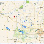
Directions: Exit Edmonton on Hwy 16 west, then take Hwy 43 north.
Distance: 137 km, or about 1 hour and 34 minutes, from Edmonton.
Info: www. tow nofmayertho rpe.ab.ca.
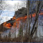
On the way to Mayerthorpe, pull into Sangudo for a look at one of the world’s largest working sundials, which is shaped like a grain elevator. You might also enjoy stopping at the Paddle River Dam, which has a day-use area with a boat launch. It’s a pretty spot to drop a fishing line, swim, and water-ski. Winter visitors are often seen ice-fishing here. The Rochfort Bridge Trading Post is also along Highway 43. From the trading post, you can view the Rochfort Bridge by heading north on Highway 43, then west toward Township Road 570C, followed by a sharp right at Township Road 572 (totalling 12.8 kilometres from the Rochfort Bridge Trading Post). The longest wooden trestle bridge in western Canada, Rochfort Bridge spans about 736 metres. The nearby Rochfort Bridge Trading Post has a licensed dining room with homestyle cooking. Call 780-785-3467 for reservations and ask about the one-pound hamburgerif you can eat it in 20 minutes, it’s free. The Trading Post gift shop, with its unique country gifts and crafts, is a fun place to browse.
Like many Alberta towns, Mayerthorpe takes part of its name from an early postmaster, Robert Ingersoll Mayer, who moved to Alberta with his wife, Emma, in 1908. Peter Gunn, Member of the Legislative Assembly, suggested the name Mayerville when opening the post office, but Mayerthorpe formed by adding the family name of a local teacherwas chosen instead.
In 1919, the Canadian Northern Railway was on its way. Leo Oscar Crockett, a US navy veteran turned settler, subdivided land and encouraged pioneers to live in the townsite of Little Paddle, about five kilometres east of Mayer’s post office. In 1921, the first post office closed and a new one opened in Little Paddle, which took the name Mayerthorpe. Incorporated as a village in 1927, the community became a town in 1961.
Today the town of Mayerthorpe has 1,398 residents. Located in the midst of farm and cattle country, it is primarily an agricultural hub with a mix of oil, gas, and forestry industries. It is also the official start of the 640-kilometre Cowboy Trail that stretches south to Cardston.
The town has one of Alberta’s few remaining wooden grain elevators (4715-52nd Ave). Lessard Lake, Rangeton Park, and secluded Dolberg Lake are recreational areas worthy of exploration. Annual events include a rodeo, the 4H Beef Show and Sale, the Show and Shine, and the Agricultural Fair. The Rangeton Farmer’s Day Festival is held at a nearby rustic campground beside the Pembina River.
MAYERTHORPE MAP EDMONTON Photo Gallery
Maybe You Like Them Too
- Explore East Lindfield, Australia with this detailed map
- Explore Bonferraro, Italy with this detailed map
- Explore Doncaster, United Kingdom with this detailed map
- Explore Arroyito, Argentina with this Detailed Map
- Explore Belin, Romania with this detailed map

