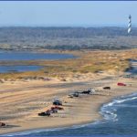
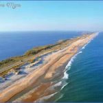
Unquestionably, North Carolina’s most idyllic mountain drive is the Blue Ridge Parkway. On the coast, that honor falls to NC Highway 12 from Nags Head to Ocracoke. Most of the drive passes through Cape Hatteras National Seashore and Pea Island National Wildlife Refuge. On the east side are wide sandy beaches; to the west are picturesque marshes, mud flats, and the expansive Pamlico Sound. Along the way are three lighthouses and numerous other historical sites. If you can ignore the fact that NC 12 can get mighty crowded in the tourist season, this drive is among the best there is along the entire Atlantic seaboard.
While you could drive this route in less than three hours, why would you want to? People come here to spend their entire vacations and hate to leave. So do yourself a favor and plan to spend as much time as you can. You should also study up before the trip so you don’t miss any of the natural and historical features. Literature abounds about the Outer Banks and an Internet search will turn up more pages than you could read in a lifetime.
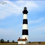
Start out in Nags Head. Drive south on NC 12 to the village of Ocracoke. (47 miles) Morning twilight is often colorful at Bodie Island Lighthouse in Cape Hatteras National Seashore.
The setting sun casts a warm glow on the charter-fishing boats at Oregon Inlet Fishing Center.
The first stop for many visitors is Bodie Island Lighthouse, located about six miles south of Whalebone Junction. Pronounced body, it makes a great photo subject because you can view it from so many different vantage points. In fact, one of the best views is from the main highway, where you can watch the sun setting beside the lighthouse. You can tour the keeper’s house, but the lighthouse itself is presently closed due to structural defects. From the southwest end of the lighthouse loop road, a sandy path goes a short distance to the Pamlico Sound, providing a reprieve from the tourist crowds and an intimate view of the marsh system. The Bodie Island Dike Trail branches off from the sand road and follows an old dike to NC 12. Be sure to pick up the interpretive map from the visitor center before hiking this trail.
You might wonder why anyone would build a lighthouse so far from the water. The answer is that no one did. When constructed in 1872, Bodie Island Lighthouse stood beside Oregon Inlet. Since it first opened, the inlet has moved some two miles toward the southwest. The best way to see this process is to drive the Herbert Bonner Bridge over Oregon Inlet. Notice how the first mile of the bridge spans sand flats and marsh and then ends abruptly on the opposite shore. The inlet wants to keep moving south, cutting into the north end of Pea Island, but rock walls built by the Army Corps of Engineers are halting it. The controversial efforts at controlling the inlet and maintaining the aging bridge are temporary at best. Plans are being considered for some type of new bridge, possibly bypassing Pea Island altogether on a route through Pamlico Sound.
If you’re a birder, or have any notion of becoming one, you’ll want to spend some time at Pea Island National Wildlife Refuge. Various species of shorebirds are seen throughout the year. During the peak autumn migration period (September and October), the refuge hosts impressive numbers of raptors and warblers. By November, the waterfowl take center stage, with snow geese a prominent species. In all, more than 360 bird species make the list for this small (5,834 acres) refuge. The North Pond Wildlife Trail begins from the refuge visitor center and makes a loop around the impoundment. It starts out at a small pond that is usually full of turtles and then follows the south end of the main pond to a couple of overlooks. Be sure to bring binoculars and a bird guide.
A few miles from the visitor center, you’ll see the wooden remains of the bridge that once crossed New Inlet, which closed naturally in the 1930s. Inlets have been opening and closing along the Outer Banks as long as the islands have been here. Barrier islands are dynamic structures, constantly changing and shifting with winds and storms. Back in the 1930s, the government thought they could do something about that. The CCC constructed an artificial dune system from the Virginia line all the way south to Ocracoke Island. The shoreline dunes you see today are the result. Once the islands had been stabilized, people gradually started building roads and houses. In the last few decades, this development has reached absurd proportions. The trouble is that the dunes haven’t stabilized the islands; they have only altered the natural equilibrium of the ecosystem. In many circumstances, the dunes have increased the likelihood of greater storm damage.
The small villages of Rodanthe, Waves, and Salvo lie at the end of Pea Island National Wildlife Refuge. A good stop in Rodanthe is the historic Chicamacomico Life Saving Station. From Salvo, it’s about twelve miles to the next small village, Avon. A few miles south of Avon, look out on the sound side for Haulover Day Use Area. Known locally as Canadian Hole, this section of Pamlico Sound is world-famous among windsurfers and kiteboarders, many driving down from Canada. The winds are best in spring and fall, but expect to see people here anytime the wind is blowing.
Just beyond Canadian Hole is the village of Buxton, carved out of Buxton Woods. The largest maritime forest in the state, Buxton Woods is a nationally significant natural area.
Hike the Buxton Woods Nature Trail for an up-close view of this special place. Of course, the real reason everyone comes to Buxton is to see the Cape Hatteras Lighthouse. America’s Lighthouse, as it’s often called, is possibly the tallest brick lighthouse in the world. Its exact height is a matter of debate. The oft-cited figure of 208 feet supposedly refers to the distance from mean sea level to the top of the beacon’s lightning rod, which doesn’t exactly seem like a fair measurement. The Coast Guard measures the distance from the high-tide line to the focal plane of the light. That measurement is 191 feet. Though modern navigational aids have rendered the lighthouse mostly obsolete, the Cape Hatteras Light once served an invaluable role in guarding ships from the treacherous Diamond Shoals off Cape Point.
It’s a leisurely mile-long walk through soft sand to Cape Point the Point, as the locals call it or a quick ride if you have a four-wheel-drive vehicle. Diamond Shoals extends some ten miles out from the cape and separates the water of the cold Labrador Current from the north and the warm Gulf Stream from the south. Cape Point might be the most popular and well-known surf fishing spot on the East Coast. Come here in the fall or when the blues are running, and you’ll have to fight for elbow room to cast. Tangled lines are a common occurrence.
Surf fishers crowd the beach during sunset at Cape Point in Cape Hatteras National
Seashore.
Between the villages of Frisco and Hatteras, you’ll drive over a newly paved section of road where the island narrows and the vegetation on each side is sparse. In 2003, Hurricane Isabel came ashore and ripped a new inlet here. Coastal geologists warn that this spot is extremely vulnerable to experiencing the same thing during another storm.
THE OUTER BANKS FROM NAGS HEAD TO OCRACOKE Photo Gallery
Maybe You Like Them Too
- The Best Cities To Visit in The World
- World’s 10 Best Places To Visit
- Coolest Countries in the World to Visit
- Travel to Santorini, Greece
- Map of Barbados – Holiday in Barbados

