County: Oppland fylke.
Altitude: 180 m (590 ft). Population: 22,000.
Postal code: N-2600. Telephone code: 0 62. Turistkontor,
Storgata 56; tel. 510 98.
HOTELS. Turisthotel, 260 SP, SB; Oppland Turisthotel, 140 SB; Victoria, 220 Kronen, 140 Langseth, 88 SP; Sommerhotell, 300 ErsgirdAS b. on the hornsjo, 27 km (17 miles) NE: Hornsjo Hoifjellshotel, 401 b.( SP. sjusjoen, 22 km (14 miles) E: Sjusjoen Hoifjellshotell, 140 b.( SP, SB; Sjusjoen Panorama Hotell, 80 Rustad Fjellstue, 83 b. nordseter, 14 km (9 miles) NE: Nevra Hoifjellshotell, 120 SP; Nordseter Hoifjellshotell, 83 b. hunder, 24 km (15 miles) N: Nermo Fjellstue, 78 Pellestova, 75 b. Several CAMP SITES in surrounding area.
RECREATION and SPORTS. Riding, swimming, discotheque.
WINTER SPORTS. Ice rink, curling rink, sleigh rides, excellent cross-country skiing (220 km (140 miles) of trails); chair-lift up Kanten (500 m 1 640 ft) and ski-lift on Bergebakken (to N: 520 m 1700 ft); several good runs. Skiing school, in nordseter (850 m 2790 ft): 200 km (125 miles) of ski trails, two ski-lifts and one ski-cable, skiing school, in sjusjoen (850 m 2790 ft): largest group of huts in Norway, 120 km (75 miles) of ski trails, ski-lift.
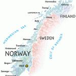
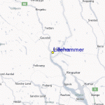
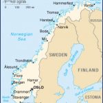
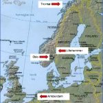
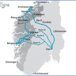
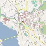
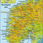
Lillehammer, main town in the county of Oppland, is located on Lake Mjosa, at the S end of the Gudbrandsdal, and is divided by the River Mesna. It is one of the best known vacation resorts in Norway, attracting large numbers of visitors not only in summer but in winter, too (excellent skiing; lifts, illuminated ski trails).
View of Lillehammer SIGHTS. The principal sight of Lillehammer is the Maihaugen Open-Air Museum on the SE outskirts ofthe town, which contains the Sandvig Collection of more than 100 old buildings. The museum was founded in 1 887 by a local dentist, Anders Sandvig (1862-1950). All the buildings have been re-erected in their original form and furnished with old domestic equipment and implements. The collection illustrates the development of dwelling-houses and also includes entire farmhouses from the heyday of peasant culture (1 8th c.). In addition, various craft workshops are housed in a large separate building. The oldest building in the collection is the stave church from Garmo. Another notable item is the Peer Gynt Hut (Peer Gynts Stue), a dwelling of about 1700, said to have been the home of the prototype of Ibsen’s hero. In the market square of Lillehammer (Stortorget) is the Municipal Art Gallery (Malerisamling), with pictures by Norwegian artists, and nearby a statue of Sigrid Undset, the
Mesnasjo on the left. Beyond Mesnalien (520 m 1705 ft), the road turns N and continues climbing, passing the Sjusjo (795 m 2610 ft) on the right and coming soon afterwards to the holiday village complex of Sjusjoen (830 m 2725 ft), with hotels’ and numerous huts and summer chalets. Beyond this point, the road is narrow but still easily negotiable. Then in another 6 km (4 miles) take a road on the left which runs along the S side of the Mellsjo (893 m 2930 ft) and joins a road coming from Lillehammer. Along this road, to the left, is Nordsetter (786 m 2580 ft), another holiday complex, from which it is a H hours’ climb to the summit of the Neverfjell (1086 m (3563 ft): fine views). From Nordsetter, the road run? down through wooded country to Lillehammer.
Up the Gausdal. Leave Lillehammer on a road which runs SW and crosses the narrow N end of Lake Mjosa on a long bridge; then turn right into Road 253 along the W side of the lake, passing Jerstadmoent and the airport on the left. At the church (1724) in Faberg turn left into Road 255, which runs up the Gausdal, the valley of the Gausa; there is another attractive road running parallel on the hillside to the E. At Follebu (alt. 31 0 m 101 5 ft) a road goes off on the right (2 km 1 miles) to an old stone church on the hillside (422 m 1 385 ft). 1 km (f mile) beyond Follebu, on the right, is Aulestad, a handsome house once occupied by the dramatist Bjornstjerne Bjornson (1832-1910), with souvenirs of the writer. From Segastad Bru Road 255 bears left up the valley, which grows steadily narrower, to Vestre Gausdal where we find a church of 1784. From here Road 254, to the right, continues up the 0stre Gausdal. On to Svingvoll (alt. 480 m 1575 ft), from which it is possible either to bear left for the ”Peer Gynt Road (115) or to turn right via Tretten into the Gudbrandsdal.
Lillehammer Norway Map Photo Gallery
Maybe You Like Them Too
- The Best Cities To Visit in The World
- World’s 10 Best Places To Visit
- Coolest Countries in the World to Visit
- Travel to Santorini, Greece
- Map of Barbados – Holiday in Barbados

