Bear Paw National Battlefield (32 miles round-trip) In the Land of the 10,000 Haystacks chapter you read about Chief Joseph and the valiant march of 800 Nez Perce as they tried to escape the U.S. Cavalry in 1877. Here, on grassy shoulders above willowy Snake Creek and in the shadows of the Bear’s Paw Mountains, is where Joseph, uttering his famous I Will Fight No More Forever speech, surrendered to Generals Nelson A. Miles and Oliver O. Howard on a frigid October day after a 1,710-mile journey spanning four months and four states.
A 1-mile interpretive trail offers a haunting look at the events that signified the end of the Indian wars, in this case 40 miles from freedom in Canada. Engraved inch-high metal posts mark the sites of teepees, including Chief Joseph’s, and show where the warriors Ollokot and Looking Glass fell to cavalry bullets. But the best way to fully appreciate the scene is to stop first at the Blaine County Museum in Chinook. Pick up a brochure and watch 40 Miles From Freedom before venturing 16 miles south on MT 240 through pastoral countryside with the Bear’s Paw Mountains rising in the near distance.
Bear Paw is one of three Nez Perce National Historic Parks and the end of the 1,310-mile Nez Perce National Historic Trail, which begins in Joseph, Oregon. Guided tours by rangers are available.
Here are the goose-bump-raising words of perhaps the most famous Indian speech ever given: Tell General Howard I know his heart. What he told me before I have in my heart. I am tired of fighting. Our chiefs are killed. Looking Glass is dead. Tu-hul-hul-sote is dead. The old men are all dead. It is the young men who say yes or no. He who led the young men (Ollokot) is dead. It is cold and we have no blankets. The little children are freezing to death. My people, some of them, have run away to the hills, and have no blankets, no food; no one knows where they are perhaps freezing to death. I want to have time to look for my children and see how many of them I can find. Maybe I shall find them among the dead. Hear me, my chiefs. I am tired; my heart is sick and sad. From where the sun now stands I will fight no more forever.
The drive has earned a Backcountry Byway designation in part because of its historical significance: Lewis and Clark camped here in 1805 and dubbed it The Deserts of America. The
Nez Perce came through on their unsuccessful flight to Canada in 1877. Appreciation of a stark natural world is a must. There are no services along the route except at Winifred, a bright agricultural town with an extraordinary little museum
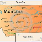
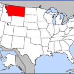
STATE MAP OF MONTANA USA Photo Gallery
Maybe You Like Them Too
- The Best Cities To Visit in The World
- World’s 10 Best Places To Visit
- Coolest Countries in the World to Visit
- Travel to Santorini, Greece
- Map of Barbados – Holiday in Barbados

