Puente Sarela Sarela de Abaixo
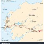
From the Carballeira San Lourenzo follow the arrows that take you down a steep concrete road (adjoining the wall of the Convento de San Lorenzo de Trasouto /(entrance is off the main road past the Sanatorio /Clinica San Lourenzc to a stone bridge over the rio Sarela [500m] Veer Left over the river onto ; rough earthen path behind the derelic mill. Cross a small stream [200m] and climb through mixed woodland and a narrow walled laneway for [500m where the path rejoins a quiet road at:
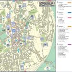
Santiago de Compostela Map World Atlas Photo Gallery
1.2 km SARELA DE ABAIXO Here you have a last look back to the spire, of the Cathedral and the city of Santiago. Turn Left past the row of new house and turn off Right [200m] (just past house No. 53). Continue through thi Eucalyptus forest on a rough walled lane to the top of a rise [500m]. At thi point beware old (faded) way marks that might direct you left (south) back t(‘ the main road. The path now descends through Eucalyptus for [900m] to rejoin road then [300m] to cross rio Fontecova, veering Left and then Right up ontc dirt track for [800m] into the hamlet of:
2.7 km j CARBALLAL Turn Left down along the road for 400m] and just beyond bridge and font turn up Right by orchard (ignore arrows pointing straigli on into the hamlet of Pineiro) into woodland following paths and track for [950m turn Right onto road for [250m] and Left back onto path, crossing road Lef and immediately Right by bus shelter down into and through Quintans [700m Proceed for [600m] veering Right (below football pitch) to:
2.9 km PUENTE (REGO DO ROXOS) Picnic site adjoining bridge over th river Roxos. The road takes you to Portela [600m] where the path then turn Right into woodland for [700m] to emerge onto the road again at:
2.8 km j AGUAPESADA Small hamlet with well preserved medieval footbridge.
Maybe You Like Them Too
- Top 10 Islands You Can Buy
- Top 10 Underrated Asian Cities 2023
- Top 10 Reasons Upsizing Will Be a Huge Travel Trend
- Top 10 Scuba Diving Destinations
- World’s 10 Best Places To Visit

