Avakas gorge
b) Akamas Region.
There are many versions concerning the etymology of Akamas, the most prevalent of which is that of Akamas, the son of Theseus, who arrived in Cyprus after the Trojan war and founded Akamantis, a town in the Akamas region, still unearthed. The true Akamas is the Forest of Akamas in the extreme northwestern part of Pafos. Sometimes, erroneously, the term “Broader Akamas” is used, comprising Laona, part of the northern coastal plain of Pafos, part of the western coastal plain of Chrysochou and often part of the valley of Chrysochou. Akamas can be approached from three different directions: (1) from Agios Georgios Pegeias, along the extreme western, earthen, coastal road, (2) from the Baths of Aphrodite, along the extreme eastern, earthen, coastal road, and (3) from Neo Chorio, via Smigies.
Rocky coastal cliff east of Akamas
1. Following the western road from Agios Georgios (Pegeia).
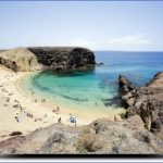
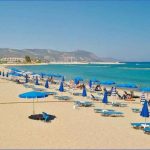
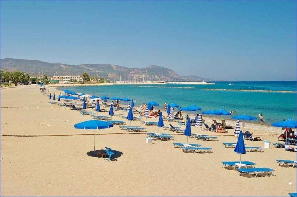
Following this route, the visitor encounters a large finegrained sandy beach, called Toxeftra or Agios Theodoros, east of which a track leads to the mouth of Avakas gorge. The gorge has already been described. (see Laona villages). From the restaurant on top of a marine terrace, an extensive and panoramic view of the area can be obtained. Along the coast the calcarenite or sandy limestone, under the influence of sea water, has obtained many shapes, including caves, sharp promontories, little bays and many other sculptured phenomena. Flora along the route consists of lentisk, asphodels, juniper, gorse, thyme and further northwards rockrose, wild carob, olive trees as well as strawberry trees. The earthen road leads to another noticeable beach, that of Lara, surrounded by the same type of vegetation and fringed by private properties. The sandy beach, under good weather, is recommended for swimming. With its semi-circular shape, it extends to about 1,5km. A restaurant, south-west of the beach, lying on a terrace, functions during the summer months. North of the beach on an elevated limestone outcrop, well-known as “Aliki Laras” (salty lake of Lara), sea water has created a number of hollows, caves, sharp surfaces, even holes from where you can look at the sea water underneath. In the small hollows salt is formed after the winter sea water is evaporated. In the past, villagers from nearby settlements collected salt from this area. Even the ruined custom house can be seen. Huge blocks of stone, arrayed in a line can be traced in the area. It constituted a fortification wall, dating back to the Mycenean times. North of the limestone surface, which as it protrudes into the sea appears like a tiny peninsula, lies another beach fringed by sandy dunes, known as Ammoudi. It has a horse-shoe shape with two edges ending up in small cliffs. The beach has a length of about 400m and a width of 30m. The sand dunes reach the height of about 10m supported by lentisks of an umbrella-shape. Amphorae on the bottom of the sea, south of Ammoudi, most probably testify to the site of an ancient shipwreck. What, however, impresses on the beach is the Turtle Hatchery, established in 1978. Turtles coming from the west, arrive at this isolated beach to lay their eggs, mainly in August-September, before they carry on their journey. At the same time turtle eggs from other beaches of Cyprus are transported here to be hatched under safe conditions. The makeshift hatchery functions only during the summer months.
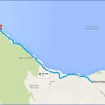
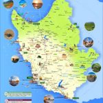
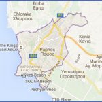
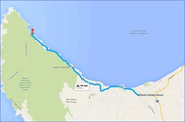
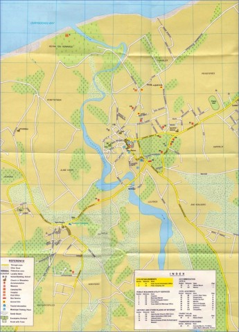
Map of the of Aphrodite Beach Hotel Area, Polis, Cyprus
Sand dunes fringing Ammoudi beach
Until recently, as shown on a map of 1962 by French historian and geographer Mas Latrie, Lara was a tiny settlement. In the private scattered plots of land the traveller can discern makeshift stone-built dwellings, known as “stiadia”, used by farmers in winter time. Further north of Lara the traveller sees a few huge blocks or rocks in the sea, known as Karavopetres (ship rocks), where, according to tradition, Saracens, the well-known pirates of the Middle Ages, moored their boats before looting, burning and destroying chapels, monasteries and households. Another locality with sculptured caves, appearing as tiny cells on the limestone, known as “Erimites” (Hermits dwellings), most probably has much to say, particularly after some research. As you follow the route northwards, a chain of isles appear on the west, like Geranisos, Kioni isle, Koppos isle and Kannoudia isle. The route ends up at Kioni, since from this point the training grounds of the British Forces do not permit further penetration into the Akamas promontory. A black marble column in the sea, is most probably a testimony of some cultural phenomenon, not yet explored. Some people place the outport of ancient Akamantis at this point, where in the summer months a fishing shelter functions. A few kilometres east of Kioni, lies the chapel of Agios Konon where the church and other traces of an ancient settlement abound.
2. Following the eastern coastal road from the Baths of Aphrodite.
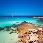
The road from Polis comes to an end at the Baths of Aphrodite. The tourist pavillion close by, built on a rather steep cliff, serves food, particularly fresh fish, while a number of steps lead the traveller to a very calm sea with crystal clear waters. Though not an extensive sandy beach, quite a few people do swim in the clear waters. The coastline is rocky with a lush vegetation reaching to the sea. A path leads from the pavillion to the Baths of Aphrodite amid dense vegetation. At the base of the limestone, on the fissures of the rock grow fig-trees with their broadleaved branches, giving abundant shadow. Green mosses colour the rock adding to the beauty of the environment. The water drops from “a thousand silver threads to the pool below”. The semi-circular pool has a depth of about half a metre and a perimeter of about five metres. According to tradition, if one bathes in the pool, eternal youth will be bestowed upon him. At least one can wash his hands or his face with the divine waters of Venus. However, it is forbidden to enter the pool for swimming. From the Baths of Aphrodite a narrow, winding, earthen road-not recommended to everybody unless a special car is used-following the coastline, amid a fascinating and unique in pictures landscape, leads the visitor to the Tower of Rigaina. Whether the Tower of Rigaina (Queen) was a monastery or a manor house has not yet been clarified. Historian I.K. Peristianis mentions the frescoes on the walls which have been worn out. Recent archaeological excavations have been carried out and the site is currently protected. It is now believed that the building was probably a monastery. On the right, a few hundred metres, one can look at the tiny isle of Agios Georgios emerging above sea water. The locality of Agios Nikolaos, south-east of Fontana Amorosa is an interesting coastal strip of land with broken pottery which probably testifies to an old settlement. Frescoes are still present on the ruined church of Agios Nikolaos, lying next to ponds and ruined buildings. Quarrying is evident on the coastland with a unique landform appearing like an open-air theatre. Quarrying is evident also on the tiny isle of Chamili, close to Fontana Amorosa. Fontana Amorosa is a beautiful area and the refuge, in recent historical times, of ships which either sought protection in the cove or a supply of fresh water. Currently, it is an ideal place for swimming. Tradition has Aphrodite taking her baths in this place. The Italian poet L. Ariosto describes the place with some lovely verses: “Nowhere else in the world have I seen women and virgins so lovely and attractiveThe water of the well lies a few metres below the surface, though during historical times the water table might have been higher and closer to the surface. If the visitor continues his journey northwards a broken ship will be encountered, stationed for decades in a cove.
Quarrying, a few centuries ago, gave rise to the “theatre” in the heart of Akamas
3. Following the Middle Road from Agios Minas to the Central Areas. West of Neo Chorio is the arched chapel of Agios Minas with some mural paintings and a recently restored fountain. Close by are the foundations of a larger church which most probably served a large crowd of people. The route takes the visitor to Smigies, close to the ruined buildings of a forest station, functioning until a few decades ago. Smigies, with its cool water, the wooden tables and seats as well as all other amenities is a picnic site, particularly for summer excursionists. In the localities of Santalies, Stavropigi, Skoteini, Pissouros and Smigies, which are all close to each other, the traveller comes across the most wonderful myths concerning Digenis and Rigaina (Queen). At Santalies their little game was interrupted because they lost each other. Suddenly they came across each other at Stavropigi, because of the existence of a spring there. Somewhere else, because of darkness, Digenis could not find the Queen and so the place was called Skoteini. On another hill, the Queen surprised Digenis, passing as a shadow next to him, but he could not catch her because it was dark as Pissouri. From that time the hill was called Pissouros. Nevertheless they were reunited and embraced at Smigies. Not far away from Smigies and before one approaches Mavri Shinia, there are the foundations of the church of Agia Paraskevi. In its present condition it has nothing to exhibit. Following a northern direction one comes across the locality of Magnisia, where in the past magnesia was quarried and exported. The ruined buildings and all other disused equipment are still there. Close by is the locality of Kefalovrysia with dense pine-trees. It is worth mentioning that at another locality of Akamas black earth was quarried for export in past decades. However, the travel could end at Vouni tis Sotiras, close to the eastern coastline. The view from Sotira is extensive and unique. Pictures of unconceivable beauty and of rare colours unfold before your eyes.
Staring at the picturesque coastline of Akamas
Nature Trails in Akamas.There are three nature trails in Akamas for those who prefer walking. Aphrodite trail starts from the Baths of Aphrodite to the Tower of Rigaina and back along the coast, while Adonis Trail starts again from the Baths of Aphrodite to the Tower of Rigaina and back to the main road Polis-Baths via a southern route. The walk time for each trail varies from 2 to 4 hours. The third trail, called Smigies, starts from the picnic site of Smigies and ends up at the starting point. It includes two routes, one of 2,5km and a longer of 5km. Along the trails, which are self-guided, there is a number of wooden signs which refer to points of interest. There are also keys for the names of trees and shrubs encountered on the way.
EXPLORING PAFOS DISTRICT THROUGH THE VALLEYS
a) Along the Chapotami valley
Route: Archimandrita, Maronas, Mousere
The route from Kouklia to Archimandrita is very picturesque, passing through a dissected landscape with a rich natural vegetation. At Orites forest there is an experimental station for goats and sheep operating since the 1950’s. Archimandrita has a rare place of interest, the Tomb of the 318 Holy Fathers. In a cave, close to the settlement, probably an original Roman tomb, converted later to a chapel and painted, 318 Holy Fathers were buried. Nowdays, the visitor can only see the fresco of Agios Onoufrios. According to tradition, 318 Holy Fathers, persecuted from Syria, arrived at Pissouri and with the company of an archimandrite walked to Archimandrita. At the village they were killed by the pagans and their sculls and bones were buried in the cave, known today as the Tomb of the 318 Holy Fathers. Maronas. On the top of a hill, east of Agios Georgios, lies the isolated and deserted village of Maronas. Mousere is currently almost deserted. Some parts of cobbled streets witness old road communication links with Pafos and Limassol.
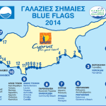
Polis Chrysochous Beach Map Photo Gallery
b) Travelling along the Diarizos valley
Route: Nikokleia, Souskiou, Fasoula, Mamonia, Agios Georgios, Trachypedoula, Prastio, Kidasi, Kedares, Filousa, Praitori, Agios Nikolaos, Medieval Bridges, Pera Vasa.
The valley of Diarizos is currently followed by many travellers from Pafos to Platres/Troodos, as it is the shortest and most picturesque route. Nikokleia. The closest significant place of interest is no doubt the Asprokremmos dam, with its height of 80m and its capacity of 51 million cubic metres of water. The lake, particularly its branches, create a fascinating spectacle, aesthetically attractive to the eye, particularly as it lies amid a dry, rainless landscape. A restaurant, housed in a spacious, traditional building of the village serves the travellers along the Diarizos valley. Souskiou, currently a deserted settlement, lies on the right bank of
Diarizos. The archaeological site and the Chalcolithic findings are of immense importance. In a cemetery, close to the settlement, bottleshaped tombs hewn from the rock and narrowing towards the top, have been unearthed. Small steatite figurines, several tiny cruciform figures used as pendants, necklaces, stone bowls and composite vases placed as tomb gifts to accompany the dead, were found. A copper spiral discovered at Souskiou, testifies the use of copper at the beginning of the 4th millenium B.C. Excavations at Souskiou resumed in 2001 by the University of Edinburgh. Fasoula is situated on the left bank of Diarizos river with its minaret constituting the most conspicuous feature of the settlement. The most impressive feature in Fasoula’s landscape is the surface channel along the river bed which carries water to southern regions. Mamonia, a very old settlement, is known for the large chiftlik of about 385 ha, initially a royal estate during the Lusignan-Venetian period. The village is also known for its Hasamboulia, who terrorized Cyprus in 1890. The criminal activity of the three Turkish brothers around 1894-5, before being arrested by the police, was particularly intense. Agios Georgios. The village, prior to 1571, was Greek, as testified by its name and the ruined church of Agios Georgios. Trachypedoula. On a gentle slope, facing the valley of Diarizos, lies Trachypedoula, which most probably owes its name to the rough and infertile landscape with the rocks of the Mamonia Complex projecting above the ground. Trachypedoula is rich in traditional architecture with stone-built, two-storeyed houses and tall walls around the dwelling. The rural character of the settlement is almost intact. Prastio, a Turkish Cypriot settlement, is abandoned since 1964. The church of Archangelos Gavriil, a building of the 15th century, is currently deserted, while on a projecting rock outcrop, close to the main road, stands the church of Profitis Ilias. Moreover, the historic monastery of Agios Savvas of Karonos, on the right side of Diarizos valley, is currently deserted. The monastery was most probably set up in 1120 A.D but was burned in 1467. An inscription over the west door informs us that the church was rebuilt in 1501 and restored in 1724. Kidasi. An old watermill, a few centuries-old oak-trees and a natural spring by the main road are the remnants of the original settlement. A coffee-shop has been established under the oak-tree which attracts passers-by during the summer months. Kedares. It is a vine-producing village known for its zivania (local alcohol drink) and its wine. Most of the houses, are built in traditional architecture. Cypriot archaeologist P.Dikaios, identified traces of neolithic settlement. The village initially was built at a different site. What survived from the old settlement is the place-name “Palio Chorio” (old village) as well as the original spring. Most probably the present restored church of Agios Antonios, next to the main road, belonged to the old settlement. However, I.Tsiknopoullos cites that Agios Antonios was the church of a disbanded monastery, dating back to the 17th century. Filousa, like the neighbouring settlements, is a wine-producing village. The tunnel that will divert the waters of Diarizos to Kouris will start from the administrative boundaries of Filousa. In the village there are two ancient churches: The church of Agios Nikolaos, steep-pitched and single-aisled, originally a monastery, and the church of Agia Marina, steep-pitched with a low belfry tower. Praitori, depends entirely on the monoculture of vines, particularly of the black variety. Despite depopulation, the few inhabitants continue to prepare zivania (local alcohol) and wine.
Agios Nikolaos
Agios Nikolaos is most probably a Byzantine settlement, while during the Frankish period it was a royal estate. The interesting church of Archangelos Michail was converted into a mosque after the 1571 conquest of Cyprus by the Turks. It was originally a double church serving both Orthodox and Latins. The Latin half was pulled down, though its foundations still exist. In the Orthodox part there remains a vast 16th century painting of Archangelos Michail on the north wall, while some portable icons are currently kept in the Byzantine Museum of Pafos. A large slab of marble lies in the apse, a Byzantine work of the 13th century. A portion of the preserved iconostasis belongs to the 16th century. Within the settlement the minaret with its height dominates the landscape. Medieval Bridges. In the upper portion of the valleys of Diarizos and Xeros, lie three renowned medieval bridges: Elia, Kelefos and Roudia. Elia, lies west of Foini, amid rich natural vegetation. It is built on a tributary of Diarizos. Its width is 2,40m and its arch 5,50m. It can be visited easily from an earthen road close by. Following the earthen road towards Pera Vasa, at the locality Platys, lies Kelefos, the second medieval bridge. Its width is 2,50m while its arch is 10,70m. Water flows all the year round while the natural vegetation is very dense. It is worthwhile taking a rest by the bridge, listening to the sweet nightingale and the murmuring of the flowing water, while enjoying the cool breeze, particularly in the summer months. West of Pera Vasa, on the Xeros river lies Roudia, the third bridge. The earthen road leading to Roudia is narrow, winding and isolated. The Roudia bridge, under the shadow of gigantic forest trees, is 2,80m wide while its arch is 10m. It was restored in 1975-76. Roudia, like the other two bridges, belongs to the 16th or 17th century. All of them were used by animal-driven carts, since cars made their appearance only at the beginning of the twentieth century. Pera Vasa. The visitor to the medieval bridges of Pafos, inevitably passes through Pera Vasa, a deserted settlement, where the largest pine tree of Cyprus once stood.
Kelefos bridge
c) Exploring on the ridge between Xeros and Diarizos valleys.
Route: Choletria, Stavrokonnou, Kelokedara, Salamiou, Malounta,
Maybe You Like Them Too
- Top 10 Islands You Can Buy
- Top 10 Underrated Asian Cities 2023
- Top 10 Reasons Upsizing Will Be a Huge Travel Trend
- Top 10 Scuba Diving Destinations
- World’s 10 Best Places To Visit

