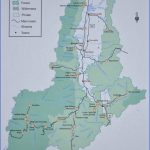
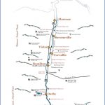
ESTIMATED LENGTH: 95 miles highlights: Historical Museum at Fort Missoula, Elk Country Visitor Center, Lee Metcalf National Wildlife Refuge, St. Mary’s Mission, Fort Owen, Lake Como, Lost Trail Pass, Lost Trail Hot Springs Resort, Lost Trail Powder Mountain
Getting there: Leave I-90 either on US 12 in downtown Missoula (Exit 105) or US 93 (Exit 101, Reserve Street) and head south along the Bitterroot River.
Long before outsiders discovered the aesthetic wonders of the Flathead and Whitefish, the Bitterroot
Valley became synonymous with the Montana mystique. Though Missoula author William Kittredge’s famous Last Best Place description was actually coined in a trailer house in the Paradise Valley south of Livingston, he drew much of his inspiration from the Bitterroot.
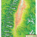
The Bitterroot is an exceptionally pretty north-south valley known for its moderate climate, prolific trout fishing, and high quality of life. One old timber town after another Missoula, Lolo, Florence, Stevensville, Victor, Hamilton, Darby, and Conner has become a bastion of 20-acre ranchettes and a jumping-off point for outdoor adventures in the wild Bitterroot Mountains.
At the north end of this route is progressive Missoula (pop. 69,122). Fueling the town’s energy is the University of Montana, which has churned out enough conservation activists to rival any East or West Coast university. The atmosphere is like Berkeley and Madison, but with hiking boots, skis, and fly rods. Missoula still has a raw side reminiscent of the town’s old Front Street honky-tonks, an image that only adds to an intrigue that has been tempered by the relatively recent arrival of strip malls, big box stores, and traffic.
Missoula has enough diversions to fill several days, but if time is short be sure to hike the switchback Mount M Sentinel Trail to the M above the university. The Rocky Mountain Elk Foundation’s 22-acre Elk Country Visitor Center features terrific dioramas of elk in their natural environment and an outdoor hiking trail. The organization is largely responsible for restoring elk populations depleted by wanton hunting at the turn of the previous century. For an interesting look at Missoula’s frontier legacy, the Historical Museum at Fort Missoula on the southwest edge of town looks at the area’s military history, including exhibits about the Buffalo Soldiers bicycle corps a group of black men who pedaled from Missoula to St. Louis, Missouri, as part of a U.S. Army experiment to see if bicycles could replace horses as the cavalry’s primary mode of transportation.
Nine miles south of Missoula, after US 93/12 slips through a neck between the Bitterroot and Sapphire mountains, US 12 splits to the west at Lolo (pop. 3,892) and begins a 31-mile ascent to Lolo Pass and Idaho. This was Lewis and Clark’s most famous crossing of the Rockies.
US 93 follows the Bitterroot past a series of river access points and through a procession of inviting communities, starting with the one-time sawmill town of Florence (pop. 765) formerly called One Horse, for the creek that arrives in town from the flanks of the Bitterroots. Between Florence and Stevensville is the Lee Metcalf National Wildlife Refuge, named after a Montana senator from the Bitterroot who would become one of the state’s great conservation champions. The watery refuge, created in 1963 as a safe stopover for migratory birds, has more than 2 miles of hiking trails and a gravel road that offers excellent waterfowl viewing.
Stevensville (pop. 1,881) was actually Montana’s first Anglo community, begun as St. Mary’s Mission in 1841 by the Jesuit priest Pierre DeSmet. The mission chapel has been restored and is a museum that features furniture belonging to the pioneering priest Anthony Ravalli, who built it. Nine years after DeSmet’s arrival, Major John Owen built the trading and military post on the site he would call Fort Owen. The state’s first gristmill, sawmill, and school for settlers were here. What remains is a barracks housing artifacts from Owen’s day, plus some reconstructed buildings.
Next up on the road south is Victor (pop. 745), once a silver mining community. Named after a Flathead chief, Victor was the site of the lucrative Curlew Mine. The area’s mining, timber, and railroad history is captured well in the Victor Heritage Museum, located in the old Northern Pacific depot.
South of Victor is Hamilton (pop. 4,556), after which the valley begins to narrow and takes on more of the characteristics of the old Montana. Ranchettes and subdivisions, though creeping south, give way to a rural and ranching persona. Just past Como Bridge, Lake Como Road follows Little Rock Creek for about 3 miles to Lake Como, which was raised for irrigation purposes to be a full-fledged reservoir and features a Forest Service campground with 10 RV sites. This is the only handicapped-accessible equestrian campground in the western United States, revealing the popularity of pack trips into the Selway-Bitterroot Wilderness Area straddling the Montana-Idaho border.
Three miles south of Como Bridge is resilient Darby (pop. 726). Three times Main Street burned, and three times the town bounced back. Darby has ridden an economic rollercoaster: first fur trading, then mining, timber, apples, and ranching. As each has waned, tourism and the accompanying shops have become staples, and Darby is a popular base for pack trips and whitewater excursions into the Selway-Bitterroot. It also has another distinction: The all-inclusive and luxurious Triple Creek
Ranch resort (with cabins starting at $1,400 per night!) was chosen as the Number 1 hotel in the world in 2015 by Business Insider, ranked third-best in the world by Travel + Leisure, and earned fifth place in Conde Nast Traveler’s 2014 Readers Choice Award.
Continuing south, the east and west forks of the Bitterroot join just north of the little logging wayside of Conner (pop. 250), which has three restaurants and a small motel. After Conner, US 93 begins its ascent along the East Fork Bitterroot River through woodsy Sula (pop. 37) toward Lost Trail Pass on the Montana-Idaho border. Four miles east of Sula on the East Fork Road is the Broad Axe Lodge & Restaurant, which features two rustic cabins and fine dining and is designated by the state as a wildlife-viewing area for its prolific number of critters. Back on US 93, the Lost Trail Hot Springs Resort at Sula has cabins, two lodges, and an RV park and is a great place to soak in the natural waters of the hot tub or swimming pool after a day on the runs at Lost Trail Powder Mountain ski area, a family-oriented operation open Thursday through Sunday from December until April.
Bitterroot Valley Map Photo Gallery
Maybe You Like Them Too
- The Best Cities To Visit in The World
- World’s 10 Best Places To Visit
- Coolest Countries in the World to Visit
- Travel to Santorini, Greece
- Map of Barbados – Holiday in Barbados

