Black Nugget Lake Map Edmonton
Location: 49117 Range Road 182. From Tofield, take Hwy 14 east approximately 11 km, then turn south onto Range Road 182 and drive 12 km.
Info: Concession at campground. 780-663-2421.
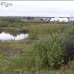
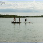
A former coal mine fed from an underwater spring, Black Nugget Lake is a small body of water with extensive shoreline, due to its undulating shape. A favourite of birdwatchers, day-use visitors can enjoy trout fishing, canoeing, kayaking, and electric motor boating. A playground, horseshoe pits, boat launch, concession, and picnic shelter are available.
The Royal Astronomical Society of Canada (RASC) uses the site for observing the night sky and hosts the annual Northern Prairie Star Party in September. Visit edmontonrasc.com for details on public access.
Ryley Museum.
Location: 5103-49 Street, Ryley. From Tofield, take Hwy 14 (854) west to Ryley. Turn left
into town, turn right onto 50th Avenue and take the first left onto 50th Street.
Info: Open July and August, usually Tuesday to Saturday, 9:00 a.m. to 5:00 p.m., as well as during local events and by appointment. Donations are appreciated. 780-663-3752; 780663-2372.
The Ryley Museum is home to a variety of day-to-day pioneer artifacts, including antique lamps, kitchen items, toys, school memorabilia, clothing, furniture, and a large collection of dolls. The main building contains articles from the Rebekah Lodge (a service organization); uniforms, photos, and other memorabilia from the Legion Ladies’ Auxiliary; and a doctor bag and graduation photograph from local physician Dr. MacPherson. Read the histories of local families displayed inside or venture to the shed to view a threshing machine, binder, seed drill, cultivator, fanning mills, 1941 Ryley fire truck, steamer, and hay rack. Outdoors you will find a windmill and log cabin
Black Nugget Lake Map Edmonton Photo Gallery
Maybe You Like Them Too
- Explore Doncaster, United Kingdom with this detailed map
- Explore Arroyito, Argentina with this Detailed Map
- Explore Belin, Romania with this detailed map
- Explore Almudévar, Spain with this detailed map
- Explore Aguarón, Spain with this detailed map

