BOYLE
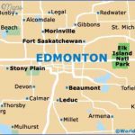
Directions: Exit Edmonton on Hwy 28A east; turn left at Hwy 831.
Distance: 149 km, or about 1 hour and 56 minutes, from Edmonton.
Info: 780-689-3643; www.boylealberta.com.
The village of Boyle was named to commemorate a man who gave much of his life to public service. John Robert Boyle wanted to become a lawyer but could not afford to further his education. He taught school until he had saved up enough to return to his studies and was admitted to the bar in 1899. Boyle went on to become Alberta’s minister of education in 1913 and a member of Canada’s Supreme Court in 1924. He held the latter position until his death in 1936. His name also marks Edmonton’s Boyle Street neighbourhood.
Home to more than 900 people, the village of Boyle is close to numerous outdoor recreation sites, including nearby Long Lake Provincial Park, Skeleton Lake, and North Buck Lake. Flat Lake is popular for birding, and Hope Lake for picking blueberries. Hope Lake Campground, 20 kilometres northeast of Boyle, off Highway 63, has a nice sandy beach, as well as a playground, boat launch, and private boat rentals. There is a 12-kilometre-per-hour boat speed limit, and a $4 day-use fee per vehicle. The annual Boyle Rodeo is held in July.
JOAN MARIE GALAT
The wild rose became Alberta’s floral emblem in 1930. It blooms from late May to early August.
Long Lake Provincial Park
Location: 20 km south of Boyle on Hwy 831, and then 2 km northeast on the paved access road.
Info: Athabasca District Park Office: 780-675-8213; 1-800-427-3582.
Long Lake Provincial Park is part of a scenic glacial meltwater channel, covered with mixed-wood boreal forest. This long, winding lake and popular park is a great place to launch a canoe or kayak, swim, watch wildlife, or play beach volleyball. Visitors come to picnic, fish, hike, cycle, use powerboats, water-ski, sail, and windsurf. You will find paved and gravel hiking trails, a boat ramp, hand launch, change rooms, fish-cleaning stations, a pier, pit and flush toilets, picnic shelters with and without stoves, a concession, and a grocery store. Winter visitors can ice-fish and use the 4.5-kilometre shoreline trail and unplowed roadways for cross-country skiing. A warm-up shelter is available.
White Earth Valley Natural Area
Location: North access through Long Lake Provincial Park, 20 km south of Boyle on Hwy 831, and then 2 km northeast on the paved access road. South access is approximately 32 km south of Boyle on Hwy 831. Travel east on Township Road 620 for approximately 3 km and follow north onto Range Road 192. After 1.5 km, turn east onto Township Road 621. Watch for the dip in the road where it crosses White Earth Creek. Gate and access are on top of the hill, on the north side of the road past the creek.
Info: In the summer, ask for a trail map at the entrance booth. No full-sized vehicle access. Long Lake Provincial Park: 780-576-3959 (May to September); Athabasca District Parks Office: 780-675-8213.
The White Earth Valley Natural Area contains diverse habitats, from marshes and lakes to lowlands, hills, and meadows. Many species frequent the area’s 2,055 hectares, including beaver, muskrat, mink, moose, mule and white-tailed deer, wolves, coyotes, and other mammals. Blueberries, cranberries, raspberries, and saskatoons attract black bears. Summertime visitors will appreciate the plentiful wildflowers. Multi-use trails accommodate hiking, mountain biking, trail riding, snowmobiling, and Nordic skiing.
Boyle Edmonton Map Photo Gallery
Maybe You Like Them Too
- The Best Cities To Visit in The World
- World’s 10 Best Places To Visit
- Coolest Countries in the World to Visit
- Travel to Santorini, Greece
- Map of Barbados – Holiday in Barbados

