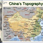
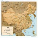
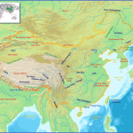
For a country which extends over 60 lines of longitude and 25 lines of Characteristics latitude, all the geographical features typical of Asia can be found within its borders. The diverse and changing landscape exhibits many complex relief formations. The densely populated heartlands of the Pacific coastal plain and river basins, the agricultural settlements and industrial conurbations stand in stark contrast to the thinly populated, desolate semi-desert of outlying central Asia with its barren plateaux and steep high-mountain ranges. One third of China, a country sometimes described as the “Land of Mountains”, consists of high-mountain ranges and high-surface plateaux, while one tenth comprises lower ranges and hilly lowlands. About 15% of the country is basin landscape and 10% is given over to intensively farmed lowland. This unfavourable topography goes some way towards explaining why only one eighth of the total surface area can be used for agricultural purposes.
The geology of East and Central Asia is determined by a complex Geology structure of what are, in relation to the history of the earth, relatively stable, consolidated massifs. Around and between these Archaean mountain ranges, more recent evidence of earth movements can be found, demonstrating at the same time the continent’s “growth ring”.
The Sino-Siberian land mass represents the most important element in the geology of the Palaeozoic northern continent of Laurasia. This central region of the Eurasian plate is characterised by a mosaic of mountain ranges, composed of plates of varying degrees of rigidity, which during the various phases of mountain building gradually merged together. Only in recent times, in the course of Alpine-
Himalayan fold movements, has the fault-block mountain range emerged. The craton of the east Siberian tableland (Angaria), which from the Pre-Cambrian Era has moved westward towards Europe linking with the east European platform (Fennosarmatia), came to form the heart of the Asian mainland and has subsequently been joined by further relatively stable plates, such as the Dsungarian, Tarim, Sinian (north Chinese/Korean), Tibetan and Vietnamese platform as well as the south Chinese and Indian plates. A huge belt of fold mountains serves as a dividing line and seam for these consolidated Pre-Cambrian primary rocks and the continental tables with their overlying rocks.
In East Asia there is evidence of four periods of tectonic activity, which have since the Pre-Cambrian repeatedly contributed to the upheavals. Between the Baikalic and the Sinian phase (the Assyntic Era), the Sayan Mountains and the mountains surrounding Lake Baikal of Angaria were raised, as well as the north Chinese platform in typical “Chinese strikes”.
During the Palaeozoic in the several mountain formation phases of the Caledonian and Variscan Era, the Altaj massif and Kazakh rift were formed and in the Upper Palaeozoic Era the Pamirs, Kunlunshan, Nanshan, Quinlinshan and Tianshan were raised.
The two most recent phases, namely the Indo-Sinian (in the Upper Triassic Period) and the Yenshan orogeny, which is peculiar to China (between the Jurassic and Cretaceous periods), can be classified as Mesozoic (Cimmerian) forerunners of the modern Alpine-Himalayan era.
Even though a continuing consolidation of the Asiatic plate was identified in the Late Permian and Early Triassic, the force of the repeated movements was so great that massifs which were already consolidated and eroded broke up into separate mountain blocks.
Such relatively weak zones where continental mass breaks up are typical of East Asia and at every time of stress they were drawn into the cycle of emergence and peneplanation – a phenomenon known as “paraplatforms”. Today’s relief map of East and Central Asia is a result of these geological changes and the tectonic movements of relatively recent times.
With the impact of the Arabic-lranian and Indian blocks (which had drifted away from Gondwana-land) against the Angarian buffer, to the south of the Eurasian plate at the collision point of the continents, a huge system of fold mountains emerged with overfolded nappe structures and considerable contractions in the earth’s crust. The related translatory motion and pressure led to upfaults, wrench and stretching faults in the hinterland and generally to a reactivation of old mountain complexes. The huge upward movements of upthrown crust in the region of the most recently formed belt of fold mountains explains the emergence and formation of the greatest mountain range in the world.
This recent upheaval in the Central Asian mainland massif, linked with German-style fault tectonics, has led to a distinctive terraced land formation. The drop from the Asiatic mainland block to the Pacific Ocean takes place in a series of terraces, which lead down from west to east from the Tibetan Plateau to the Pacific Ocean floor like a giant staircase.
It is generally possible to discern four main terraces, in which the plateaux follow on from one another, falling off gently towards the west, but with the steep faces of the tilt block towards the east. The eastern edge of Tibetan terrace follows the course of the 104th meridian. To the north the high plateau is bordered by the Altunshan and the Nanshan. The Mongolian terrace runs along the Greater Xingan Shan, the Taihangshan and the Hukwang fault, marking the boundary between East and Upper Asia. The Manchurian terrace is formed by the Sikhote Alin Range, the Korean coastal mountains and the arc of the mountains. The boundary with the Mongolian basin is formed by the south Chinese coast. The Japanese terrace corresponds with the drop from the continental mainland to the Pacific plate with its island arcs and deep-sea trenches of the oceanic undercurrent zone.
These steps which as a rule follow a south-west to north-east track are crossed in various places by striking east-west fault lines, so that China’s landscape is often characterised by basins and these can also be used to draw topographical distinctions between the various parts of the country, e.g. North Chinese Highlands, Changjiang lowland basin.
China Topography Photo Gallery
Maybe You Like Them Too
- The Best Cities To Visit in The World
- World’s 10 Best Places To Visit
- Coolest Countries in the World to Visit
- Travel to Santorini, Greece
- Map of Barbados – Holiday in Barbados

