Project Rulison Test Site, Garfield County
On September 10, 1969, the Atomic Energy Commission conducted a 43-kiloton underground atomic bomb test in western Garfield County to see if atomic blasts could be used to increase production of natural gas by ripping apart the subterranean sandstone formations in which gas was trapped. It worked, except the gas was too radioactive to use.
Ever wonder why the term “rocket scientist” instead of “nuclear scientist” is used to describe somebody who is highly intelligent? Perhaps the saga of Project Rulison offers some clues to that mystery.
In the mid-1960s, “Operation Plowshare” was launched to find peaceful uses of atomic weapons. Amazing as it now seems, there were serious proposals to use atomic weapons to excavate large amounts of land for mammoth civilian construction projects such as artificial harbors, irrigation of the Sahara Desert, and a larger replacement for the Panama Canal that would cut across Nicaragua. Only slightly less preposterous was the notion to use underground atomic blasts to free reserves of oil and gas trapped in rock formations.
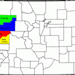
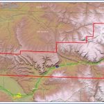
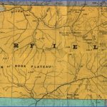
Garfield County Colorado Map Photo Gallery
The test site was approximately 14 miles south of Rifle, Colorado, in Garfield County. There are abundant natural gas reserves trapped in the underground sandstone and shale formations of the county, but most reserves are so tightly “locked” in the formations that commercial exploitation of the reserves is not economically feasible. The theory behind Project Rulison was that an underground atomic explosion could shatter the formations, releasing huge quantities of natural gas that could be recovered at little cost. The test was essentially underwritten by the Austral Oil Company of Houston, TX, which paid the Atomic Energy Commission $6,500,000 to conduct it.
Project Rulison was one of the first atomic tests to attract widespread opposition. Even though the bomb was located over 8,400 feet underground, there were major concerns over radiation leakage and the projected thousand-plus underground explosions in Colorado alone that could follow a successful test. One of the leaders of opposition to the test was Dick Lamm, a future governor of Colorado. Several lawsuits were filed to stop the test and succeeded in delaying it for several months. When the test was finally conducted on September 10, 1969, the nearby town of Rifle was subjected to a shock equivalent to a 5.5 earthquake.
The test was both a success and a failure. It did produce an artificial cavern measuring 350 feet high and 75 feet across and resulted in the release of large quantities of natural gas from the sandstone and shale formations. However, the gas contained so much radioactive material that the necessary decontamination and safety precautions against accidental release of radiation made the extraction of the gas prohibitively expensive. It was instead burned away at the test site.
What’s There: Not much. At the time this book was written, the big attractions are a few warning signs, a fenced-off pond, and a couple of sealed “pits” that mark the locations of the tunnels drilled down to the location of the test.
Getting a Look Inside: Despite the abundant federal land in the area, the test was actually conducted on private land leased from the Hayward family, who had a potato farm on the site in 1969. As a result, you might find access to this site blocked at any time; be sure to respect any “no trespassing” signs or closed roads you might encounter.
Unusual Fact: The Project Rulison site is still administered by the Nevada Test Site and Bechtel Nevada (see NEVADA). They offer for sale a ten-minute VHS tape showing (quoting from their sales literature) “the explosion, underground rock fracturing, gas release, and underground well operations in schematic operation.”
Getting There: The site is located approximately three miles south of the town of Parachute and may be reached from an exit off Interstate 70.
Maybe You Like Them Too
- Explore Góra Kalwaria, Poland with this detailed map
- Explore Gumdag, Turkmenistan with this detailed map
- Explore Telfes im Stubai, Austria with this detailed map
- Explore Langenselbold, Germany with this detailed map
- Explore Krotoszyn, Poland with this detailed map

