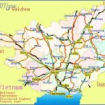
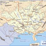
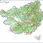
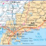
Area: 236,OOOsq.km/91,OOOsq. miles Population: 43,240,000. Capital: Nanning
The autonomous region of Guangxi lies in south China, between 104°29′ and 112°03’E and 20°54′ and 26°23’N.
In addition to the Han population, a large proportion ofthe people living in Guangxi belong to the ethnic minority known as the Zhuang, whose language is similar to that of the Thais. In addition, the Yao, Miao, Dong, Maonan.Hui, Jing, Yi, Shui and Gelao ethnic groups all live here. It was for that reason that in 1958 the central government established the Autonomous Region of Guangxi, one of the five such autonomous regions for national minorities with a status similar to that of a province (the other four being Xinjiang, Inner Mongolia, Tibet and Ningxial.The birth-control regulations which apply to all Han people do not apply to the minorities, with the result that in some cases their rate of population growth clearly exceeds that ofthe Han population.
Some 85% of this region on the upper reaches of the Xijiang river is boldly structured mountainous country of karst stone rising from the coastal plain on the Gulf of Tonkin (Beibu Wan) in the south (which extends as far as the central part of the region) up to the plateaux of Guizhou and Yunnan. The highest peak is Mount Miao’ershan (2142m/7030ft), in the northern Yue-cheng Ling chain.
The subtropical monsoon climate is characterised by long, hot summers and generally mild winters. In July the average temperature reaches 27°C/81°F in the north and 32°C/90°F in the south, while in the month of January it is4°C/39°Fin the north and 16°C/61°F in the south. Rain falls in the months of April to September, with annual amounts of between 1000 and 2000mm/40 and 80in.
Conflicts have been the dominating factor in Guangxi’s history. Up until the 19th c. the Han and the ethnic minorities fought for possession of the region, and then the French and the British tried to gain control. At the end of the 19th c. Longzhou, Wuzhou and Nanning were obliged to open themselves up to foreign trade. In 1939 and 1944Guangxi was occupied by the Japanese.
After 1949 Guangxi’s industry grew at a fast rate; major branches are food (sugar factories), metallurgy and chemicals, engineering, cement and electronics. Mineral resources include crude oil, natural gas, coal, iron, zinc, nickleand bauxite. Agriculture is Guangxi’s major industry, however, even though only 12% ofthe total land area is suitable for cultivation. Tropical fruits such as bananas and pineapples are important crops. The climate in
the south in particular means that rice (two crops every year) and sugarcane can be grown. In the wooded north sandalwood and cork are produced. Fishing also has an important role to play.
The province is one ofthe most beautiful regions of China. In addition to the capital Nanning (see entry), Guilin, Luizhou and Wuzhou (see entries) have much to offer.
Autonomous Region of Guangxi Altitude: 150m/492ft Area: 54sq.km/21sq. miles Population: 290,000 (conurbation 685,000)
Guilin lies at 110°17’E and 25°16’N, in the middle of some fabulously beautiful countryside in the north-east of the autonomous region of Guangxi.
As Guilin is one of China’s main tourist attractions there are frequent air flights from Beijing, Canton and Hong Kong. From Nanning, the capital of Guangxi, it is an eleven hour train ride to Guilin.
Several crystal-clear rivers meander through the town, which is encircled by a ring of mountains with bizarre rock-formations and caves. The landscape was formed over a period of some 200 million years, when the sea still reached this far inland. Layers of muschelkalk (chalk formed from fossilised shells) were deposited; then the earth’s crust was formed, the chalk stratified and was shaped by wind and water to produce vast numbers of caves.
All that makes Guilin a unique natural experience. For hundreds of years poets and artists have been fascinated by the the sheer splendour of the unique scenery, around which many fairy-tales and legends have been woven. In autumn the scent of cinnamon trees fills the air.
The Qin Emperor Shi Huangdi (reigned 221-210 b.c.) laid the Lingqu Canal which links the Lijiang and Xiangjiang rivers. Although today it is used mainly for irrigation purposes, for many centuries the canal was the main traffic route between south and central China. Guilin has now become the capital of the administrative region of the same name. It obtains its name (“Forest of Cinnamon Trees”) from the subtropical cinnamons which have been a feature of the town since ancient times. In the mid-17th c. the Ming government took up residence here when fleeing from the Manchurians. When the Qing dynasty (1644-1911) succeeded the Mings Guilin was made the capital of Guangxi and attained this status again between 1936 and 1949, after which it was finally replaced by Nanning. During the Sino-Japanese War many people from the north fled to Guilin. Its economic situation has improved considerably during recent years.
Guangxi Map Photo Gallery
Maybe You Like Them Too
- The Best Cities To Visit in The World
- World’s 10 Best Places To Visit
- Coolest Countries in the World to Visit
- Travel to Santorini, Greece
- Map of Barbados – Holiday in Barbados

