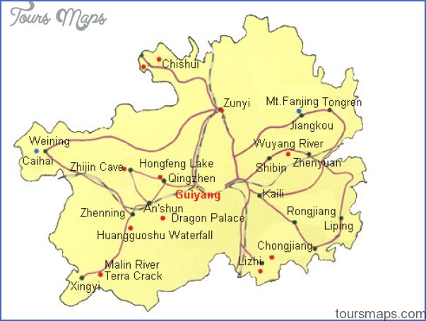
Area: 170,OOOsq.km/65,600sq. miles Population: 33,150,000. Capital: Guiyang
Guizhou province lies in south-west China, between 103°37′ and 109°32’E and 24°37′ and 29°13’N.
Many national minorities (Dong, Hui, Yao, Zhuang) live in Guizhou, with the Miao in the majority.
85% of Guizhou is a high plateau crossed by mountain ranges, the highest peak being 2900m/9520ft. The level of the land drops in three stages from east to west, and the dense network of rivers and valleys produces a very complex natural structure.
The climate is the typical monsoon type, with mild winters and warm summers. In the capital Guiyang the average temperature in July is 24°C/75°F and in January 4°C/39°F.
Rainfall amounts are very large (1000-1500mm/40-60in. per annum), and very few days have completely cloud-free skies. When talking about Guizhou province the Chinese are fond ofthe saying “There are neverthree days of clear skies nor three dry feet of earth to be seen in Guizhou”.
This region was originally inhabited by minorities, mainly the Miao. Its history has been marked by constant uprisings against the ever-increasing influence exerted by the Chinese central government.
Guizhou’s industries – iron and steel, engineering, electronics, tyres, cement and fertilisers – are centred mainly in Guiyang and Zunyi. The major mining products are mercury, coal, bauxite and manganese ore.
Guizhou Map Photo Gallery
Maybe You Like Them Too
- The Best Cities To Visit in The World
- World’s 10 Best Places To Visit
- Coolest Countries in the World to Visit
- Travel to Santorini, Greece
- Map of Barbados – Holiday in Barbados