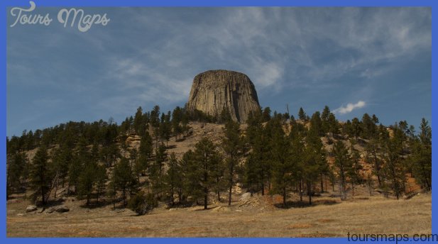
The first observers of Yellowstone Park’s features were often reminded of the Prince of Darkness and his abode. As historian Aubrey L. Haines writes in Yellowstone Place Names: Mirrors of History (1996): For a time, the devil had a proprietary interest in thirty-nine Park features, with the word hell’ appearing in eight others and Satan’ in one. But in the last half century, he has been largely dispossessed, so that his influence is now minimal. A mere three place names remain: Devils Thumb and Devils Kitchen at Mammoth Hot Springs, in addition to the Devils Den . . . (located near Tower Fall). Park Historian Lee Whittlesey, in his book Yellowstone Place Names, adds Devil’s Stairway (on the former Mary Mountain road), Devil’s Well near Icebox Canyon, and Devil’s Inkstand on Mount Washburn.
His book also describes Devil’s Gate. 4.2/15.2 0 Lone Star Geyser Trailhead. A short road to the west leads to the parking area. This round trip of about 5 miles (8 km) is a level trail also suitable for biking, since it is a former automobile road. The route soon passes the source of the Old Faithful Village water supply. In about 1.8 miles (2.9 km), the Spring Creek Trail intersects this one. You can follow it up to the Grand Loop Road, but coming down the Spring Creek Trail might be more to your liking (description at mile 8.2/11.2). The Lone Star Trail passes some small hot springs and a beautiful meadow be-Lone Star Geyser fore reaching the geyser. Lone Star Geyser erupts to as high as 45 feet (14 m) from a pink-stained steep cone as wide as it is tall about 10 feet (3 m) in each dimension. Its major eruptions are 20 to 30 minutes long. Lone Star’s eruptions occur almost exactly three hours apart, and the interval has averaged 2.5 to 3 hours with no interruption ever since the park was founded. Rangers no longer post eruption predictions at the Old Faithful Visitor Center, but you can help other visitors by recording the time of any eruption you witness in the logbook near the geyser.
The backcountry trail continues past Lone Star’s thermal area to Shoshone Lake and Geyser Basin (another 6.2 mi/10 km). Before the lake, a (southern) branch leads to the vast and undeveloped Bechler Region in the park’s southwest. A much closer trail to Shoshone Lake is at mile 10.5/8.9, the DeLacy Creek Trailhead. 6.5/12.9 Scaup Lake to the north. A scaup is a type of duck related to the canvasback and sometimes seen in the park. Not far from here, along Spring Creek (which the road used to follow), the most profitable to the robber! of Yellowstone’s five stagecoach robberies took place. The victims of this 1908 crime called it the greatest stage coach hold up and highway robbery in the 20th century. One man was able to stop 17 coaches and take more than $2000 in money and jewelry from the passengers. He was never caught. Scaup Lake was the center of a more recent scandal, according to Alston Chase’s book, PlayingGod in Yellowstone. This was one of the places in the park where geologists were allowed to use dynamite as part of a 1980 borehole project, possibly causing the extinction of a rare species of salamander. 6.8/12.6 I Small pond, Congr ess Lake (named because it just sits there and does nothing) to the south, and large parking area a little farther east for easy trail access down Spring Creek Trail. As the road climbs you may see patches of snow along the road, even in July. 7.2/12.2 ©(10) S© Spring Creek picnic area on the right (south). Near the restroom is a trailhead for the Spring Creek Trail that shortens the hike down the creek to the Lone Star Geyser Trail by over a mile. 8.2/11.2 S Spring Creek and Divide Lookout marked trailheads.
The Spring Creek Trail follows the creek and the Firehole River for a total of about 6 miles (9.5 km) from this trail-head to the Lone Star Trailhead parking area (at mile 4.2/15.2). The trail uses the route of an 1890s stagecoach road through Spring Creek canyon, described in early literature as one of the prettiest short trips on the Loop, and as having irregular walls and rock needles pointing skyward. Spring Creek was named for the several small cold springs that flow out from beneath the rhyolite along its course. The downside of having so many springs is that parts of the trail are marshy, while the upside is that wildflowers thrive here. On the east side of a 20-foot-high (6 m) rock located partway down the trail is a turtle shape engraved by natural forces. The rock has always been called Turtle Rock and was the site of the successful stagecoach robbery described above. The trail could be highly recommended were it not so dicult to get through the narrow part of the canyon at Turtle Rock and to traverse the marshy areas near the trail’s bottom. The steep Divide Lookout Trail goes to the site of a former fire tower about 2.5 miles (4 km) south of the road and nearly 8800 feet (2680 m) above sea level. Along the road between here and Isa Lake, as well as east of the lake, you can spot beautiful patches of altered rhyolite in some of the road cuts and hillsides.
There are many colors: cream, yellow, orange, salmon pink, red, dark brown. At some time in the past, hot water and gases altered the minerals in these rocks, creating the colors. Water lilies cover Isa Lake in midsummer. 9.3/10.1 I Isa Lake has parking space at both ends, 0.2 mile apart. The lake was named in 1893 for a Cincinnati tourist, Isabel Jelke, but was sometimes called Two Ocean Lake because of its location. It’s directly on the Continental Divide at an elevation of 8262 feet (2518 m). The flow directions from the two ends of this lake are the opposite of what you’d expect. The seeming paradox will become clear to you with a look at the map and explanation in Understanding the Continental Divide.
Hell and the Devil in Yellowstone Photo Gallery
Maybe You Like Them Too
- Top 10 Islands You Can Buy
- Top 10 Underrated Asian Cities 2023
- Top 10 Reasons Upsizing Will Be a Huge Travel Trend
- Top 10 Scuba Diving Destinations
- The Best Cities To Visit in The World

